Etappe 1c: Variante BergZeitReise Bodenbauer - Hochschwab - Schiestlhaus


- Brief description
-
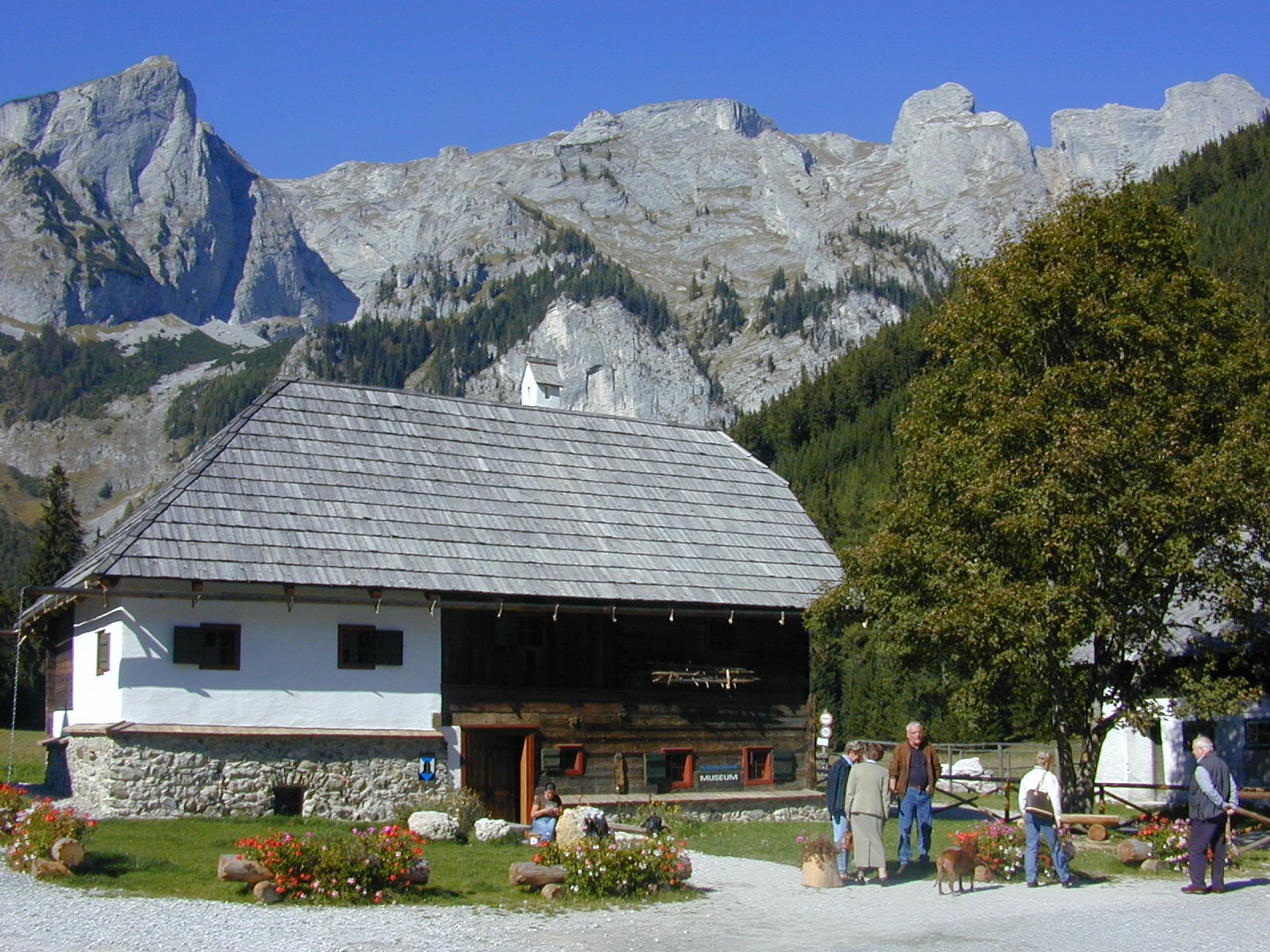
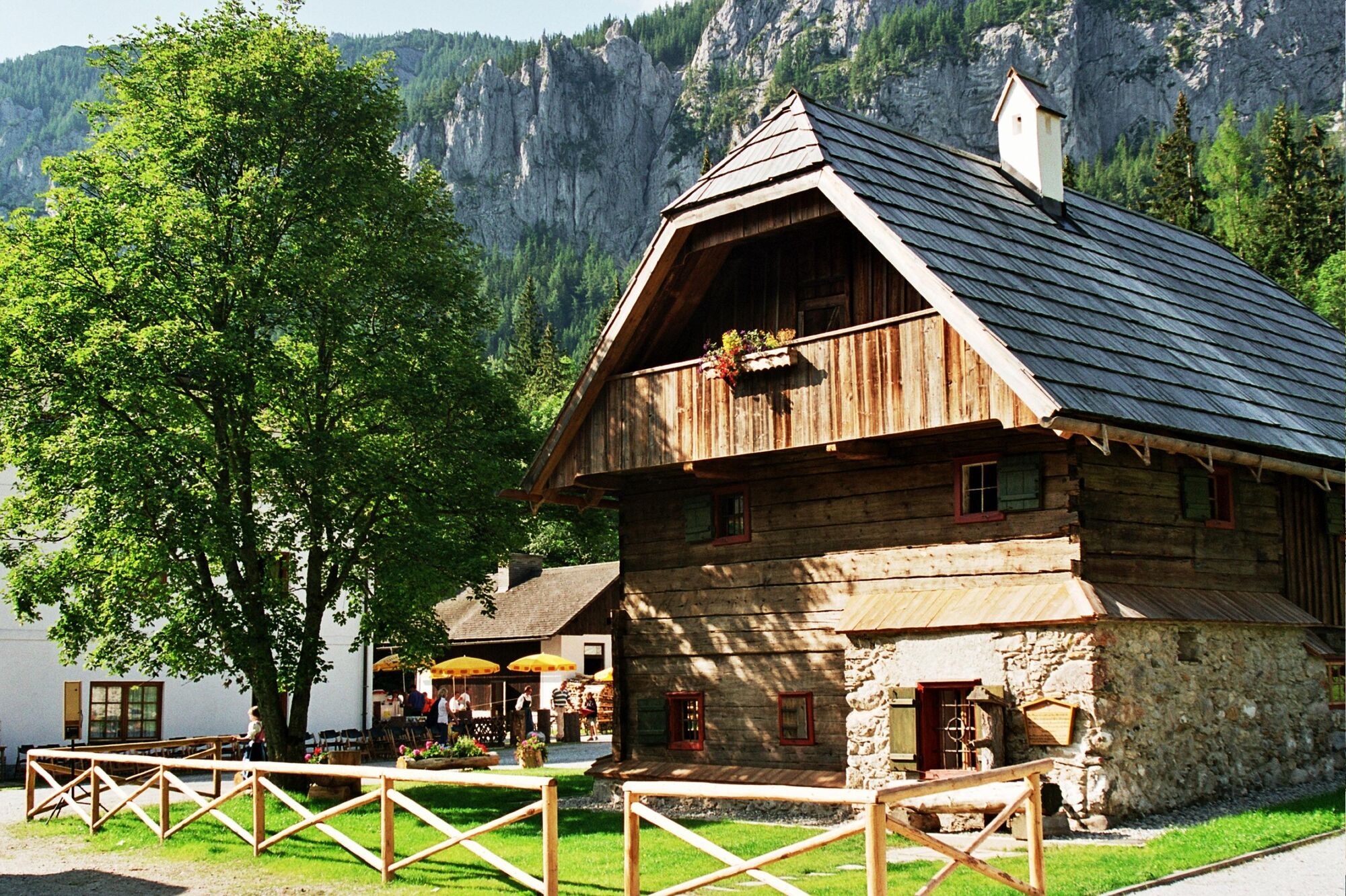
Start: Alpengasthof Bodenbauer, Tel.: +43 3861 8130,www.der-bodenbauer.at
GPS Gradnetz N 47° 34' 48,0" O 15° 6' 46,8"
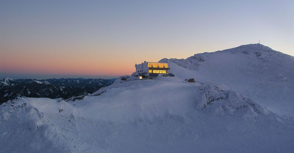
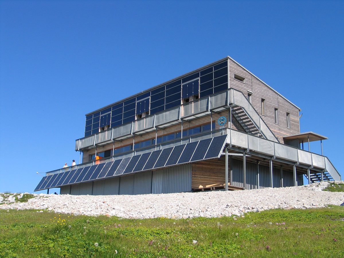
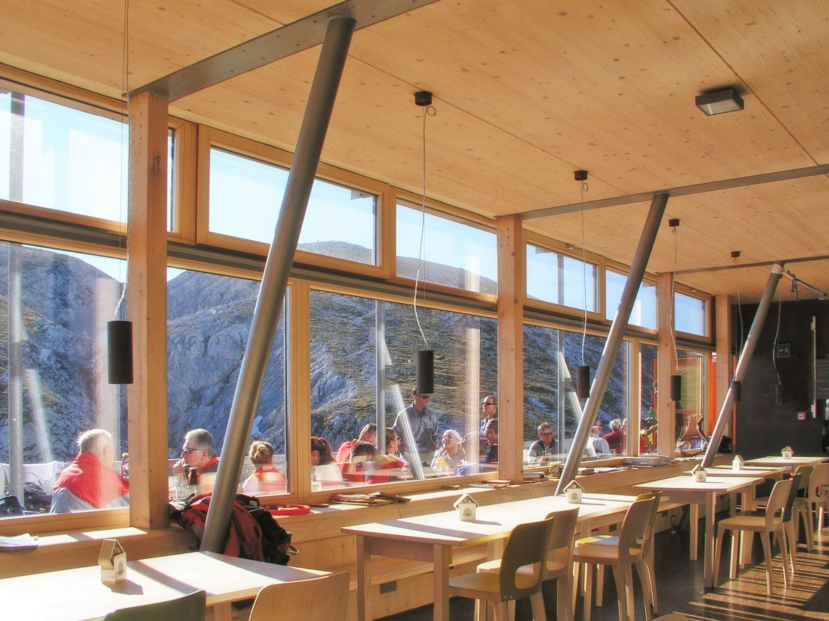
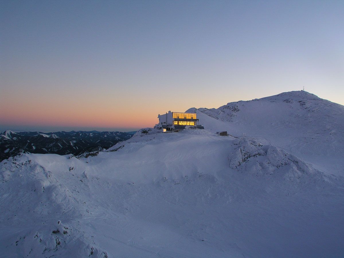
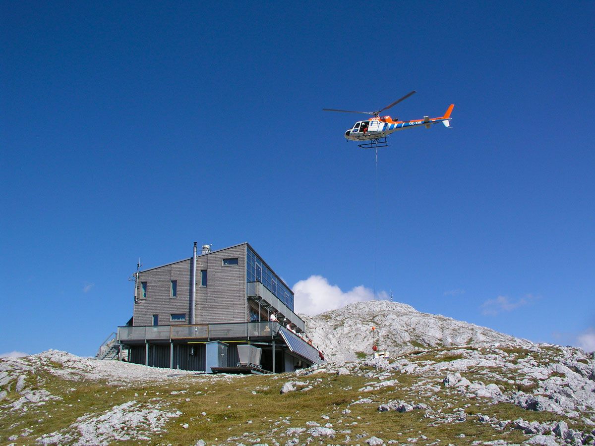
Ziel / Nächtigungsort: Schiestlhaus am Hochschwab, Tel.: +43 699 108 121 99, www.schiestlhaus.at
GPS Gradnetz N 47° 37' 19,5" O 15° 8' 54,2"
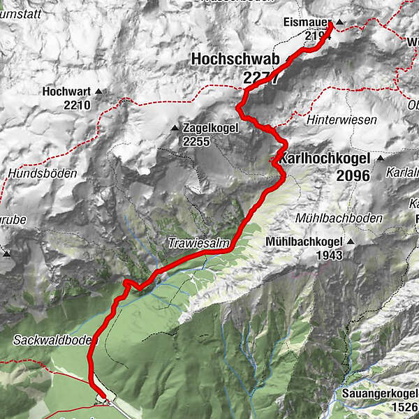
Etappenlänge: 8 Kilometer
Gehzeit gesamt (ohne Pausen): 5 Stunden
Höhenmeter Aufstieg: 1.440 Höhenmeter
Höhenmeter Abstieg: 160 Höhenmeter
Schwierigkeiten: anstrengende, alpine Etappe, Trittsicherheit nötig!
- Difficulty
-
difficult
- Rating
-
- Route
-
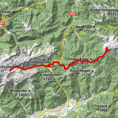
Schottenkogel (1,100 m)1.8 kmTrawiesalm2.5 kmVogelbad4.8 kmG'hacktbrunn5.3 kmDas G'hackte5.8 kmHochschwab (2,277 m)7.0 kmKleiner Hochschwab (2,248 m)7.4 km
- Best season
-
JanFebMarAprMayJunJulAugSepOctNovDec
- Description
-
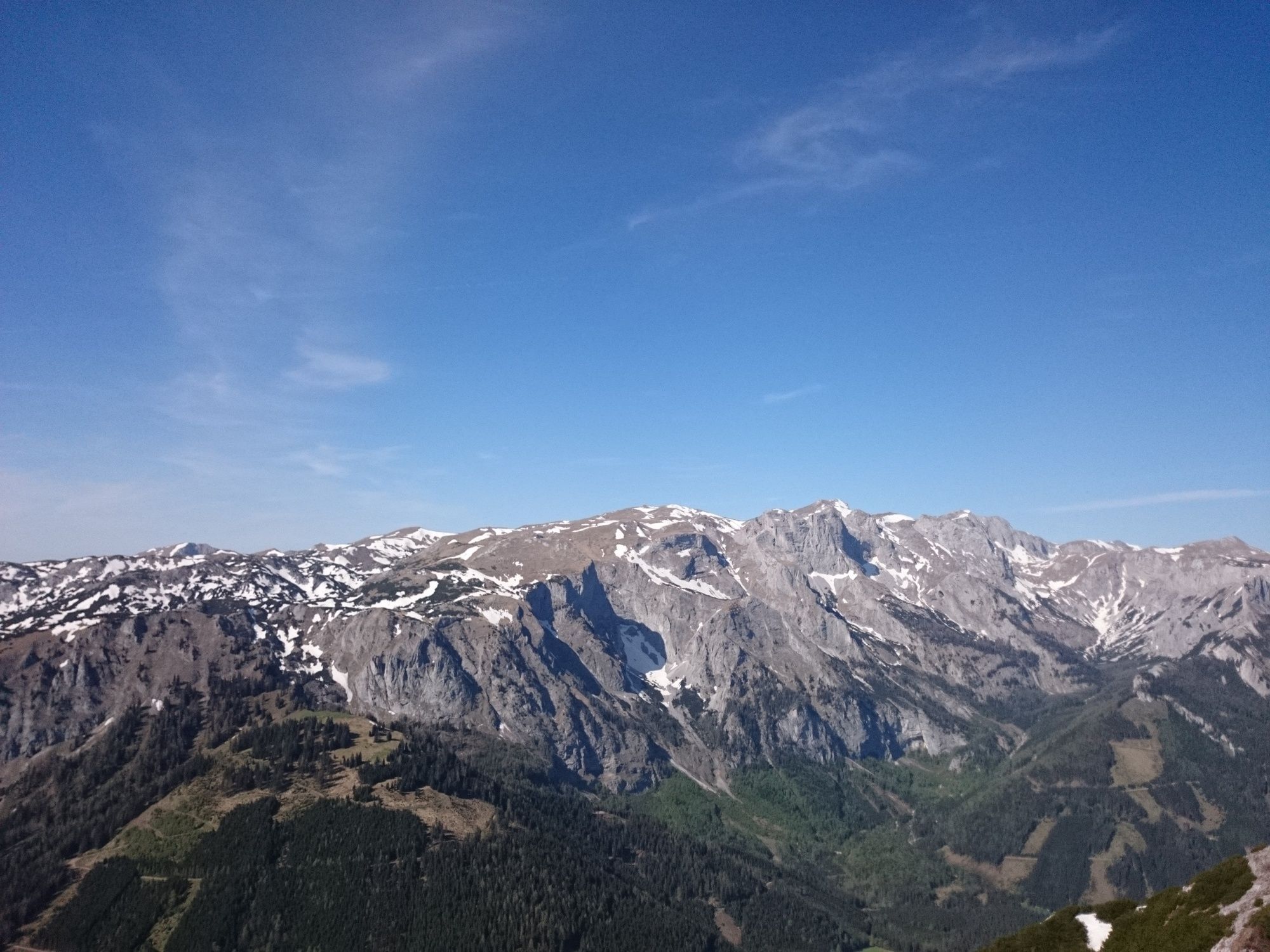
Actually a day hiking classic, one of the most popular and beautiful tours in Styria. Today this path serves us as the last feeder of our variant on the Hochschwab.
We start at the Alpengasthof Bodenbauer in the face of the mighty rock faces of the Hochschwab area and first climb at the foot of the Hundswand to the no longer managed Trawiesalm. From here the path becomes steeper and also more alpine. In numerous hairpin bends and finally over a steep meadow ridge we reach the ladders of the "G'hackten".
Over these (surefootedness necessary!) it goes steeply, but always well secured, upwards. So we quickly stand on the wide plateau of the "Schwaben", not far from the yellow Fleischer bivouac box.
In foggy conditions, the way ahead is not so easy, because the path leads us directly across the plateau to the 2,277m high summit of the Hochschwab - the highest point of the BergZeitReise has been reached.
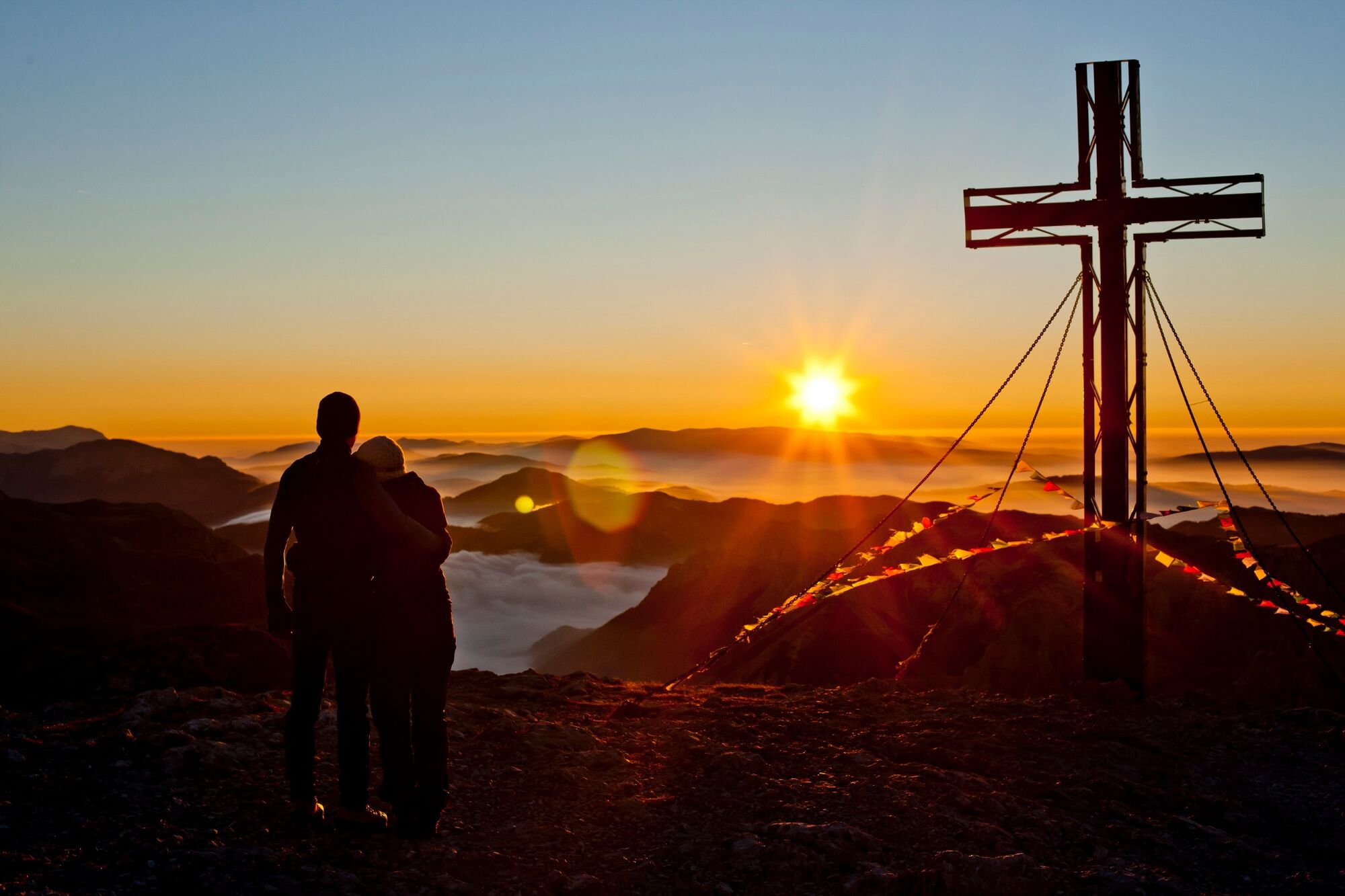
A mighty summit cross and an equally mighty - magnificent view await us on the broad summit plateau. Only a few steps eastward and we see our destination for today, the new Schiestlhaus. The last part of today's hike, the descent to the house, takes about 20 minutes.
- Directions
-
This stage is also one of the most beautiful of Hochsteiermark as a day hike! However, a good portion of fitness as well as surefootedness is necessary here (wire rope protections in the so-called "G'hackten").
We start flat in the valley from the Bodenbauer on a wide forest road, keeping to the right (do NOT ascend to the Häuslalm!) to a stream crossing. After this, a path begins, which is partly steeper, partly flatter through the forest and under the rock walls of the Hundswand up to the dilapidated Trawiesalm.
Here a beautiful view opens up to our further path, which takes us, now keeping slightly to the left and partly very steep, to the so-called Vogelbad (spring).
Here we could, foregoing the summit, hike over the Trawiessattel directly to the Schiestlhaus or to the Voisthaler Hütte.
However, we choose the much more beautiful, but also more difficult variant through the so-called "G'hackte" and the 2,277m high Hochschwab peak to reach the Schiestlhaus.
From the Vogelbad it goes steeply uphill to the entrance of the "G'hackte" and through this (wire ropes, climbing aids) up to the plateau. There is then the Fleischer bivouac box as an emergency shelter and last "base" before the Hochschwab summit storm.
This summit with the mighty summit cross is soon reached via the path that leads eastwards upwards over the summit area (pole marking).
Now we look over the whole of Styria, from the Dachstein to the Thermenland, a panorama board helps us to identify the numerous peaks.
Again in an easterly direction, a trail leads us downhill from the summit (pole marking, attention - sinkholes!) to the already clearly visible Schiestlhaus, our night's lodging.
- Highest point
- 2,267 m
- Endpoint
-
Schiestlhaus am Hochschwab
- Height profile
-

- Equipment
-
Normal hiking gear, sturdy shoes, sun protection, jacket, hood and gloves. Do not forget a water bottle and a snack box! And just in case, pack a small pharmacy with blister plasters.
- Safety instructions
-
Difficulties: Strenuous, alpine stage, surefootedness necessary!
- Tips
-
From 15.9. - 15.10. every year the huts around the Sonnschienalm are closed for hunting and forestry reasons. The hiking trails can be walked, but then there is a lack of overnight accommodation.
Therefore, here is a tip for the problem-free walking of the BergZeitReise also in the time of the hunting closure.
"Unintended" additional benefit - so we can also visit the Green Lake, voted in 2014 as the most beautiful place in Austria.
- Additional information
-
www.bergzeitreise.at
The Styria Tours app, available for free on Google Play and in the App Store (Android, iOS), offers detailed first-hand information: short facts (length, duration, difficulty, ascent and descent in altitude meters, ratings), map, route descriptions, altimeter, compass, summit finder, navigation along the tour. In addition, you can create your personal favorites list of favorite tours and points, save tours and destinations offline, play on social media channels and more.With the BusBahnBim app from Verbundlinie, timetable information has never been easier: all bus, train and streetcar connections in Austria can be queried by entering locations and/or addresses, stops or important points. The app is available as a free app for smartphones (Android, iOS) - on Google Play and in the App Store.
- Public transportation
-
With the BusBahnBim app from Verbundlinie, timetable information has never been easier:All bus, train and streetcar connections in Austria can be queried by entering places and/or addresses, stops or important points.The app is available as a free app for smartphones (Android, iOS) - on Google Play and in the App Store.
- Parking
-
Large parking lot at the GH Bodenbauer.

- Author
-
The tour Etappe 1c: Variante BergZeitReise Bodenbauer - Hochschwab - Schiestlhaus is used by outdooractive.com provided.


General info
-
Erzberg Leoben
2529
-
Hochschwab
1273
-
Tragöß - Grüner See
471