
- Brief description
-
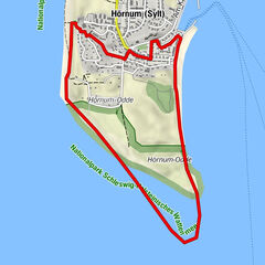
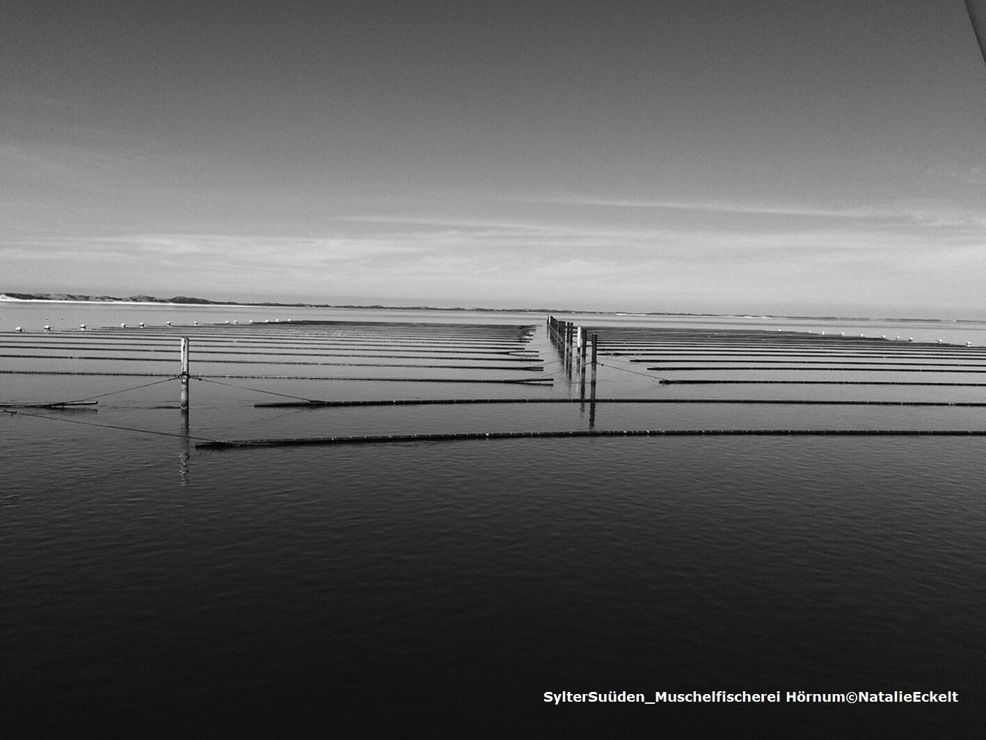
The route takes you to the wild southern tip of the island Sylt, the Hörnum Odde.
- Difficulty
-
easy
- Rating
-
- Starting point
-
Bus stop "Dikjen Deel"
- Route
-
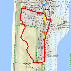
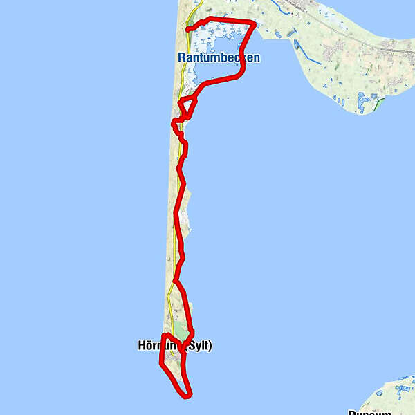
Rantum9.1 kmHörnum (Sylt)23.7 kmHörnum (Sylt)29.5 km
- Best season
-
JanFebMarAprMayJunJulAugSepOctNovDec
- Description
-
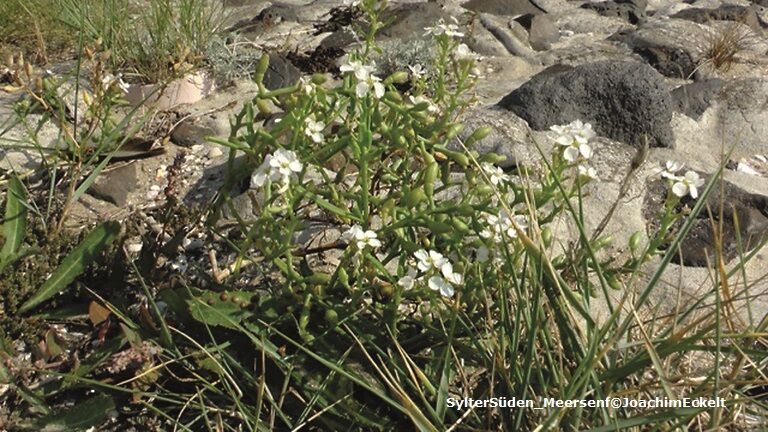
During the tour you will learn about sunken churches, abandoned airfields, sophisticated bird-catching ponds of the past and sea gods. On your way you will pass through small woods, move through wide dune landscapes and enjoy the view of the unique Wadden Sea World Heritage Site. An eventful detour leads you to the international seabird sanctuary Rantumbecken. During your hike you will always look out over extensive heathlands and dune valleys, which are home to a special animal and plant world.
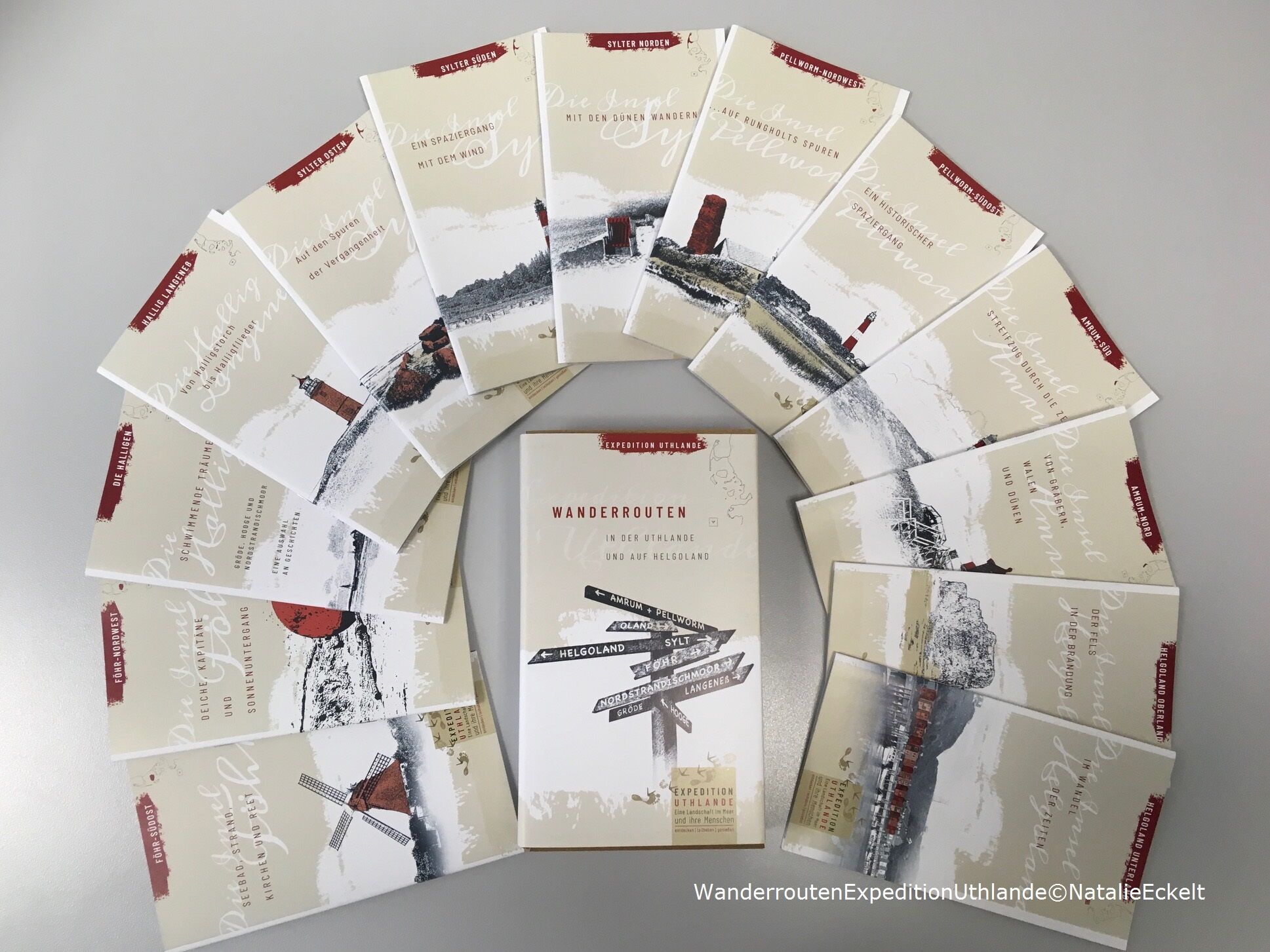
The tour is part of the series "Expedition Uthlande - A landscape in the sea and its people". The printed brochures with detailed information are available for a donation at the Insel- und Halligkonferenz e.V., www.ihko.de, Tel. 04681-3468.
- Directions
-
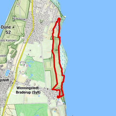
The route starts at the bus stop Dikjen-Deel. This can be reached by bus 2, which is about 200 m walk from the bus stop. The bird bunk is signposted. Only the name "Eidum" reminds you of the old place, which sank further west in the sea. The inhabitants of the village have demolished their houses several times and rebuilt them about 2 km further east in the south hedig. From this the village Westerland developed. When you leave the Vogelkoje, keep left and follow the path diagonally opposite the forest path further south to the refuge in the forest. A few steps away you will find the signpost to the Rantum basin. Here you turn right and continue walking on the dike towards the south. The Rantum basin is on the left. On the way up to the house Hanna we almost stumble over a small boundary stone: up to here the municipal area of Westerland reaches and from there Rantum begins. The dike stretches along the Rantum basin to Rantum. At the level of the Rantum camping site it makes a bend towards the mainland, which can be easily seen on a clear day. If you don't want to follow the path around the Rantum basin, turn on the dike right to the sailing port. A visit to the Sylt coffee roastery or the small Rantum sailing port is worthwhile. Behind the sailing port you have the possibility to take the path on the left through the salt marshes. Depending on the season, it can sometimes be very muddy here, as the North Sea water sometimes floods this part of the marina. At the end of the salt marshes you will find the Merret-Lassen-Wai. There is a small supermarket in Raanwai - here you can replenish your supplies. If the path through the salt marshes is too wet, stay on the dike until you reach the dikwai. There you keep left and walk along the Raanwai. This road also leads you to the supermarket. On your way to the dunes, make a small detour to the St. Peter church, the only thatched church on Sylt. Going south, shortly after the northern crossing of the Raanwai and Merret-Lassen-Wai you will find the beach path, which you follow, cross the main road and walk about 50 m towards Hörnum. Then turn right into the Stiindeelke path. This road meets the Henning-Rieken-Wai, which you follow to the left. You turn into the Henning-Rieken-Waiein until you reach the boardwalk on the left hand side, which you follow until the end through the nature reserve Baakdeel-Rantumer Dünen to the parking Taadjem-Deel. If the path becomes too long, you can always go to the crossings on the road and take the bus. The path continues south for 2.3 km until Puan Klent. Long before we reach the youth hostel Puan Klent, the red-white antenna of the LORANStation can be seen. From Puan Klent the trail continues through the dune valley to Hörnum, which is about 4 km away. About 1 km behind Puan Klent a path crosses. Here you can turn left and pass the youth camp directly to the Wadden Sea. After about one more kilometer the path turns into a sandy beach. From here you can go directly to the port of Hörnum. From the harbour you can climb the stairs towards the old school and enjoy the view over the harbour and the neighbouring islands of Föhr and Amrum. Now go down the Oberen Dünenweg, turn right into the Hangstraße until you reach Rantumer Str./Bushalte Steintal. Diagonally opposite is the National Park House Ark Wadden Sea (Tues-Sun 10-18 hrs). From here a round trip (approx. 1-1.5 hours) around the southern tip of the island Sylt is possible. Two hours before or after low tide, you can walk along the western beach to the harbour in the east. First you walk towards the camping site, where you take the beach crossing no. 76 and walk along the beach around the Odde.
- Highest point
- 21 m
- Endpoint
-
Bus stop "Hörnum Hafen"
- Height profile
-
 © outdooractive.com
 - Safety instructions
-
The little etiquette for protected areas:
- All protected areas are marked with official signs.
- Look out for informative signs. They contain information about the protective purpose of the region and about the animals and plants in the area,
- The Wadden Sea is a vital gas station for millions of migratory birds. Please avoid bird aggregations over a large area. Do not disturb breeding birds.
- Throughout the entire protected area, dogs must be kept on a leash.
- Keep your distance to resting seals, seals and seabirds.
- Camping, building fireplaces and leaving official paths is prohibited.
- Please do not "camp" in the overgrown dunes.
- Take your garbage with you again.
- Do not feed seagulls.
- One more request: Do not take any animals or plants.
- Vital: Under no circumstances should you undertake a mudflat hike on your own! As harmless as the Wadden Sea looks at low tide, the flood can surprise you and take the idyllic natural environment back into your own hands.
- Additional information
-
Bird protection association Jordsand
Phone 0 15 20 - 5 92 59 28
Wadden Sea Ark
Wadden Sea Protection Station
Tel. 0 46 51 - 8 86 22 29
Eidum Vogelkoje - Hegering Sylt
Südringe 1
25980 Westerland
Opening hours and dates under:Tel. 01 71 - 2 16 7887
Tourism Service Hörnum
Rantumer Strasse 2025997 Hörnum
Tel. 0 46 51 - 96 26 0
Rantum coffee roastery
www.kaffeeroesterei-sylt.com
- Directions
-
By car to Sylt: Take the A7 to the Flensburg exit, from there approx. 35 km on the B 199 to Niebüll.
www.syltshuttle.dewww.autozug-sylt.de
By ferry: By car across the water you can reach us from the Danish island Rømø.
- Public transportation
-
With the passenger train to Sylt :www.bahn.dewww.nah.sh or by ferry from the mainland with the Adler ships from Cuxhaven, Nordstrand and Dagebüll to Hörnumer Hafen: www.syltfaehre.de; www.adler-schiffe.de/ab-sylt/; www.sylt.de/entdecken/erlebnisse/schifffahrten
Mobile on Sylt: Sylt buses run regularly on all routes. Timetable under www.svg-busreisen.de


-

-
AuthorThe tour Expedition Uthlande: South Sylt - A walk with the wind is used by outdooractive.com provided.

General info
-
Sylt
45