© GDM, Fotograf Kratz

© Holtsein Tourismus u. photocompany - Vanessa Klamka

© T. Baumann

© GDM

© GDM

© GDM

- Brief description
-
Mit Genuss ...eben!
- Difficulty
-
easy
- Rating
-
- Route
-
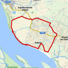
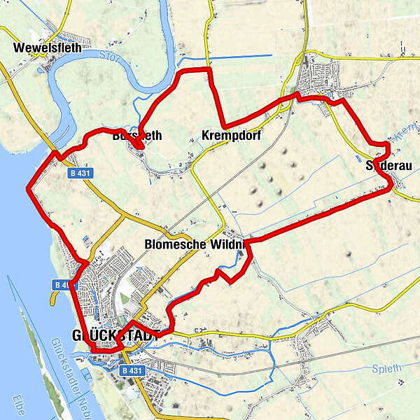
Glückstadt0.0 kmZur Störmündung6.4 kmZum Aukrug8.0 kmBorsfleth8.5 kmKrempdorf12.4 kmKrempe14.8 kmGehrhof17.7 kmSüderau17.9 kmElskop19.1 kmKrempdorferaltendeich21.5 kmEngelbrechtsche Wildnis25.2 kmStadtkirche Glückstadt26.3 kmGlückstadt26.8 km
- Best season
-
JanFebMarAprMayJunJulAugSepOctNovDec
- Highest point
- 7 m
- Endpoint
-
Glückstadt
- Height profile
-
 © outdooractive.com
-

-
AuthorThe tour Der Gemüsetörn is used by outdooractive.com provided.
GPS Downloads


General info
Refreshment stop
Flora
A lot of view
Other tours in the regions