© Ferienregion Nationalpark Hohe Tauern - Tourismusverband Uttendorf/Weißsee
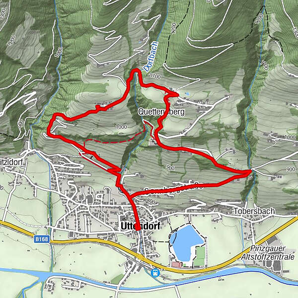

- Route
-
Uttendorf0.1 kmAlpengasthof Liebenberg3.2 kmQuettensberg3.5 km
- Highest point
- 1,075 m
- Height profile
-

-

-
AuthorThe tour Ge(h)sund Bergauf Weg is used by outdooractive.com provided.
GPS Downloads


Other tours in the regions