- Difficulty
-
medium
- Rating
-
- Starting point
-
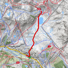
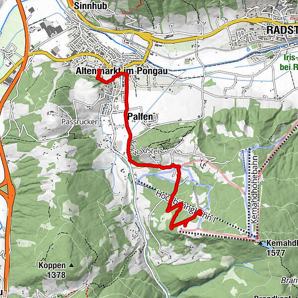
Starting point (AP) at the Altenmarkt-Zauchensee tourist office
- Route
-
Altenmarkt im Pongau0.7 kmPfarrkirche Altenmarkt0.8 kmPalfen1.5 kmPlum Restaurant2.3 km
- Best season
-
AugSepOctNovDecJanFebMarAprMayJunJul
- Description
-
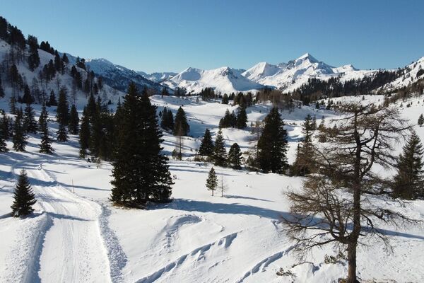
The path leads from the Altenmarkt-Zauchensee Tourist Office via the market square along Schattauergasse to the Bifangweg. Via this lightly traveled road, on which you have a wonderful view of the idyllic Altenmarkt through clearings, you finally reach the two huts (Hochnössleralm & Bifeis Hütte). After refreshment, sleds are ready for the rapid descent. The toboggan run is illuminated until midnight.
- Highest point
- 1,244 m
- Endpoint
-
Bifeis Hütte or Hochnössleralm
- Height profile
-

- Equipment
-
very good, non-slip shoes
- Tips
-
On Tuesdays and Thursdays there is alpine live music on the Hochnössleralm from 8 p.m. (free entry!).
- Additional information
- Directions
-
Tauern Autobahn A 10, Altenmarkt exit (EXIT 63), Altenmarkt West exit, along Oberndorfer Strasse, at the crossroads (BP petrol station) turn left and continue on the federal road (B 163), after 250 m turn right to the starting point (AP) at the Altenmarkt tourist office -Zauchensee
- Public transportation
- Parking
-
Parking opposite the information (Altenmarkt-Zauchensee Tourismus)
-

-
AuthorThe tour Winter Hiking Trail-Hochnössleralm/Bifei's Hütt'n is used by outdooractive.com provided.