© Saalbach Hinterglemm - Paul Kubalek
- Brief description
-
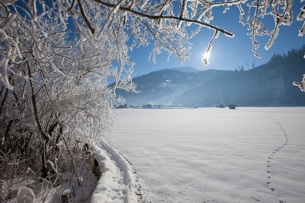
Winter walk with a fantastic view.
- Difficulty
-
medium
- Rating
-
- Starting point
-
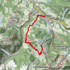
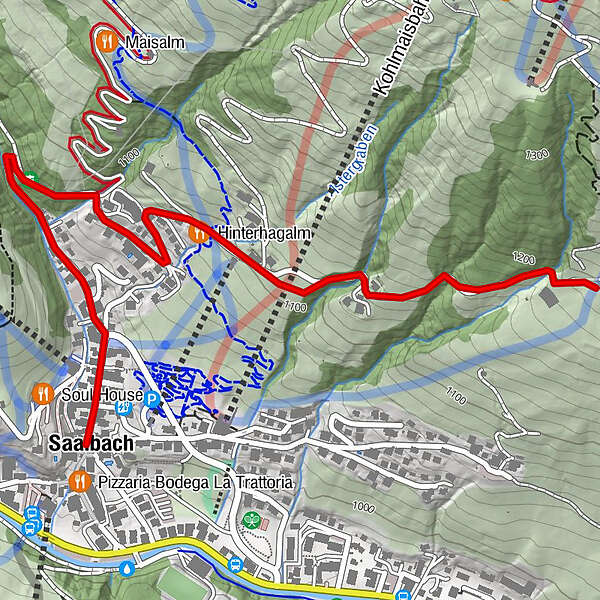
Town hall Saalbach (village square)
- Route
-
Saalbach
- Best season
-
AugSepOctNovDecJanFebMarAprMayJunJul
- Description
-
From the village square continue along the village road in the direction of Oberdorf (upper village) to the dam wall. Continue the Hinterhagweg to the Astergut and Lienbichl. Return along the same route to the starting point.
- Highest point
- 1,196 m
- Endpoint
-
Lienbichl
- Height profile
-

- Directions
-
From Maishofen approx. 14 km along the L111 to Saalbach. At the Aral petrol station turn right into the tunnel where you will find the park house (in the tunnel).
- Public transportation
-
Postbus - daily from 07.00 - 19.00
http://www.postbus.at/de/Fahrplanauskunft/index.jsp
- Parking
-
Park house centre
-

-
AuthorThe tour S07 Lienbichl is used by outdooractive.com provided.
GPS Downloads


General info
A lot of view
Other tours in the regions
-
Saalbach Hinterglemm
187
-
Hochfilzen
64