- Brief description
-
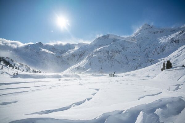
Comfortable winter hike along the river from Grossarl to Hüttschlag.
- Difficulty
-
easy
- Rating
-
- Starting point
-
Grossarl - village center
- Route
-
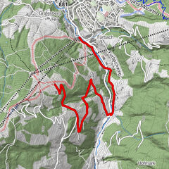
Großarl0.0 kmHubdörfl1.6 kmNiederaigen2.4 kmBichlkapelle4.0 kmKaminstadl8.7 kmSchappachkapelle8.9 kmHotel Almrösl9.0 kmHüttenwirt9.1 kmHüttschlag9.1 kmNeuhofkapelle10.3 kmBichlkapelle14.1 kmNiederaigen15.3 kmHubdörfl16.6 kmGroßarl18.2 km
- Best season
-
AugSepOctNovDecJanFebMarAprMayJunJul
- Description
-
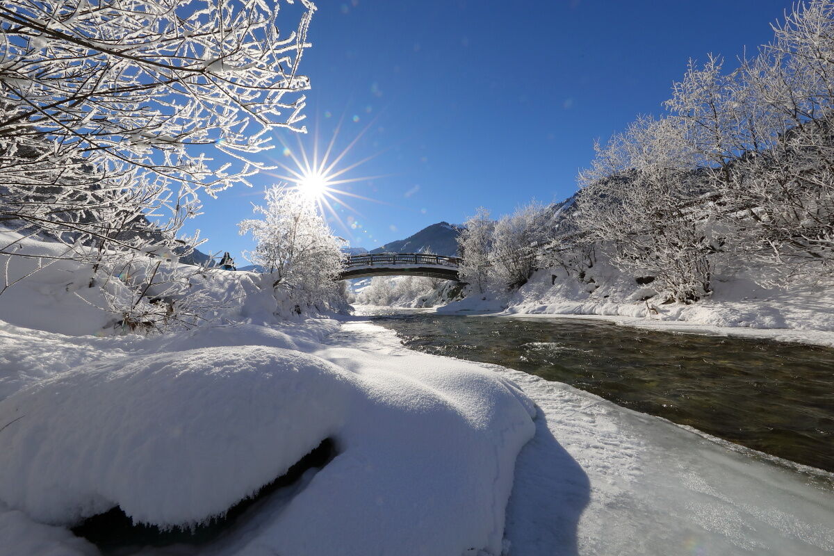
From the village center of Grossarl, you hike upstream along the river. Just after you have crossed the bridge, you will see an old mill. Earlier, grain was also ground here.
You contine along the river and then you pass several houses and the Zimmerei Gruberl as well as the building of the Kaiserbau. Then the path leads again through the snow-covered winter landscape until you finally reach Gasthof Neumayr, which is currently closed. Here you cross the river.
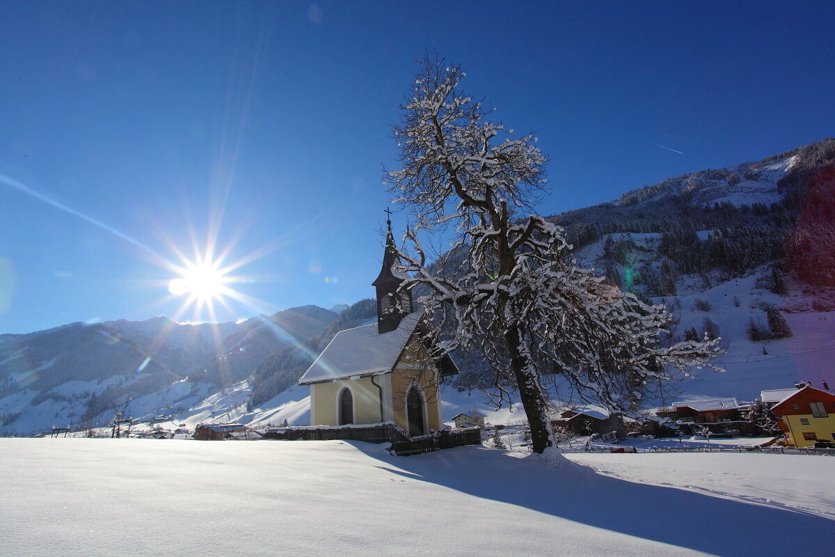
The route continues upstream. On the left, there is the Bichl Chapel. This chapel was built in the 17th century and is part of the Chapel Path. You continue and pass some farms until you finally reach a small rise. There is the Griesbichl Chapel, you continue and come to the Neuhof Chapel. From here you go around the tunnel and finally to Hüttschlag, where you take a break in the inns.
You go back on the same route or by public bus.
On the way back you have the opportunity to go the footpath along the street (stay on the street after Gasthof Neumayr). After about 1 km you see the Laireiting Chapel on your right. The chapel was built in 1860 by the Linsinger family. Like the Bichl Chapel, it belongs to the Chapel Path.
You can also take one direction by public bus. Since there are almost no steep parts on the whole route, this hike is also suitable for children's carriages or sleds.
- Directions
-
From the village center of Grossarl, you go to the roundabout, then turn left (upstream). After about 50 m you take the bridge over the river. From here, you follow the Achenpromenade up to Zimmerei Gruber. Here you cross the Bergstrasse, turn left and after the Baumeister Kaiser turn right. The Achenpromenade continues and leads to the Gasthof Neumayr (closed). Then you cross the river again and follow the path to the "Harbachhäuser" (about 5 km). Then cross the river again and follow the way to the "Harbachhäusern" (about 5 km). Then cross the road at the power station and go upwards to the Griesbichlhof. Finally, you walk along the river, cross the street and go around the tunnel. Turn left and you walk into the village center of Hüttschlag (about 8 km from Grossarl) - back on the same way or you return by public b
OPTION: On the way back, you can walk along the street from Gasthof Neumayr. There you come to Laireitingkapelle after about 1 km.
- Highest point
- 991 m
- Endpoint
-
Hüttschlag - village center
- Height profile
-

- Equipment
-
winter boots with grip sole
- Tips
-
You can use children's carriages or sleds along this winter hike.
- Additional information
- Directions
-
You go by car or public bus no. 540 to the village center of Grossarl.
- Public transportation
- Parking
-
parking spaces at the gas station and the south of Grossarl

- Author
-
The tour Grossarltal: Achenpromenade and hike towards Hüttschlag is used by outdooractive.com provided.