
- Brief description
-
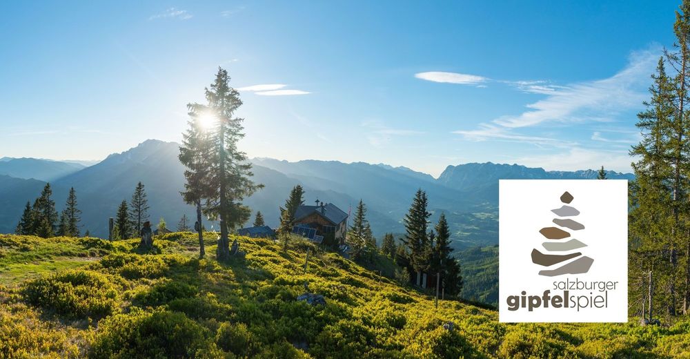
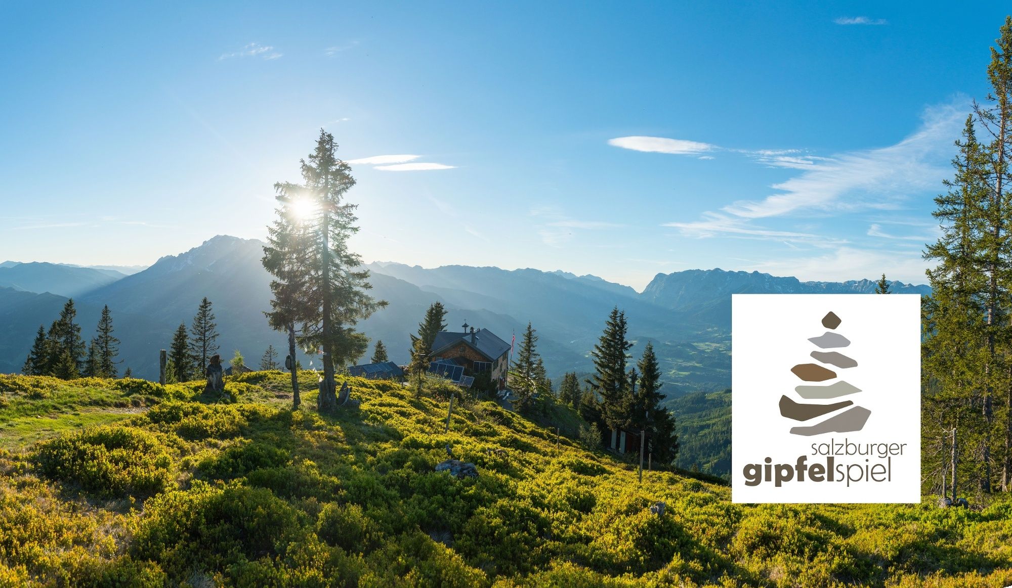
The Hochgründeck Mountain is one of the highest forested mountains in Europe.
- Difficulty
-
medium
- Rating
-
- Starting point
-
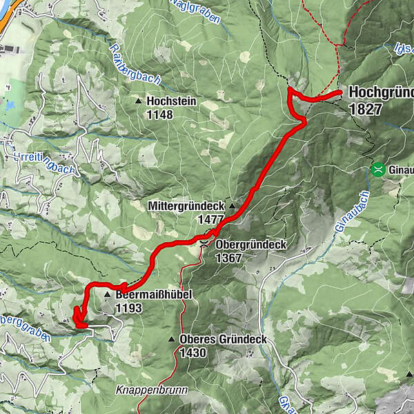
Parking Stein-Bauer, Talblickstrasse
- Route
-
Obergründeck (1,367 m)2.9 kmHeinrich-Kiener-Haus5.5 kmSt. Vinzenz Friedenskirche5.6 kmHochgründeck (1,827 m)6.2 km
- Best season
-
JanFebMarAprMayJunJulAugSepOctNovDec
- Description
-
Start the hike at the Stein-Bauer car park. Here, you can park your car free of charge. The narrow agricultural road on the left starts off quite steeply, then rises gently through the forest in the direction of the Gründeck ridge and on towards Hochgründeck along the signposted trails. Worth a visit: Friedenskapelle, a little chapel just above Heinrich-Kiener-Haus on the St. Rupert pilgrim trail.
Hochgründeck is one of the highest forested mountains in Europe and is regar-ded as one of the most beautiful moun-tains with a view in Austria. The relatively long tour spoils you with views onto approx. 300 peaks (Hochkönig, Tennen Mountains, Dachstein, Low and High Tauern, Kitzbühel Alps and Dientner Alps).
- Highest point
- 1,823 m
- Endpoint
-
Hochgründeck
- Height profile
-

- Tips
-
Salzburger Summit Game - Listen to what the mountains have to say!
The Salzburger Summit Game is a unique hiking experience, unveiling to you the world of the “Benevolent Queen and her six noblemen“: conquer the seven summits in the seven resorts of the Salzburger Sportwelt and discover a wonderful natural landscape. All peak tours promise a special mountain experience and breathtakingly fantastic views plus profound messages and rituals.
Hochgründeck in St. Johann: The Healer
The Hochgründeck is one of the highest, wooded mountain peaks in Europe and is an ancient place of ritual. Those walking up through the forest will find peace and tranquillity. A healing spot for reflection and recharging your batteries.
- Author
-
The tour Hochgründeck (from Stein-Bauer) is used by outdooractive.com provided.