
- Brief description
-
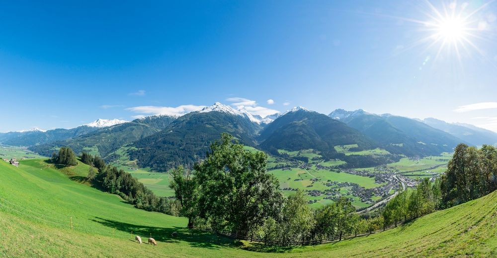
Beautiful leisurely circular hike with a magnificent view of the Hohe Tauern.
- Difficulty
-
easy
- Rating
-
- Starting point
-
Parking lot Ematen Niedernsill
- Route
-
SteindorfEmatenNaglköpfl (1,090 m)1.6 kmJausenstation Nagelbauer1.8 kmSteindorf4.4 kmEmaten4.4 km
- Best season
-
JanFebMarAprMayJunJulAugSepOctNovDec
- Description
-
Take a hike of a different kind! The hike leads past three Tauern loungers that invite you to relax and enjoy. Afterwards, recharge your batteries at the magical place of power on Naglköpfl, one of the first settlement points of the Celts. The view from there over the Salzach valley and the Hohe Tauern with its 3,000-metre peaks is fascinationg and creates a unique feeling of happiness.
- Directions
-
From the starting point follow path no. 6 to Naglkköpfl. Now hike past the Naglköpflkapelle (chapel). Continue along path no. 19 towards Röderlehen. At the bend in the road turn left onto path no. 5 and follow it down the valley via Gitschen to the starting point of the tour.
- Highest point
- 1,170 m
- Endpoint
-
Parking lot Ematen Niedernsill
- Height profile
-

- Equipment
-
Light hiking boots, drinking bottle & energy bar
- Safety instructions
-
Dear nature lovers!
We hope that the snacks and drinks you take with you on your hike will give you the strength to carry back the packaging material and empty cans and bottles.We kindly ask you to observe the Fair Play & Rules of Conduct!
Fairness and mutual consideration form the basis for a common together and the protection of the various interests in the natural region!
- Additional information
- Public transportation
- Parking
-
Limited parking available at the parking lot Ematen.


-

-
AuthorThe tour Niedernsill: Naglköpflweg zum Kraftplatz von Ematen is used by outdooractive.com provided.