

- Brief description
-
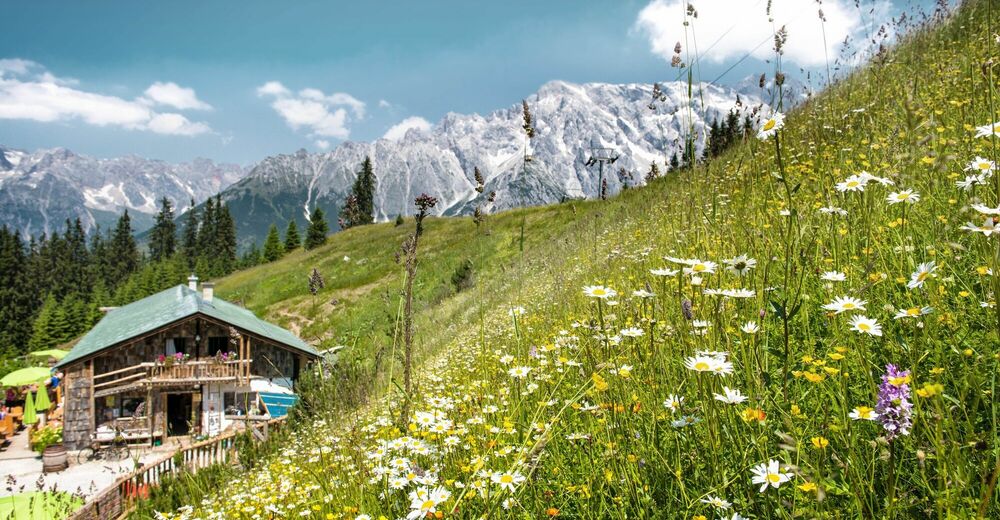
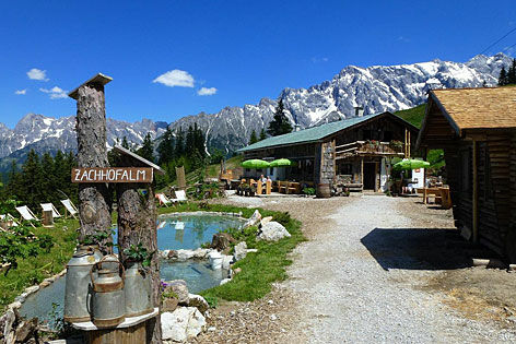
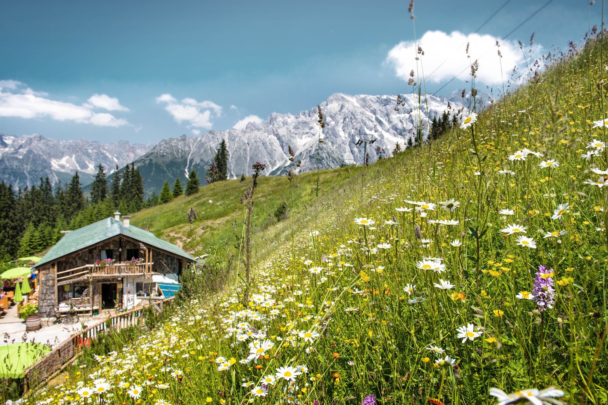
Leisurely hike along a rock path and forest road to the Zachhofalm.
- Difficulty
-
easy
- Rating
-
- Starting point
-
Zachhofalm parking lot
- Route
-
Zachhof Alm3.3 km
- Best season
-
JanFebMarAprMayJunJulAugSepOctNovDec
- Description
-
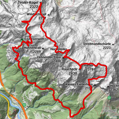
We walk from the Zachhofalm cable car parking lot past the Liebenaualm in the direction of the Zachhofalm. This can be reached in about 1 hour. The ascent leads comfortably on a forest road or over a somewhat steeper path up the mountain. The descent is then either on the forest road or on a steeper path.
- Directions
-
We start the tour above the Hotel Übergossene Alm at the parking lot of the Zachhofalmbahn (only open in winter), here we follow the parking lot in the direction of Liebenaualm (only open in winter) on trail no. 64 until we reach a turn-off. Here we decide whether we want to take the easy forest road or the steeper path. The forest road crosses the Bürglalmweg and follows it for a while. At a junction we follow trail nr. 63a in the direction of Zachhofalm. This way we reach the huts within an hour. Herbal products, homemade farm ice cream and many other products are sold at the huts. Here you can also participate in TEH seminars by registration. The way back down to the valley we start the same way we came until we reach a turnoff where the ski slope is in winter, there is the beginning of the climb down to the Liebenaualm. We follow this to the Liebenaualm and further to the starting point.
- Highest point
- 1,576 m
- Endpoint
-
Zachhofalm parking lot
- Height profile
-

- Equipment
-
Sturdy, ankle-high footwear
Walking sticks
Headgear
Sun protection
Sunglasses
Rain protectin
Drinks and a snack
Necessary medication
First aid kit
Hiking map - Safety instructions
-
Self-assessment Check your physical fitness before every mountain tour and correctly assess your strength as well as that of your companions - especially those of your children! Surefootedness and a head for heights are often very important!
Planning and preparation Plan each intended mountain tour in detail beforehand. Hiking maps and guides as well as information from alpine associations and local experts such as mountain guides and mountain hut keepers can be helpful.
Equipment On the mountain, you will need appropriate equipment and clothing, especially sturdy, high shoes with good grip soles. Weather and cold protection are essential, as the weather can often change unexpectedly.
Weather forecasts Take note of the current weather conditions at: www.zamg.at
Together Follow the 10 rules for the correct handling of grazing animals and do not leave any waste in nature!
Do not kick stones Do not kick stones as this can seriously endanger other hikers. Marked places with a danger of falling rocks should be crossed as quickly as possible and with attention and caution.
Turn back in good time This is not a disgrace, but a sign of common sense. It becomes necessary when the weather changes, fog rolls in, and also when the path is too difficult or not in good condition.Emergency numbers: Alpine emergency call: 140
International emergency call: 122 - Tips
-
The Zachhofalm is TEH classified.
- Additional information
- Directions
-
Coming from Salzburg: Take the A10 freeway to the Bischofshofen exit, then take the B311 in the direction of Bischofshofen. Follow the Hochkönig Bundesstraße/B164 to Mühlbach and further to Dienten.
Coming from Innsbruck/ Kufstein: On the Loferer Straße/B178 in the direction of St. Johann i.T., then on the Hochkönig Bundesstraße/B164 via Saalfelden and Maria Alm to Dienten or to the Filzensattel.
A valid vignette is required to use the Austrian motorway and motorway network. It is also compulsory to carry a first-aid kit, warning triangle and high-visibility waistcoat. Further information can be found under Asfinag. - Public transportation
- Parking
-
Free parking at the Dacheggbahn/Zachhofalmbahn and at the Liebenaualm car park

- Author
-
The tour Hike to the Zachhofalm is used by outdooractive.com provided.


General info
-
Hochkönig
2042
-
Dienten am Hochkönig
536