- Brief description
-
Beautiful leisurely circular hike with a great view of the Hohe Tauern.
- Difficulty
-
easy
- Rating
-
- Starting point
-
Parking lot Walchen
- Route
-
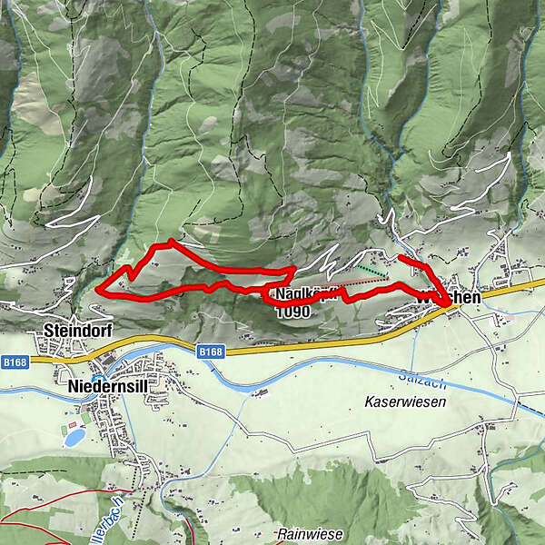
Walchen0.5 kmSt. Ulrich0.6 kmNaglköpfl (1,090 m)2.8 kmJausenstation Nagelbauer3.1 kmSteindorf5.7 kmEmaten5.7 kmNaglköpfl (1,090 m)7.4 kmWalchen9.6 kmSt. Ulrich9.7 km
- Best season
-
JanFebMarAprMayJunJulAugSepOctNovDec
- Description
-
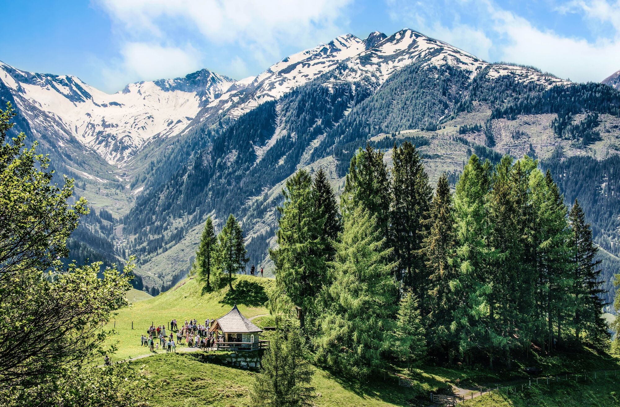
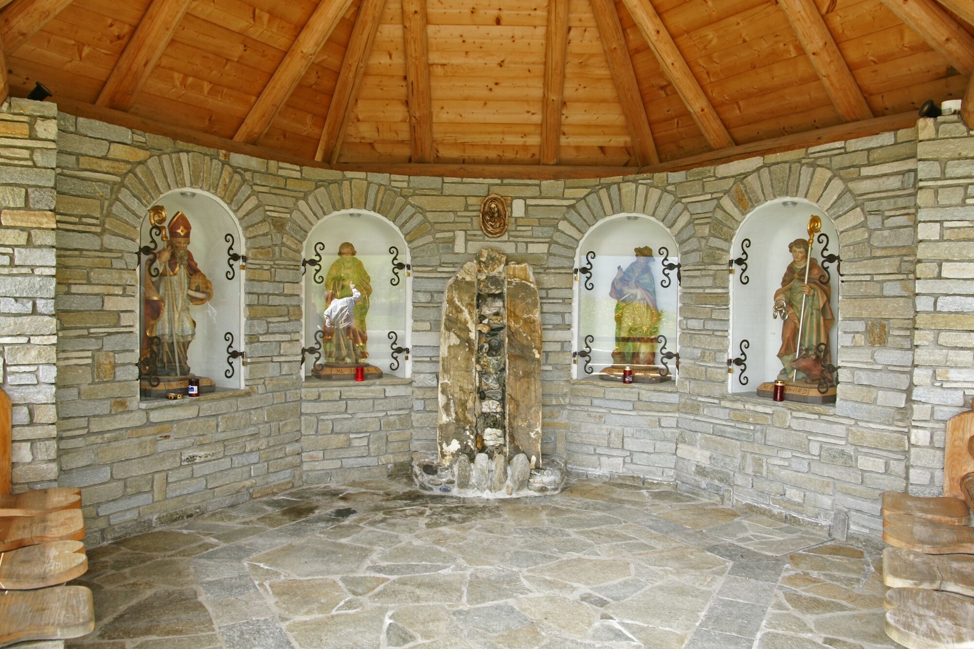
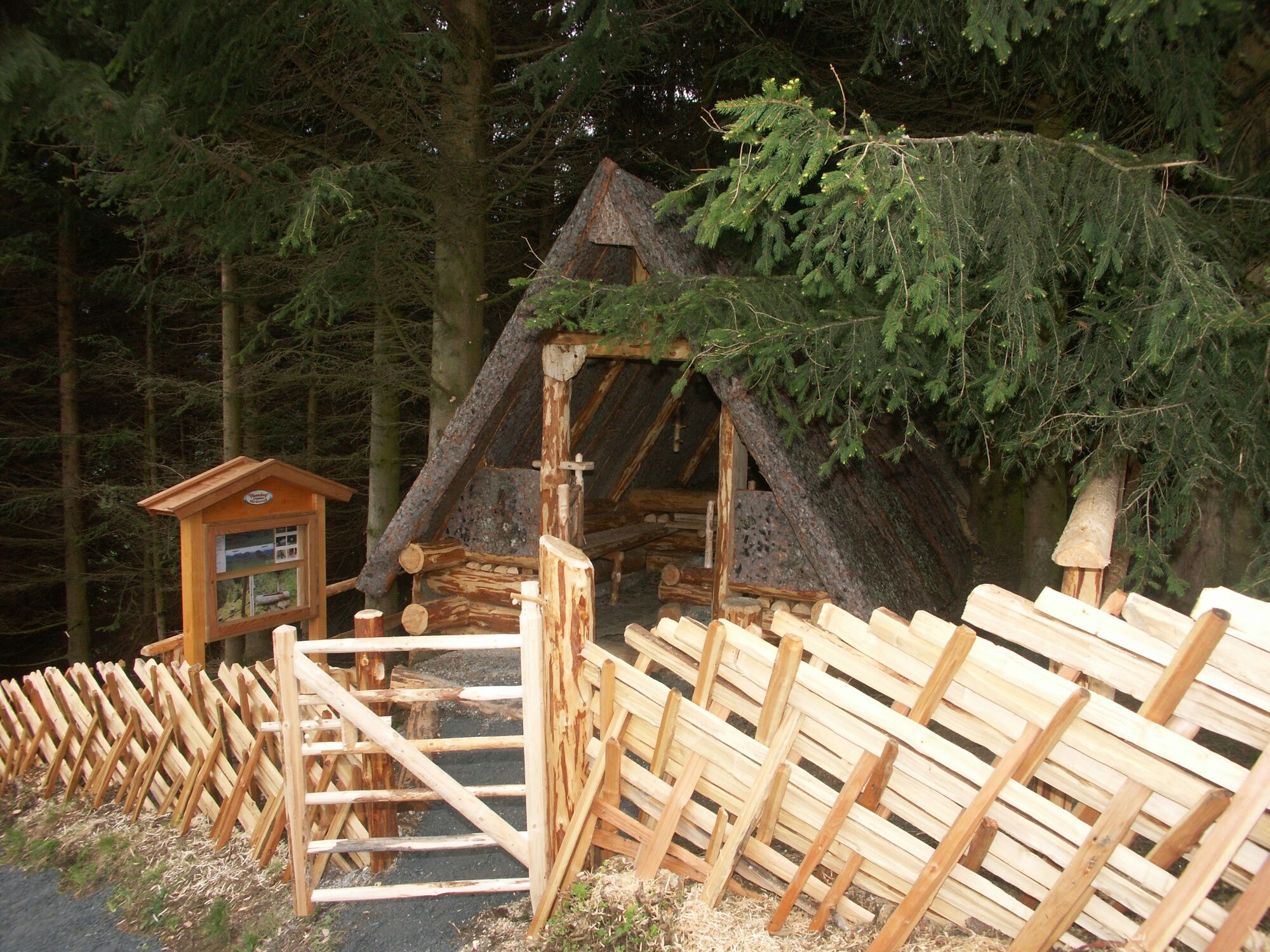
Starting in Piesendorf/Walchen, the "Kulturlandschaftsweg" trail stretches past orchards and herb gardens, a woodcutter's bark hut and artistically designed forest spirits to the Naglköpfl with the Köpfl Chapel with its figures of saints.
The Naglköpfl was one of the first settlement points of the Celts and is therefore a magical place of power that invites you to relax and recharge your batteries. In addition, you are rewarded with an impressive panorama.
- Directions
-
From the car park, follow the road Schiliftstraße downhill to the church. Turn right into the Alte Landesstraße and immediately right again into the Bachweg. Then turn left into Kehlbachgasse and follow uphill the Kulturlandschaftsweg trail to Naglköpfl. The hike leads past the Naglköpfl Chapel and the Beim Naglbauer inn. Continue along hiking trail no. 19, along the road in the direction of Röderlehen. In the right-hand bend, turn left onto trail no. 5 and follow it downhill to Ematen. Turn left again here and hike along the road for a short distance. Return to the starting point along Naglköpflweg no. 6 and then along the Kulturlandschaftsweg trail.
- Highest point
- 1,172 m
- Endpoint
-
Parking lot Walchen
- Height profile
-

- Equipment
-
Light hiking boots, drinking bottle, energy bar
- Safety instructions
-
Dear nature lovers!
We hope that the snacks and drinks you take with you on your hike will give you the strength to carry back the packaging material and empty cans and bottles.We kindly ask you to observe the Fair Play & Rules of Conduct!
Fairness and mutual consideration form the basis for a common together and the protection of the various interests in the natural region!
- Additional information
- Public transportation
- Parking
-
Sufficient parking spaces are available at the parking lot in the Schiliftstraße in Walchen.
-

-
AuthorThe tour Piesendorf: Naglköpflweg zum Kraftplatz von Walchen is used by outdooractive.com provided.