- Brief description
-
Extensive hike along forest and hiking trails.
- Difficulty
-
medium
- Rating
-
- Starting point
-
centre of Abtenau
- Route
-
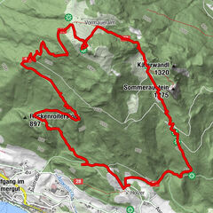
MarktAbtenau0.0 kmRöm. Kath. Pfarrkirche zum Heiligen Blasius0.0 kmMarienkapelle0.0 kmKehlhof1.4 kmRinnbergalmen16.6 kmRußbachsaag20.2 kmKirchenwirt20.3 km
- Best season
-
JanFebMarAprMayJunJulAugSepOctNovDec
- Directions
-
From the Abtenau market square, turn left next to the church into the side road, there head west along the road that leads to the Abtenau adventure pool. Keep to the right past the swimming pool, after the slight ascent turn left onto the forest path and follow path 160. After approx. 1 km, turn right into the forest path and follow the path downhill to the Lammer. Cross the bridge there and change to trail 160 opposite the sawmill. Follow this forest path steadily through the forest - here you also come across the St. Rupert Pilgrims' Path. After about 7 km you will pass the Klausegg Chapel. Now hike up a little further and you will reach the asphalt road of the Postalm-Panoramastraße, which you follow for a short distance. A forest path 159 leads away from the panorama road, which you now hike along for about 2 km. At the crossroads to the Moosbergsattel, stay on trail 33 in the direction of the Rinnbergalm, which can be reached in about 40 minutes. After a possible stop for refreshments at the Rinnbergalm, descend in the direction of Rußbach.
- Highest point
- 1,370 m
- Endpoint
-
centre of Rußbach
- Height profile
-
- Tips
-
A stop at the Rinnbergalm or Angerkaralm will definitely pay off.
- Directions
-
Via Tauernautobahn A10 exit Golling direction Abtenau. To Abtenau to the free public car park Ost.
- Public transportation
- Parking
-
Free parking at the public car park East.
- Author
-
The tour Abtenau to Rußbach via Klausegg and Rinnberg is used by outdooractive.com provided.
General info
-
Salzkammergut Oberösterreich
3089
-
Wolfgangsee - Salzkammergut
1792
-
Postalm
504


