Tour data
10.55km
1,250
- 1,820m
557hm
561hm
03:30h

- Brief description
-
Forest roads and well-marked trails
- Difficulty
-
medium
- Rating
-
- Starting point
-
Klammalm in Hüttau
- Route
-
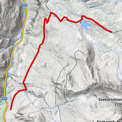
Iglsbach0.0 kmKlammalm0.1 kmGasthaus Klammalm0.1 kmHochgründeck (1,827 m)4.9 kmHeinrich-Kiener-Haus5.6 kmSt. Vinzenz Friedenskirche5.6 kmKlammalm10.3 kmGasthaus Klammalm10.3 kmIglsbach10.5 km
- Best season
-
JanFebMarAprMayJunJulAugSepOctNovDec
- Description
-
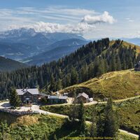
A special hiking trail leads from the Klammalm to the Hochgründeck, located at 1,827m above sea level. Once at the top of the Hochgründeck you can enjoy a 360 ° panoramic view of 300 mountain peaks.
- Directions
-
The first stop on this meditation and peace path is a chapel that can be reached from the Klammalm. To do so, keep right and hike along the forest road (path 452). At the chapel you pass a gate to a fork where you turn left. After about 10 minutes, the hiking trail branches off to the Hochgründeck and thus to the fourth station. Then the path crosses a forest road and leads on a pleasant slope in the shade of the trees to the ninth station on the 1,635 m high Hofersattel. The path splits here and the path on the left continues with an ascent over the ridge. The forest clears and you will soon reach a free saddle. Here is also the natural arena for the "Ranggeln am Hochgründeck". You reach the summit of the Hochgründeck via a ridge to the left. To the right is a flat path to the Heinrich-Kiener-Haus. From its terrace you have a bird's eye view of the Salzach Valley with the towns of St. Johann, Bischofshofen and the “Hohen Werfen” fortress. The descent is identical to the ascent.
Variant: From the Hofersattel you can also choose the steep climb to the right and after a short descent you come to a nice forest road that leads to the Klammalm.
- Highest point
- 1,820 m
- Endpoint
-
Klammalm in Hüttau
- Height profile
-
- Equipment
-
In our hiking test center in Radstadt you can rent and test hiking shoes, hiking poles, backpacks and child carriers. With the guest card, the first day is free.
- Tips
-
This hiking tour is one of the most beautiful around Radstadt. You can get a brochure from the Radstadt Tourist Office.
- Parking
-
Parking at the Klammalm
-

-
AuthorThe tour Klammalm - Hochgründeck is used by outdooractive.com provided.
GPS Downloads
General info
Refreshment stop
Cultural/Historical
Other tours in the regions
-
Salzburger Sportwelt
2210
-
Hüttau
481


