


- Brief description
-
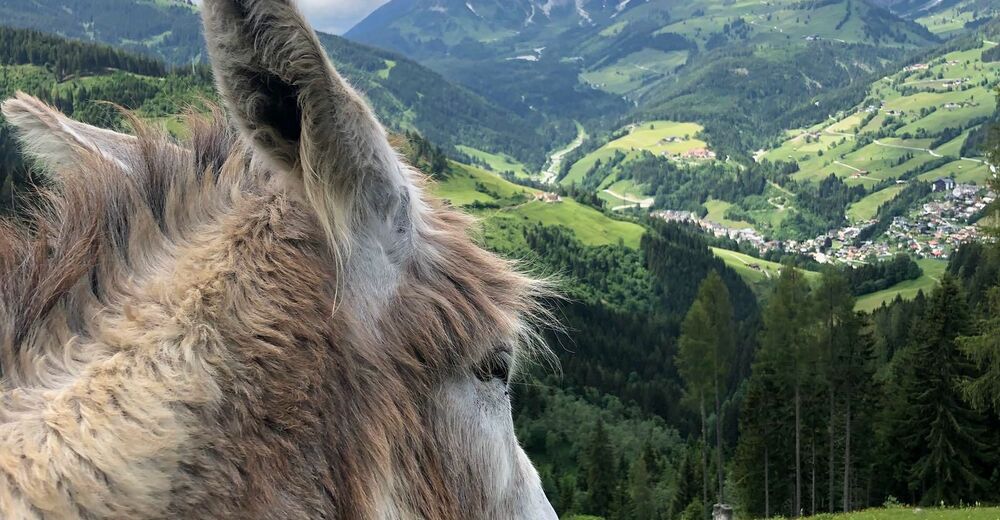
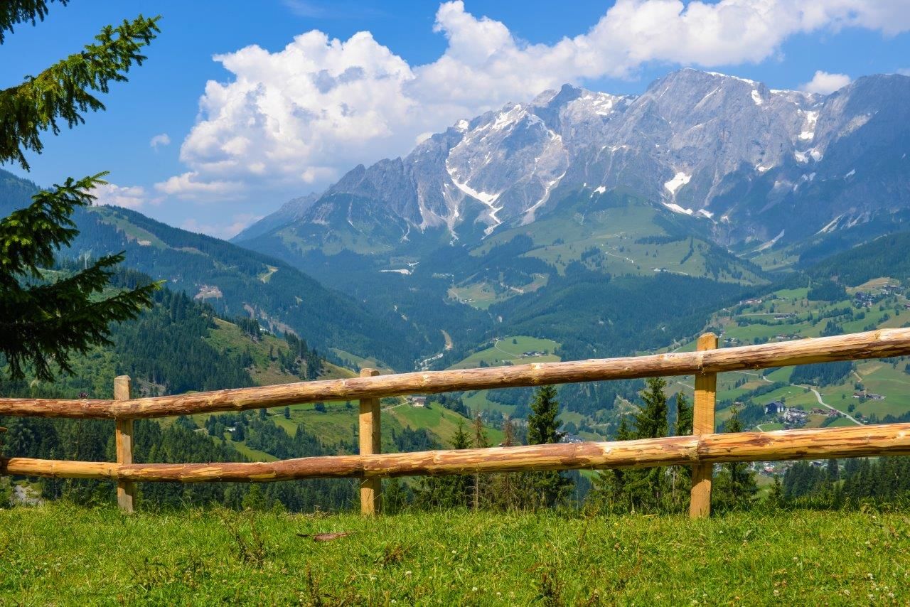
The breathtaking view of the mountain village of Mühlbach and the mighty Hochkönig Massif - a delight! There is a playground and lots of animals for the little guests.Special feature: From the Paussbauern the path of good thoughts leads along a romantic hiking trail to the Pronebenalm.
- Difficulty
-
medium
- Rating
-
- Starting point
-
cable car Mühlbach
- Route
-
Althausalm3.3 kmAlthaussattel3.6 kmKreisten4.2 kmHubertuskapelle4.2 kmPronebenalm7.4 kmPaussbauer8.8 kmMühlbach am Hochkönig11.5 kmHöring11.5 kmKarbachalm12.7 km
- Best season
-
JanFebMarAprMayJunJulAugSepOctNovDec
- Description
-
Ascent with the cable car to the Karbachalm. From there, the trail descends and then turns right into the forest on trail nr. 79. Follow the path to the Althaussattel and the Hubertuskapelle. Continue on a short, ascending section on trail nr. 17, before you continue on trail nr. 79 to the Pronebenalm.Return to the village via the Gasthof Paussbauern.
- Directions
-
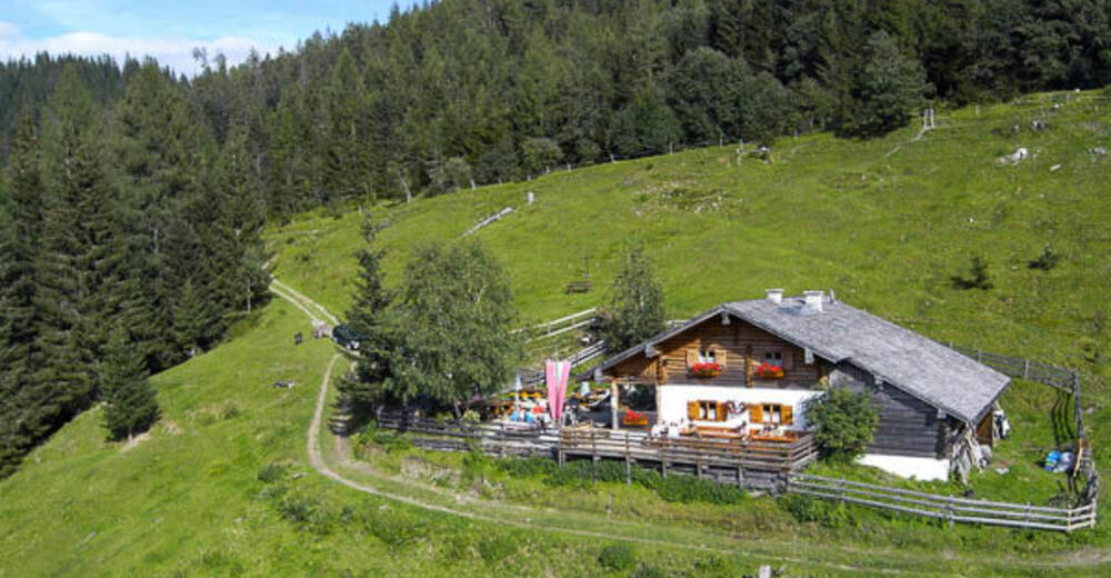
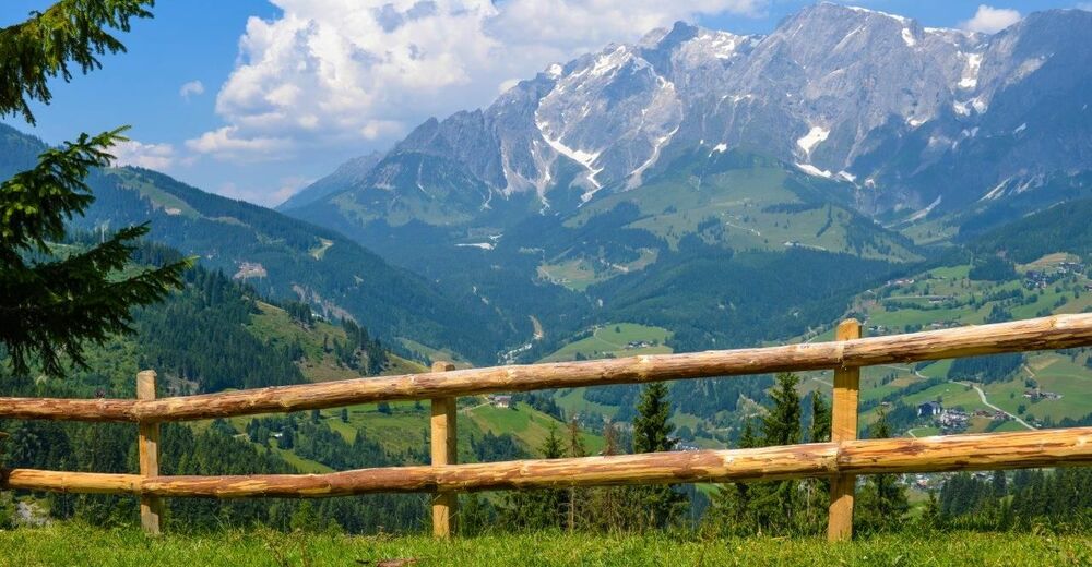
The Karbachalm cable car takes you to your starting point (L8). The first part of the hike leads downhill on trail number 75b and finally into a cool forest. You follow trail number 79 to the Althaussattel and the Althausalm. After a refreshment, you are well prepared for the ascent (trail no. 17) to the Hubertus Chapel. Here the hunters also celebrate numerous, solemn devotions. Now trail number 79 leads to the left uphill more steeply through a forest. With a little luck, you will also find chanterelles and gentlemen's mushrooms next to the path. After the ascent, the forest thins out and the oasis of peace invites you to take a short rest before heading back downhill to the Pronebnalm, where you should definitely try a Hochkönigjause and the homemade juices. From the Pronebenalm you take the path number 79, the "path of good thoughts", a narrow forest trail, to the Paussbauer. Once here, enjoy the views of Mühlbach and the Hochkönig from the panoramic terrace and then hike back to the village via the Paussenberg gallery.
- Highest point
- 1,493 m
- Endpoint
-
Pronebenalm
- Height profile
-

- Equipment
-
Ankle-high hiking boots
sufficient water
Sun and rain protection
Headgear
Hiking poles
Binoculars - Safety instructions
-
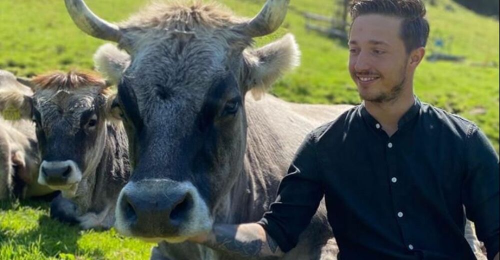
Safe hiking requires advance information and preparation. Please observe the rules for correct behaviour in the mountains. Because your safety is very important to us. And don't forget to drink plenty of fluids during the tour! Take litter down into the valley. Conserve the flora and fauna. Behaviour with animals on the mountain pastures: Do not stroke or irritate cows, calves, sheep, horses etc., but behave "quite normally" and do not show any fear. Do not leave paths on alpine pastures and avoid animals at great distances. Dogs must be kept on a leash. Dogs must never chase the grazing animals, especially mother cows fear for their calves. However, if a grazing animal attacks the dog, simply let it run for its own protection.
Emergency numbers: Alpine emergency call: 140International emergency call: 112
- Tips
-
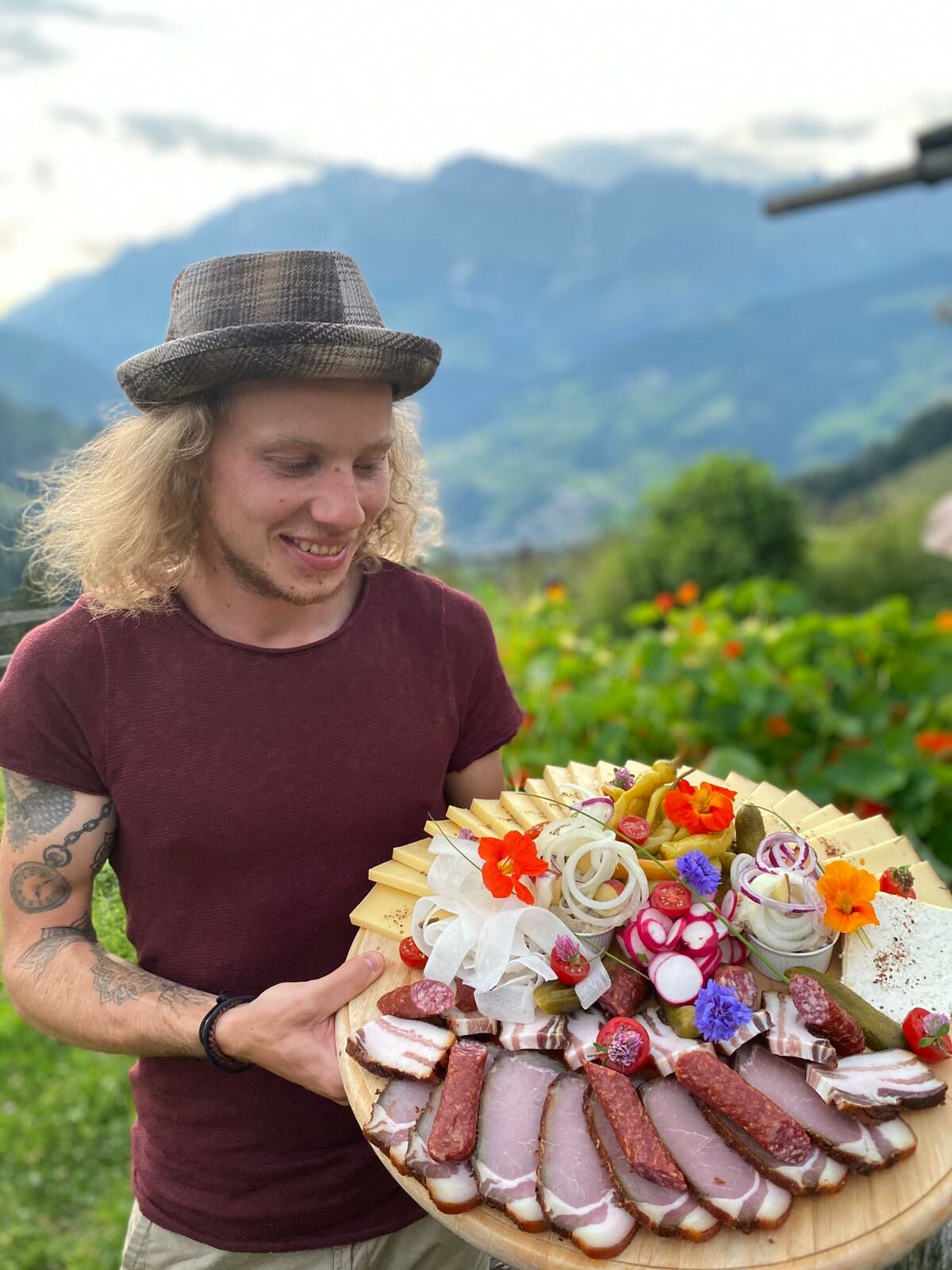
The Hochkönig herb snack not only tastes exceptionally good but is also a feast for the eyes.
- Additional information
- Directions
-
Hochkönig main road B 164
- Public transportation
- Parking
-
Karbachalm lift valley station


- Author
-
The tour ON THE TRAIL OF HERBS - to the Pronebenalm is used by outdooractive.com provided.


