

© AreitLounge - Birgit Arnold

© Unbekannt - (c) AreitLounge
- Brief description
-
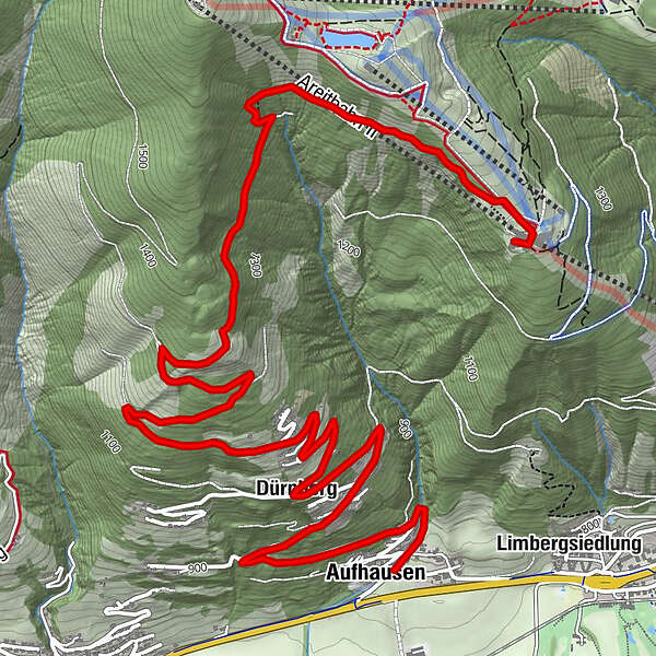
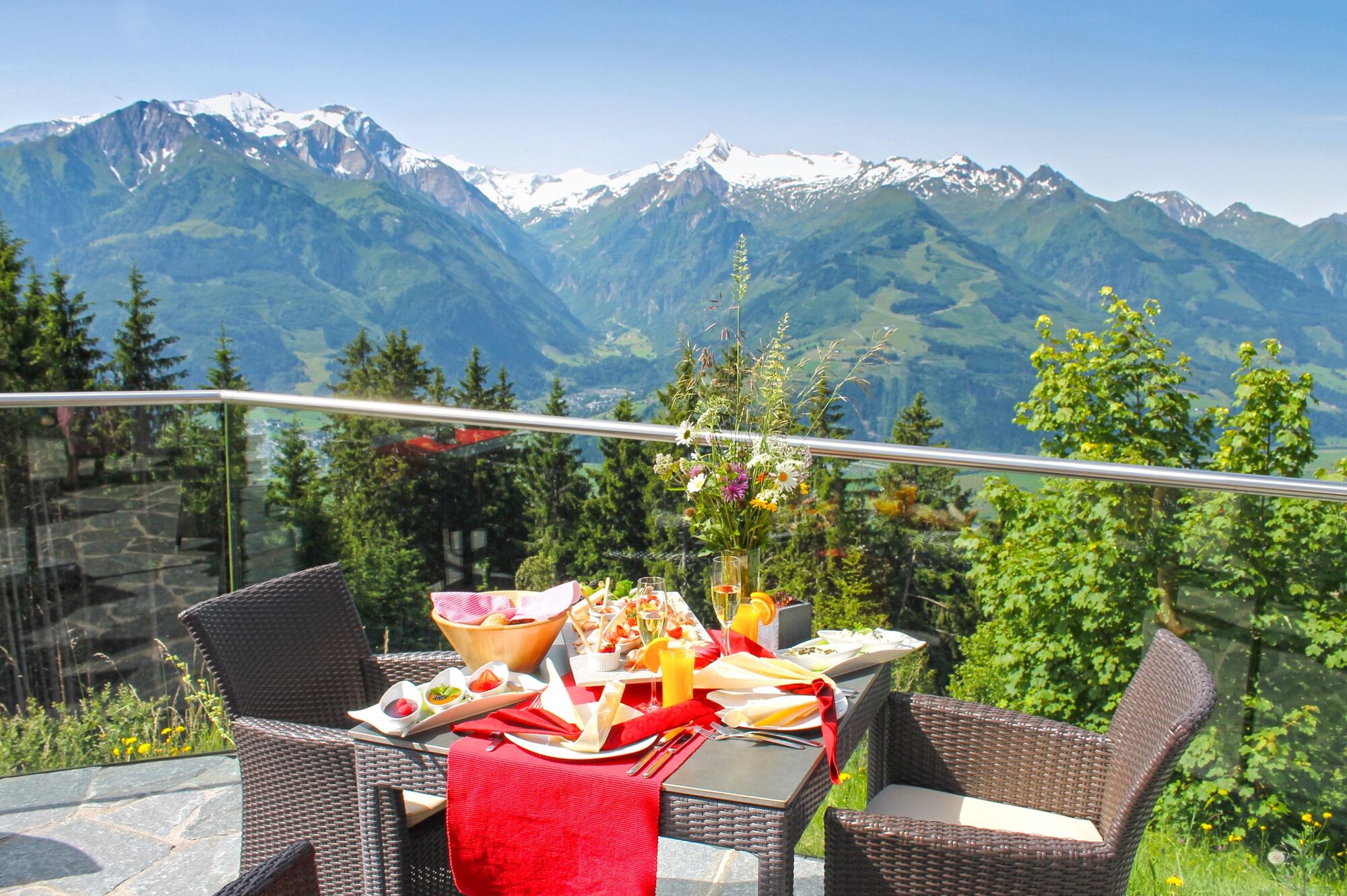
Perfect for cloudless days: If you hike from Fürth/Aufhausen to the Areitalm/AreitLounge, a panoramic view of over 30 three thousand metre peaks in the Hohe Tauern awaits you.
- Difficulty
-
medium
- Rating
-
- Starting point
-
Aufhausen | Fürth
- Route
-
AufhausenFilialkirche St. Leonhard0.1 kmDürnberg2.3 kmAreit Lounge8.0 kmAreitalm8.0 km
- Best season
-
JanFebMarAprMayJunJulAugSepOctNovDec
- Description
-
The tour with a medium level of difficulty inspires the whole family not only with the great view, but also with typical Austrian cuisine and playing fun for the kids at the finish.
- Directions
-
From Aufhausen or Fürth, follow the well-marked hiking trail no. 8 over Dürnberg to Hochedt. Shortly afterwards, turn right at the fork and continue along trail no. 8 to the AreitAlm/AreitLounge.
The descent is either via the ascent route or comfortably with the areitXpress to Schüttdorf and by bus or train back to the starting point.
- Highest point
- 1,492 m
- Endpoint
-
Areitalm/AreitLounge
- Height profile
-

- Equipment
-
Ankle-high hiking boots, drinks & snacks, backpack, rain protection, mobile phone
- Safety instructions
-
Dear nature lovers!
We hope that the snacks and drinks you take with you on your hike will give you the strength to carry back the packaging material and empty cans and bottles.We kindly ask you to observe the Fair Play & Rules of Conduct!
Fairness and mutual consideration form the basis for a common together and the protection of the various interests in the natural region!
- Additional information
- Public transportation
- Parking
-
Sufficient parking available at the train station Fürth/Kaprun or at the church in Aufhausen.

-

-
AuthorThe tour Piesendorf: Areitalm/AreitLounge is used by outdooractive.com provided.
GPS Downloads


General info
Refreshment stop
A lot of view
Other tours in the regions
-
Zell am See - Kaprun
1504
-
Schmittenhöhe
522


