


- Brief description
-
The Schmitten is one of the most beautiful viewing mountains, offering a 360° panoramic view of the surrounding Kitzbühel Alps.
- Difficulty
-
medium
- Rating
-
- Starting point
-
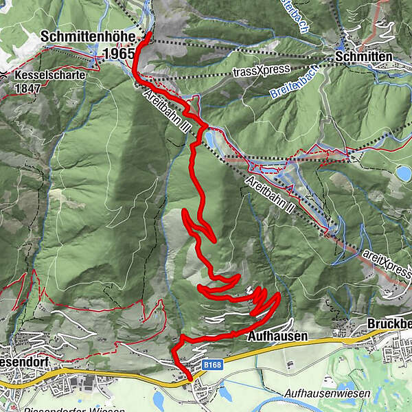
Fürth | Aufhausen
- Route
-
Gasthaus Matzen0.0 kmFürth0.2 kmAufhausen1.9 kmDürnberg2.7 kmtrassXpress9.8 kmpanorama Restaurant am Berg9.8 kmElisabeth-Kapelle10.3 kmSchmittenhöhe (1,965 m)10.5 kmBerghotel Schmittenhöhe10.5 km
- Best season
-
JanFebMarAprMayJunJulAugSepOctNovDec
- Description
-
The ascent of about 1,200 metres with a medium level of difficulty from Fürth or Aufhausen is therefore always worthwhile - not only for adults, as the mountain is considered to be very family-friendly. Culinary rewards await you at the top of the mountain hut, and if you are too tired for the descent afterwards, simply take the Schmittenhöhe cable car down to Zell am See - a viewing pleasure in itself.
- Directions
-
The starting point of the tour is either in Fürth or Aufhausen. From the respective starting point, follow trail no. 8 over Dürnberg. At the fork, turn left onto trail no. 8A and continue along this trail to Breiteck Alm. Now the trails nos. 50 and 58 lead further up to the Schmittenhöhe.
The way back is via the same route or comfortably with the Schmittenhöhe gondola to Zell am See and by bus or train back to the starting point.
- Highest point
- 1,950 m
- Endpoint
-
Schmittenhöhe Zell am See
- Height profile
-

- Equipment
-
Ankle-high hiking boot, drinks & snacks, backpack, rain protection, mobile phone
- Safety instructions
-
Dear nature lovers!
We hope that the snacks and drinks you take with you on your hike will give you the strength to carry back the packaging material and empty cans and bottles.We kindly ask you to observe the Fair Play & Rules of Conduct!
Fairness and mutual consideration form the basis for a common together and the protection of the various interests in the natural region!
- Additional information
- Public transportation
- Parking
-
Sufficient parking available at the train station Fürth/Kaprun or in Aufhausen at the church.


-

-
AuthorThe tour Piesendorf Fürth/Aufhausen: Schmittenhöhe is used by outdooractive.com provided.


General info
-
Zell am See - Kaprun
1504
-
Schmittenhöhe
522


