

© Piesendorf Niedernsill - Harry Liebmann

© Piesendorf Niedernsill - Tourismusverband Piesendorf Niedernsill
- Brief description
-
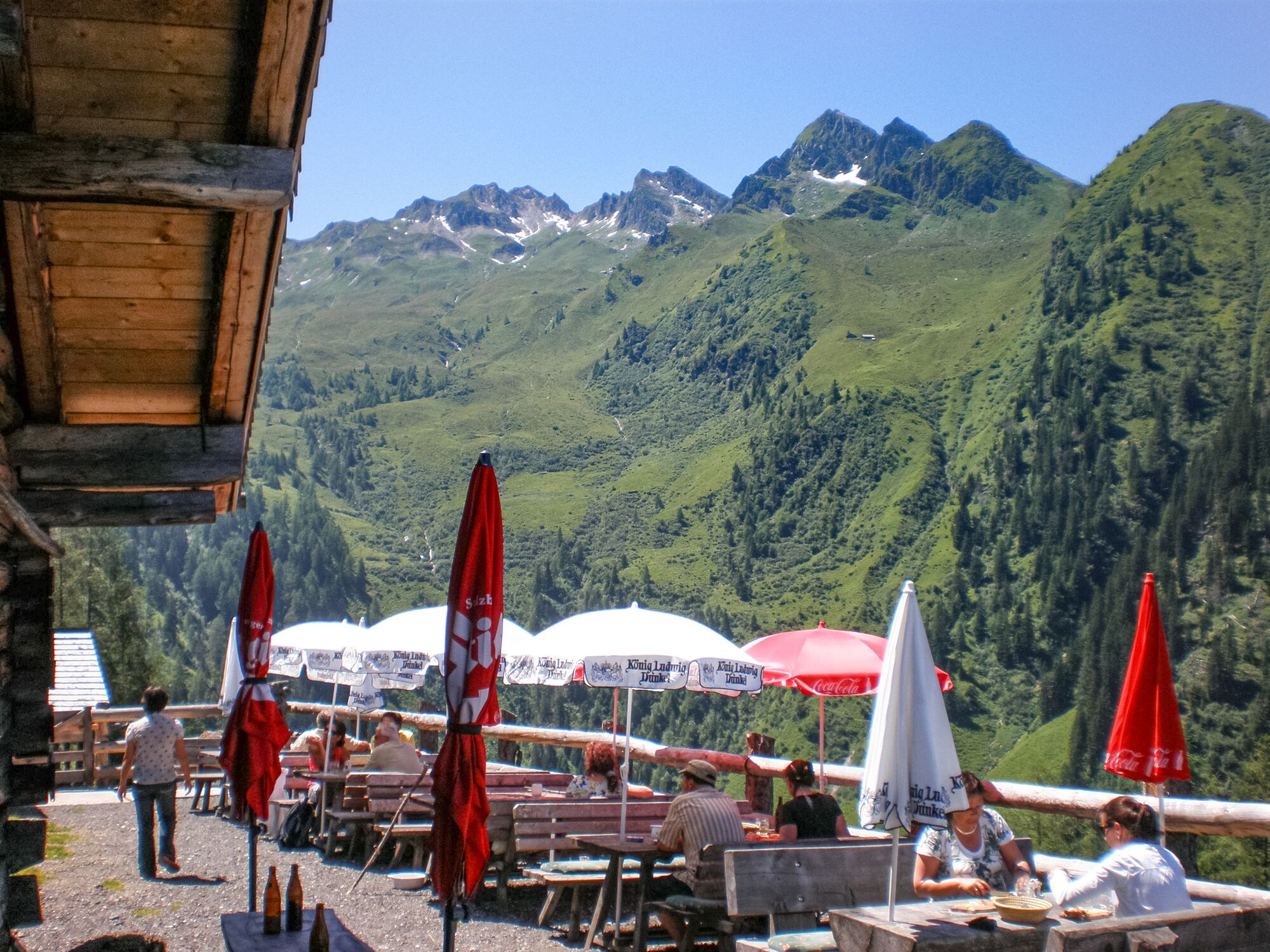
An absolute highlight for all pleasure hikers: homemade cheese specialities, creamy butter and flavourful butter milk impress with their freshness.
- Difficulty
-
medium
- Rating
-
- Starting point
-
Hummersdorf
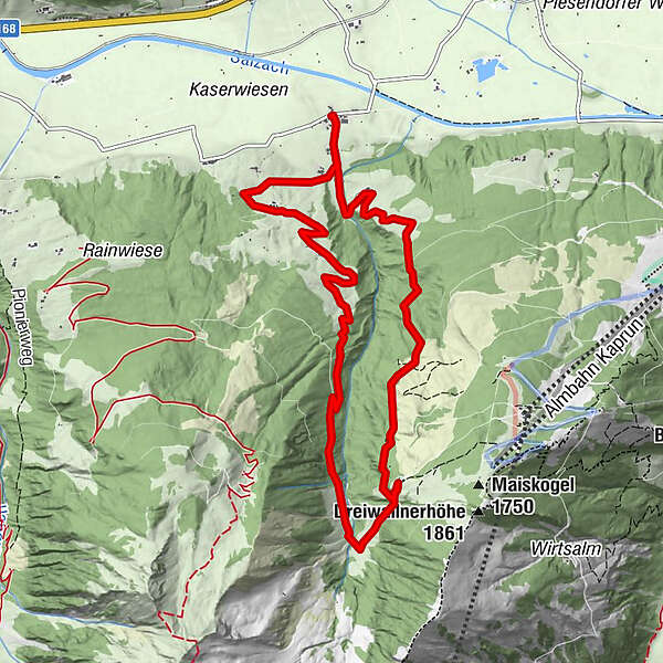
- Route
-
HummersdorfUnterbergalm6.2 kmHummersdorf10.5 km
- Best season
-
JanFebMarAprMayJunJulAugSepOctNovDec
- Description
-
While you enjoy homemade products from the own farm on the terrace of the Unterbergalm, you are also rewarded with a magnificent view of the Große (Hohe) Arche and the Kitzbühel Alps/Pinzgauer Grasberge.
- Directions
-
Starting from Dietlgut, follow the Hummersdorferstraße uphill towards Bam and Unterholz. Then take hiking path no. 14A via Erlach Grundalm to the Unterbergalm. The descent is on hiking path no. 14B via Mooslehen.
You can also reach the Unterbergalm with the MK Maiskogelbahn gondola from Kaprun - hiking time approx. 20 minutes.
- Highest point
- 1,559 m
- Endpoint
-
Hummersdorf
- Height profile
-

- Equipment
-
Ankle-high hiking boot, drinks & snacks, backpack, rain protection, mobile phone
- Safety instructions
-
Dear nature lovers!
We hope that the snacks and drinks you take with you on your hike will give you the strength to carry back the packaging material and empty cans and bottles.We kindly ask you to observe the Fair Play & Rules of Conduct!
Fairness and mutual consideration form the basis for a common together and the protection of the various interests in the natural region!
- Additional information
- Public transportation
- Parking
-
Parking available at the Hummersdorf bridge.

-

-
AuthorThe tour Piesendorf: Unterbergalm am Maiskogel is used by outdooractive.com provided.
GPS Downloads


General info
Refreshment stop
A lot of view
Other tours in the regions


