


- Brief description
-
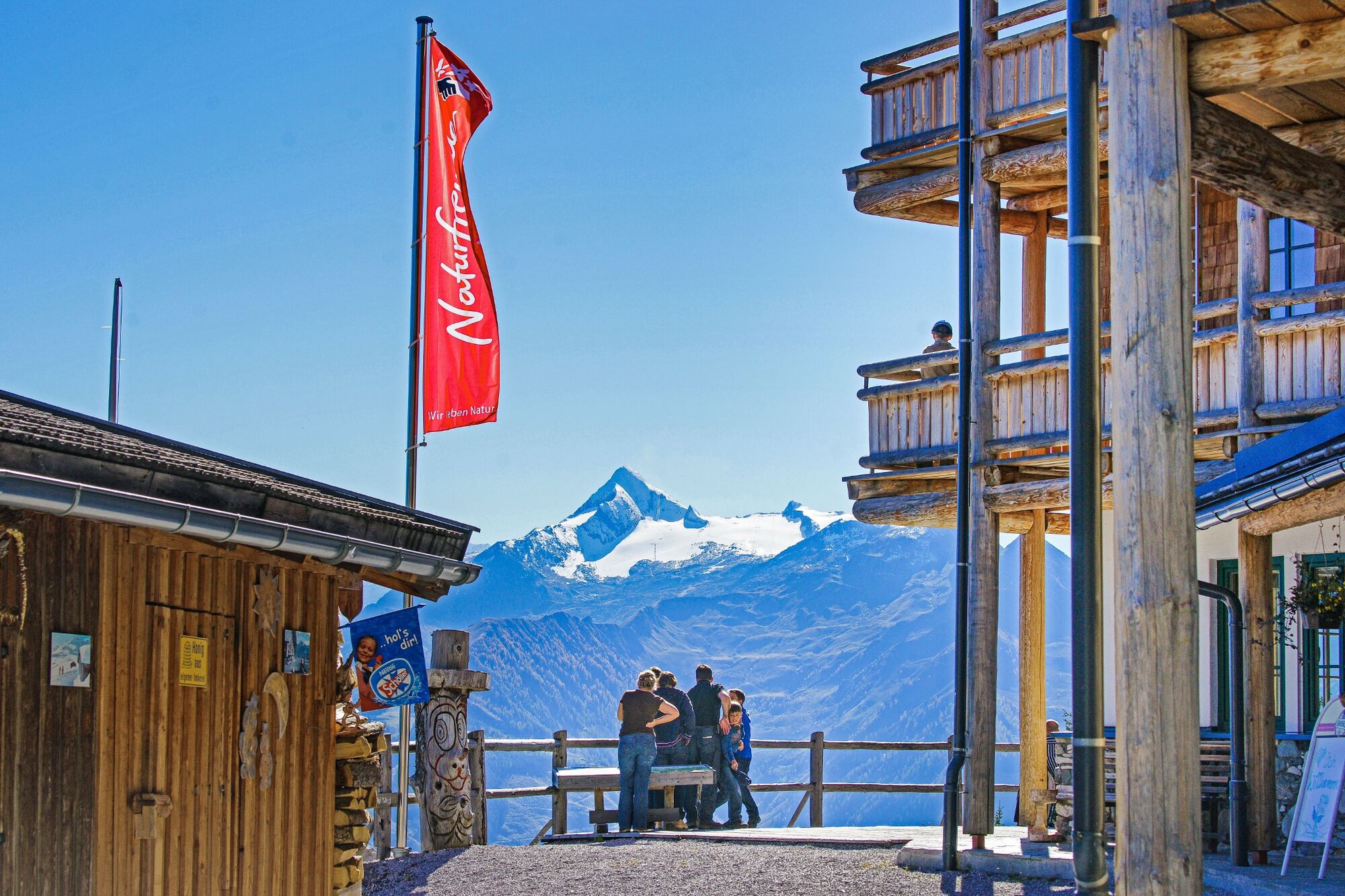
A real insider tip for hikers: the position, surrounded by the beautiful Pinzgauer Grasberge mountains with a marvellous view onto the Großglockner, is unique.
- Difficulty
-
medium
- Rating
-
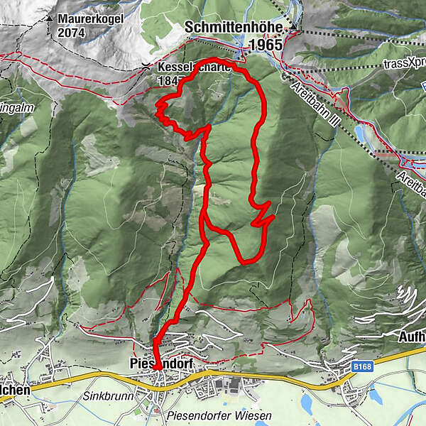
- Starting point
-
Hiking info point Piesendorf
- Route
-
Gasthof Neuwirt0.0 kmIl Capriccio0.1 kmPiesendorf0.1 kmPfarrkirche St. Laurentius0.1 kmPinzgauer Hütte5.3 kmPfarrkirche St. Laurentius12.9 kmPiesendorf12.9 kmGasthof Neuwirt12.9 kmIl Capriccio13.0 km
- Best season
-
JanFebMarAprMayJunJulAugSepOctNovDec
- Description
-
The destination offers a refreshment stop with sun terrace, spoils you with a great views and is also an ideal starting point for further summit experiences. For motivated people there is a combination with the "Pinzgauer Spaziergang".
- Directions
-
The starting point of the tour is the hiking info point, from here you cross the village bridge and immediately turn left to the church. Now follow trail no. 2 and then trail no. 1A uphill to the fork in the trail. Then take trail no. 749/1B via the Kottingeinödenalm to the Pinzgauer Hütte. Well refreshed, you hike back via the hiking trails 1A and 2 to the starting point.
- Highest point
- 1,721 m
- Endpoint
-
Hiking info point Piesendorf
- Height profile
-

- Equipment
-
Ankle-high hiking boots, drinks & snacks, backpack, rain protection, mobile phone.
- Safety instructions
-
Dear nature lovers!
We hope that the snacks and drinks you take with you on your hike will give you the strength to carry back the packaging material and empty cans and bottles.We kindly ask you to observe the Fair Play & Rules of Conduct!
Note: Leashes are compulsory in Piesendorf and Niedernsill!
Fairness and mutual consideration form the basis for a common together and the protection of the various interests in the natural region!
- Additional information
- Public transportation
- Parking
-
Parking available.

- Author
-
The tour Piesendorf: Pinzgauer Hütte is used by outdooractive.com provided.


General info
-
Zell am See - Kaprun
1502
-
Schmittenhöhe
522


