
- Brief description
-
Leichte Familienwanderung mit Einkehrmöglichkeit.
- Difficulty
-
medium
- Rating
-
- Route
-
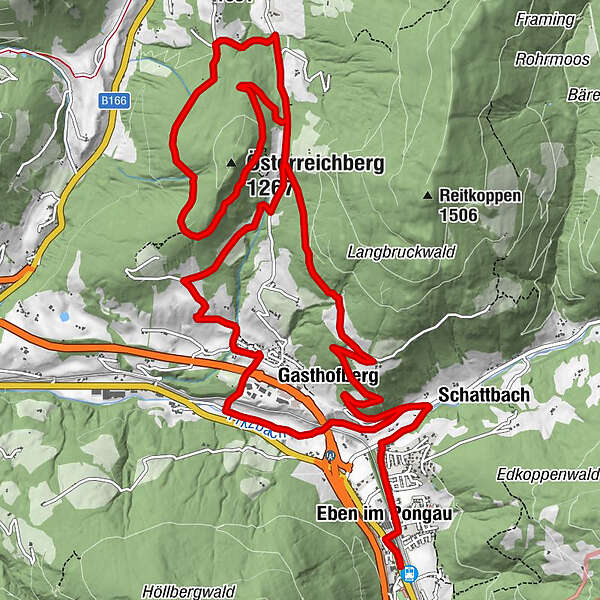
Steiner's0.1 kmGasthof Ebnerwirt0.2 kmEben im Pongau0.5 kmSchattbach1.6 kmGasthofberg2.4 kmHalmgutspielplatz12.2 kmGasthofberg16.8 km
- Best season
-
JanFebMarAprMayJunJulAugSepOctNovDec
- Directions
-
From village center go into „Alleestrasse“ further until the „Filzmooserstrasse“. Cross this street and follow the way downhill until the way “Stauweg” (Nr. 17 before Egglgut). From here go uphill until “Reitgut” and turn afterwards at the way 16 (left) until “Ellmaubauern” and further to the junction way 16A. Follow this way until “Halmgut”. Turn right downhill and then left at the “Österreichbergweg” (Nr. 75). Circuit the mountain and at the second junction go right. Again uphill ca. 100 meters height until “Jausenstation Halmgut”. Go back at the way 18 and 19 until the village. 80 meters after the underpass turn left and go further at the way “Fritzbachweg” 17A until Eben.
- Highest point
- 1,196 m
- Endpoint
-
Österreichberg / Berggasthof Halmgut
- Height profile
-

- Author
-
The tour Österreichberg | Rundweg is used by outdooractive.com provided.


General info
-
Salzkammergut Oberösterreich
3081
-
Salzburger Sportwelt
2210
-
Eben im Pongau
565