Dientner Sattel - Tiergartenalm - Sunnhüttel - Bürgl ALm - Dienten - Vital Hotel Post


- Brief description
-
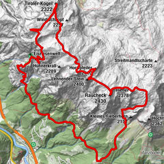
Pleasant hike with fabulous panoramic views ranging from the Hochkönig to the Dachstein Massif, the Radstädter Tauern, the Hohe Tauern from the mighty Grossglockner to the Wilder Kaiser, the Leoganger Steinberge and the Steinernes Meer.
- Starting point
-
car Park Dientner Sattel
- Route
-
Dientalm0.1 kmZachhofalm4.2 kmWastlhöhe (1,737 m)4.3 kmWastlhöhelift4.6 kmBürglalm5.6 kmDienten am Hochkönig9.5 km
- Description
-
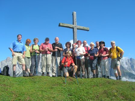
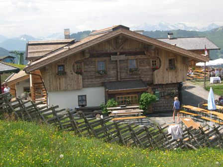
We ride the hotel hiking shuttle to the Dientner Sattel bus stop. Right, past the Dientalm, on broad pathway No.11 to the Tiergartenalm. We now continue along Ameisensteig No. 11 A (a parallel trail which runs to the right of the Tiergartenalm) to the Sunnhüttel, where refreshments are available. Walk-time ca. 80-90 min. From the Sunnhüttel (1740 m ), we enjoy a pleasant hike along trail No. 17 via the Wastlhöhe to the Bürglalm (refreshments). Walk-time ca. 40 min. From here we continue along a forestry road in the direction of Dienten village. After about 40 minutes, we make a steep descent down trail No. 17 back to the village. Total walk-time about 1 hour.
- Highest point
- 1,739 m
- Height profile
-

- Directions
-
Ride on the hotel hiking shuttle to the Dientner Sattel (ca. 3 km)
- Public transportation
-
Travelling coach removes 50 metres beside the hotel at 09.05 o'clock.
- Author
-
The tour Dientner Sattel - Tiergartenalm - Sunnhüttel - Bürgl ALm - Dienten - Vital Hotel Post is used by outdooractive.com provided.


-
Hochkönig
2042
-
Dienten am Hochkönig
536