


- Brief description
-
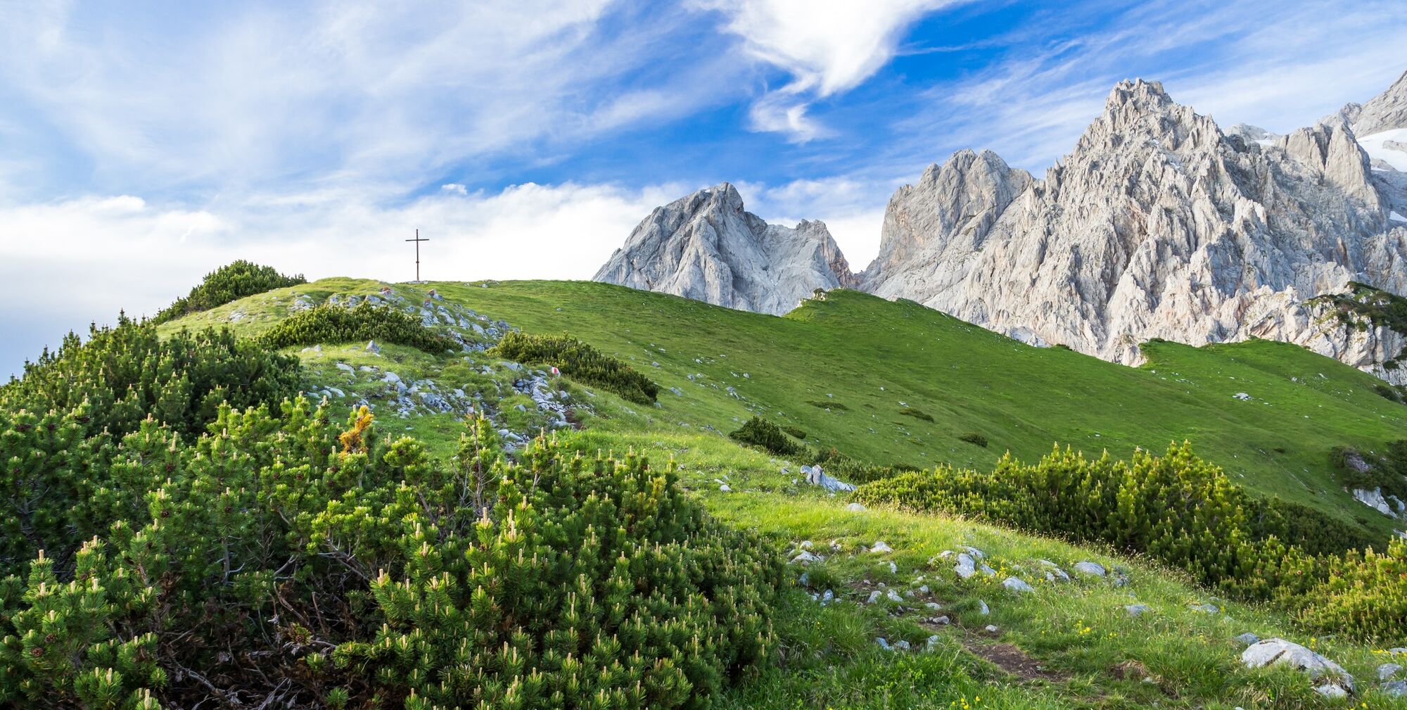
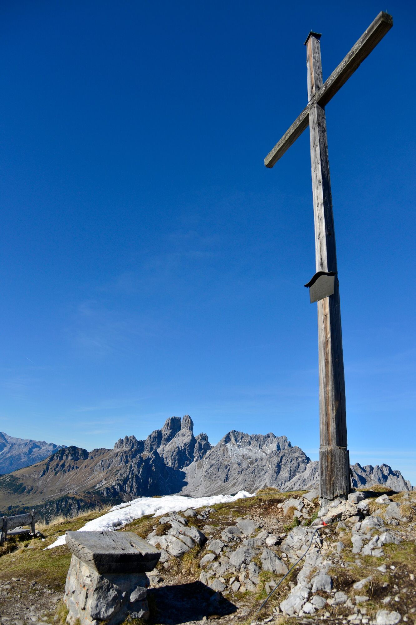
From the summit cross you have a wonderful round view of the Bischofsmütze, Hochkesselkopf, Torstein, Rötelstein and Hochkönig.
- Difficulty
-
medium
- Rating
-
- Starting point
-
Oberhofalm
- Route
-
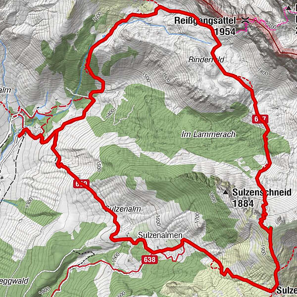
Oberhofalm0.1 kmKaserboden1.6 kmSulzenhals (1,824 m)5.8 kmSulzenalmen7.1 kmKrahlehenhütte7.1 kmOberhofalm9.4 km
- Best season
-
JanFebMarAprMayJunJulAugSepOctNovDec
- Description
-
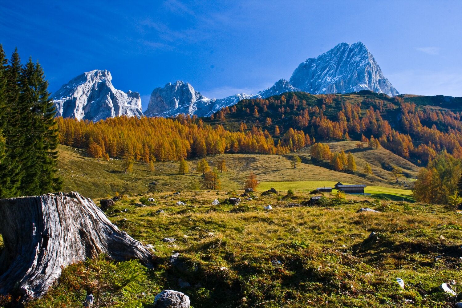
From the Oberhofalm a steep serpentine path leads through forest to the "Rinderfeld", a beautiful alpine landscape. At the "Rinderfeld" it almost always remains on the same level in the direction of "Sulzenschneid" and one crosses the source of the warm Mandling River. Shortly before the "Sulzenschneid", the trail passes between the laces, once again steeply uphill. From the summit cross you have a wonderful round view of the Bischofsmütze, Hochkesselkopf, Torstein, Rötelstein and Hochkönig. Then you descend via the Sulzenhal to the Sulzenalmen (Wallehen- and Krahlehenhütte farmed). From the Sulzenalmen one comes back after about 1 hour back to the Oberhofalm.
- Directions
-
From the Oberhofalm a steep serpentine path leads through forest to the "Rinderfeld", a beautiful alpine landscape. At the "Rinderfeld" it almost always remains on the same level in the direction of "Sulzenschneid" and one crosses the source of the warm Mandling River. Shortly before the "Sulzenschneid", the trail passes between the laces, once again steeply uphill. From the summit cross you have a wonderful round view of the Bischofsmütze, Hochkesselkopf, Torstein, Rötelstein and Hochkönig. Then you descend via the Sulzenhal to the Sulzenalmen (Wallehen- and Krahlehenhütte farmed). From the Sulzenalmen one comes back after about 1 hour back to the Oberhofalm.
- Highest point
- 1,938 m
- Endpoint
-
Sulzenschneid
- Height profile
-

- Author
-
The tour Sulzenschneid is used by outdooractive.com provided.


General info
-
Schladming - Dachstein
3001
-
Ramsau am Dachstein
1689
-
Filzmoos
628


