Winter
Summer
Weather
Webcams
Accommodations
Tours
Search history
Search suggestions
No results found
Search
Tours
Home
Summer Österreich
Salzburg
Tours
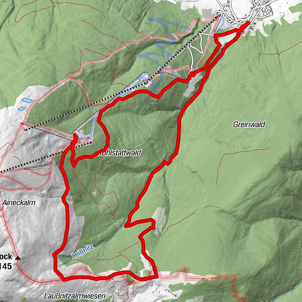
Kößlbacher - Branntweiner Variante B
Regions
Weather
Webcams
Tours
Highlights
Bathing lakes
Accommodations
Offers
Sports provider
Events
Ski resorts
Cross-country skiing
Snow parks
Kößlbacher - Branntweiner Variante B
Hiking
Bookmark
Map
show
hide
Print
Tour data
16.06
km
-
Distance
-
Ascent
-
Duration
created am 18.04.2013
716
Views
Brief description
Wanderung über den Sackstadl
Difficulty
medium
Rating
Technique
Fitness
Landscape
Experience
Write a review
Overall rating
5
0
%
4
0
%
3
0
%
2
0
%
1
0
%
Reviews
(0)
0 Comments
Write a review
Error
An error has occurred. Please try again.
Thank you for your review
Rating has been deleted
Report tour
GPS Downloads
GPX
GPS Exchange Format (XML)
KML
Google Earth, Google Maps
QR Download Codes for Mobile Phones
Kößlbacher - Branntweiner Variante B
QR Codes - tour download for cell phones
GPX
KML
Other tours in the regions
Katschberg Lieser-Maltatal
2555
Lungau - Ferienregion
870
St. Margarethen im Lungau
179
Popular tours in the area
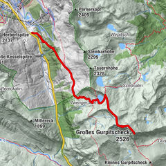
Großes Gurpitscheck
difficult
Hiking
11.76
km |
863
hm |
04:45
h
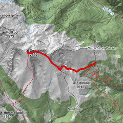
Bergfriedhütte - Gmeineck
medium
Hiking
7.41
km |
784
hm |
03:13
h
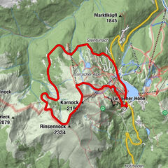
Rinsennock 2.334 m
medium
Hiking
11.33
km |
627
hm |
02:50
h
Gr. Gurpitscheck
medium
Hiking
12.54
km |
900
hm |
06:00
h
No entries found.
The search is currently not available.
Please refine your search.
Local search results
(<= 25km)
More results
(> 25km)
%count% Search results
%name%
%type%
%elevation%
%population%
%lpButton%