

© Tourismusverband St. Johann in Salzburg - Tourismusverband St. Johann

- Brief description
-
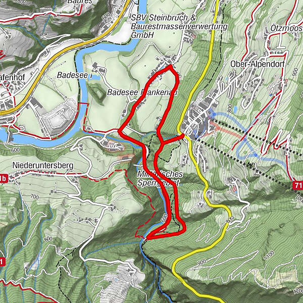
Hike from Alpendorf to the Liechtensteinklamm
- Difficulty
-
easy
- Rating
-
- Starting point
-
Alpendorf
- Route
-
Alpendorf0.0 kmKlammfürst1.3 kmLiechtensteinklamm1.5 kmPlankenau3.2 km
- Best season
-
JanFebMarAprMayJunJulAugSepOctNovDec
- Description
-
You start your tour in Alpendorf next to the valley station of the Alpendorf gondola. Take the pedestrian underpass to the parking, turn right and follow the path down to the Liechtensteinklamm. Return the same way or take the roundtrip along the Liechtensteinklammstraße on the direction to Hotel Lerch Plankenau. At the hotel you turn right to the Klammweg and then take the forest track back to Alpendorf – please be aware that this path can be steep at times.
- Highest point
- 711 m
- Endpoint
-
Liechtensteinklamm
- Height profile
-


- Author
-
The tour Alpendorf - Liechtensteinklamm is used by outdooractive.com provided.
GPS Downloads


General info
Refreshment stop
A lot of view
Other tours in the regions


