
- Brief description
-
Eine tolle Wanderung mit beeindruckender Fernsicht.
- Difficulty
-
medium
- Rating
-
- Starting point
-
Hahnbaum
- Route
-
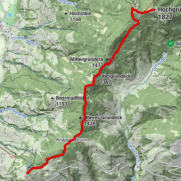
Obergründeck (1,367 m)4.0 kmHeinrich-Kiener-Haus6.6 kmSt. Vinzenz Friedenskirche6.7 kmHochgründeck (1,827 m)7.3 km
- Best season
-
JanFebMarAprMayJunJulAugSepOctNovDec
- Description
-
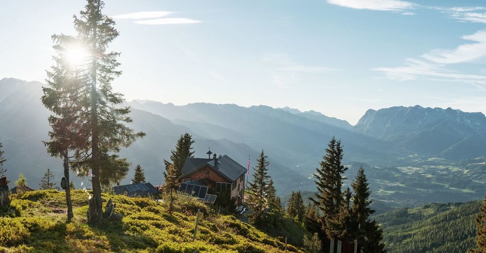
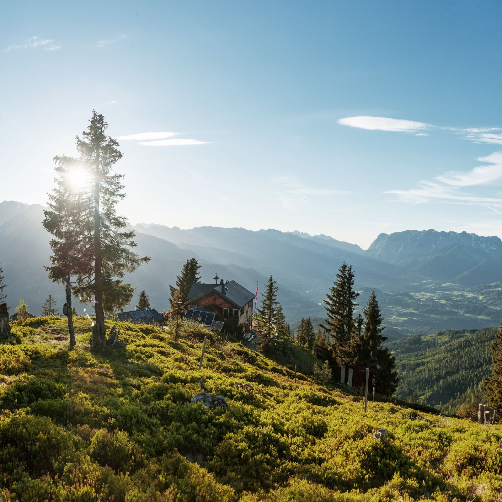
Enthusiastic hikers use the top of Hahnbaum Mountain as a point of departure for a tour up to the popular Hochgründeck Mountain Peak. Well worth the effort, the Hochgründeck Mountain will reward you with an astonishing panorama of about 300 of Austria’s most imposing summits (Hochkönig, Tennengebirge, Dachstein, Lower and Upper Tauern, Kitzbühler Alpen and Dientner Schieferberge).
The Hochgründeck Mountain is one of the highest wooded peaks in Europe and is among the most impressive of Austria’s panorama mountains. It’s a hike the whole family will enjoy with; the paths are well-prepared and the peak is accessible within 1-3 hours from 4 different towns. Renowned also for its beautiful sunrises and sunsets, photography buffs may want to time their hikes in order to enjoy the 360° panorama under perfect light conditions.
The Hochgründeck Mountain is also accessible via:
Bischofshofen – Buchberg-Ronachbauer approx. 1-2 hours Hüttau – Klamm Alm approx. 1½ hours Wagrain – Floitensberg or Ginau approx. 2-3 hours - Highest point
- 1,806 m
- Endpoint
-
Hochgründeck
- Height profile
-

- Tips
-
The Hahnbaum may also be accessed by car. Follow the road towards Wagrain and turn left after about 3km. The drive to the Hahnbaum is about 3km uphill on this route.
Enthusiastic hikers start their tour in the city centre - see From St. Johann to the Hahnbaum.
- Author
-
The tour Hahnbaum - Hochgründeck is used by outdooractive.com provided.