
- Brief description
-
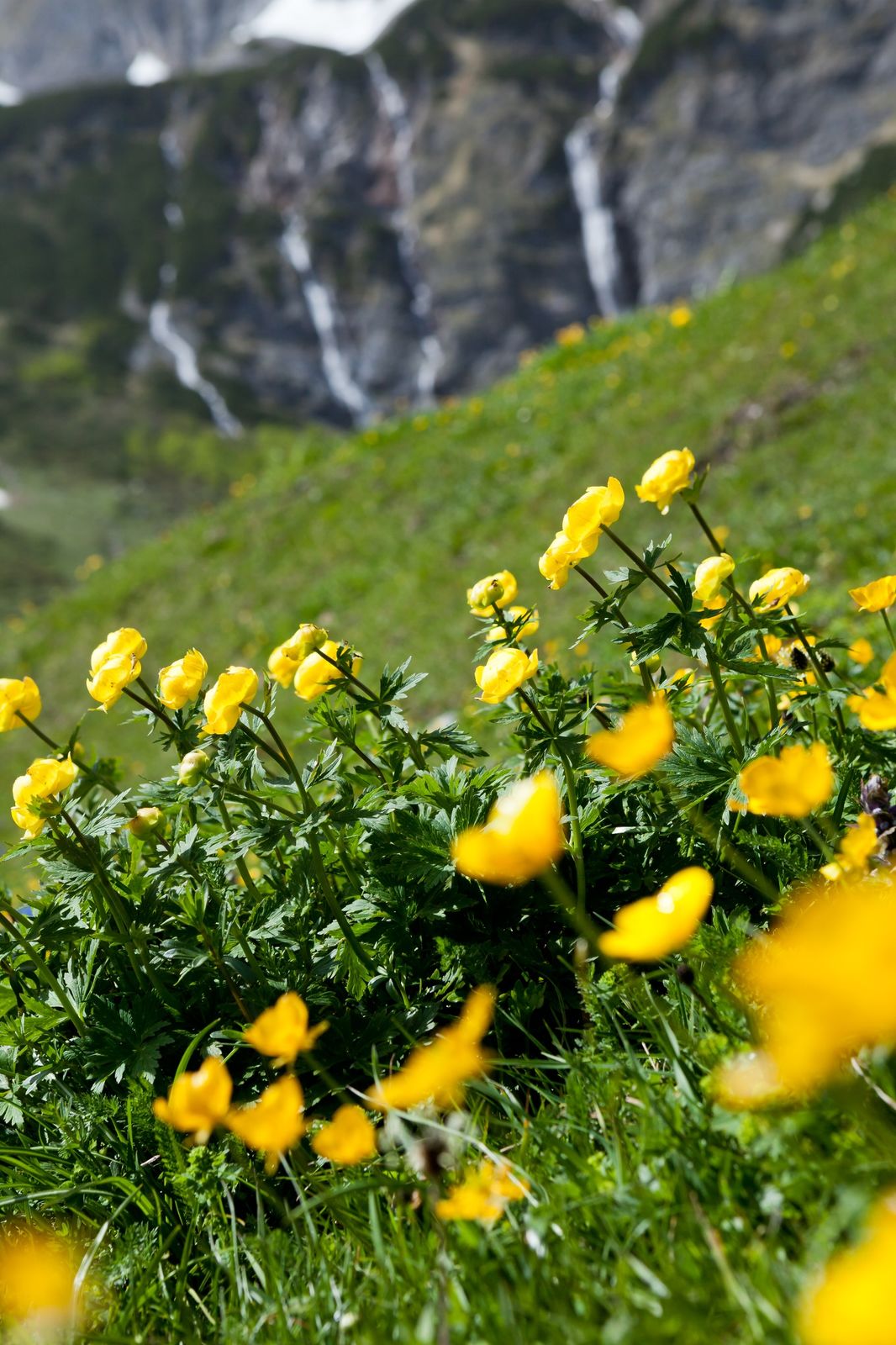
When hiking in Mühlbach, each step leads you deeper into nature. Fresh mountain air, towering rocks, idyllic hill farms, lush meadows, and legendary views of the alpine world – this is a balm for the soul. The network of hiking paths is well signposted and designated with the Austrian Hiking Seal of Quality.
- Difficulty
-
easy
- Rating
-
- Starting point
-
Busstop Kopphütte
- Route
-
Riedingalm1.5 kmAuwald2.0 km
- Best season
-
JanFebMarAprMayJunJulAugSepOctNovDec
- Description
-
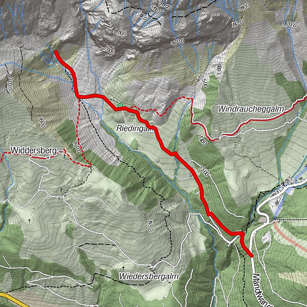
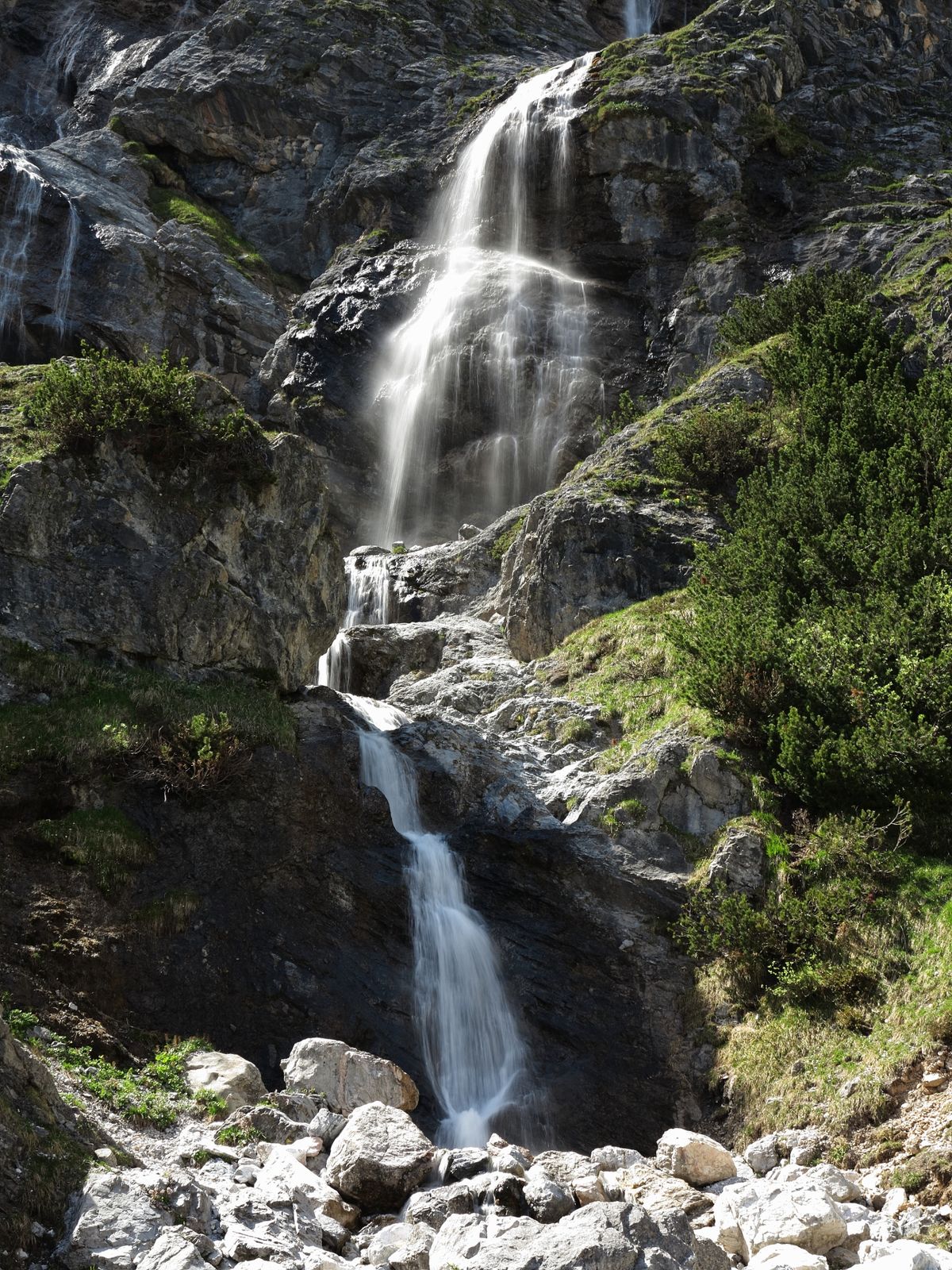
Who is a real nature lover we love this hike! Not for nothing are the Riedinger waterfalls in the Riedingtal the natural jewel of Mühlbach am Hochkönig.The hike starts at the bus stop of the Kopphütte and leads over a wide Schötterweg past the Kopphütte and the Koppalm to the Riedingalm.Here you can treat yourself to a little refreshment or you can continue your hike on a well-signposted hiking trail to the natural spectacle of the Rieding waterfalls.
Here you can really let your soul dangle and simply enjoy the peace and quiet. You can return on the same path or you can extend the hike via the 4 huts to the Schweizerhütte. From there the hiking bus leaves or you walk along the Mitterbergstraße to the parking lot Kopphütte.
- Directions
-
From the Mandlwandstraße, bus stop Kopphütte (parking possibility) to the sports hall over the upper right bridge No.86 on the forest path to the small settlement, on the gravel road past the Lettenalm and in a slight ascent to the Riedingalm. From the Riedingalm you continue to the beautiful Riedinger waterfalls. At the beginning a wide gravel road which leads into a hiking trail from the Riedingalm. From there it goes over rough and smooth into the Rieding valley on a well signposted hiking trail.
- Highest point
- 1,518 m
- Endpoint
-
Riedingtal
- Height profile
-

- Equipment
-
Good walking shoes , possibly rain gear, something to drink.
- Safety instructions
-
It is expected to smooth or slippery areas.
- Tips
-
A great Kaiserschmarrn at the Riedingalm
- Additional information
- Directions
-
Hochkönigbundesstraße B164, Mandlwandstraße towards Arthurhaus.
- Public transportation
- Parking
-
Parking at Busstop Kopphütte
- Author
-
The tour Hike into the Riedingtal (waterfalls) is used by outdooractive.com provided.

General info
-
Hochkönig
2016
-
Mühlbach am Hochkönig
597