


- Brief description
-
A hike with pleasure: magnificent views, pleasant paths and tasty snacks.
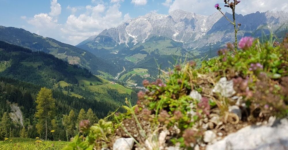
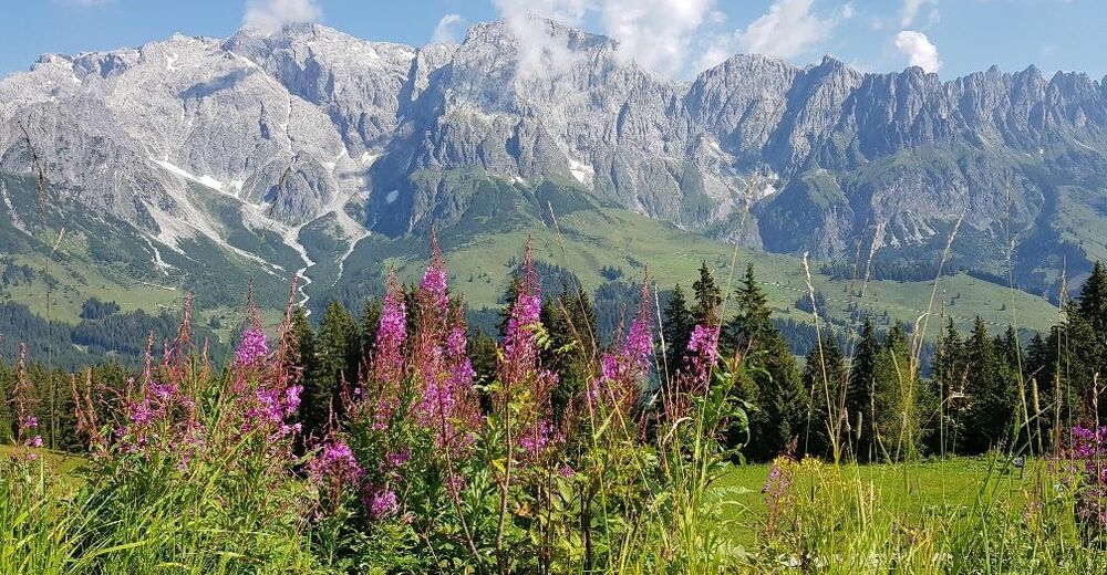
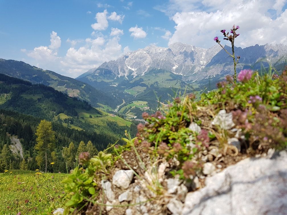
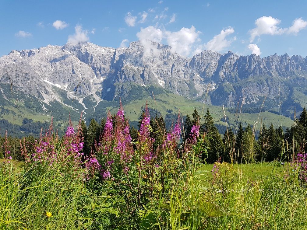
When hiking in the Hochkönig region during your summer vacation, every step leads into nature.Clean mountain air, towering cliffs, idyllic alpine pastures, fresh meadows and fabulous views of the mountain world - that's balm for the soul.
The network of paths is well signposted and has been awarded the Austrian Hiking Seal of Quality.
- Difficulty
-
medium
- Rating
-
- Starting point
-
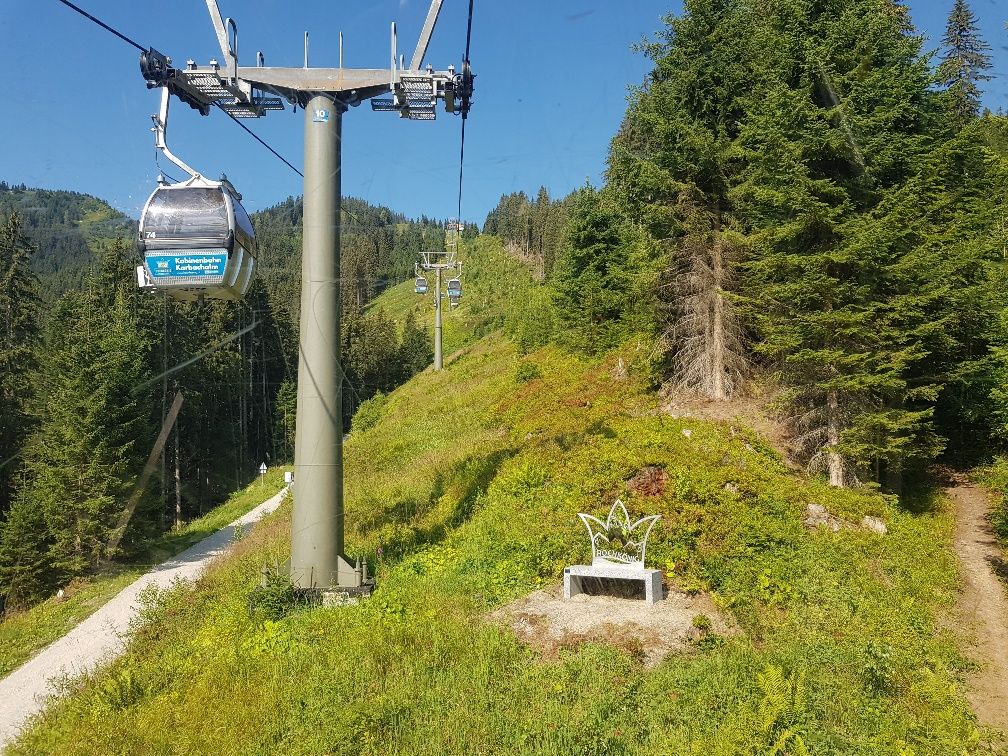
cable car Mühlbach
- Route
-
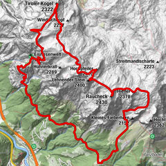
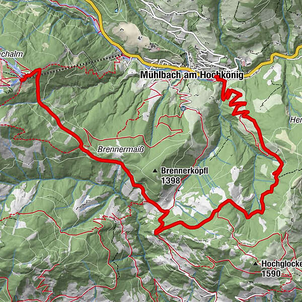
Karbachalm0.0 kmKarbachalm0.2 kmAlthausalm3.8 kmAlthaussattel4.1 kmKreisten4.7 kmHubertuskapelle4.7 kmPronebenalm8.0 kmPaussbauer9.4 kmMühlbach am Hochkönig11.8 km
- Best season
-
JanFebMarAprMayJunJulAugSepOctNovDec
- Description
-
The hike from the Karbachalm via trail no. 79 to the Althaussattel and the Hubertuskapelle leads through the Mühlbach forests, which again and again offer spectacular views of the majestic Hochkönig.
We continue on trail no. 17, a short stretch steeply uphill to the so-called "Ruheoase".
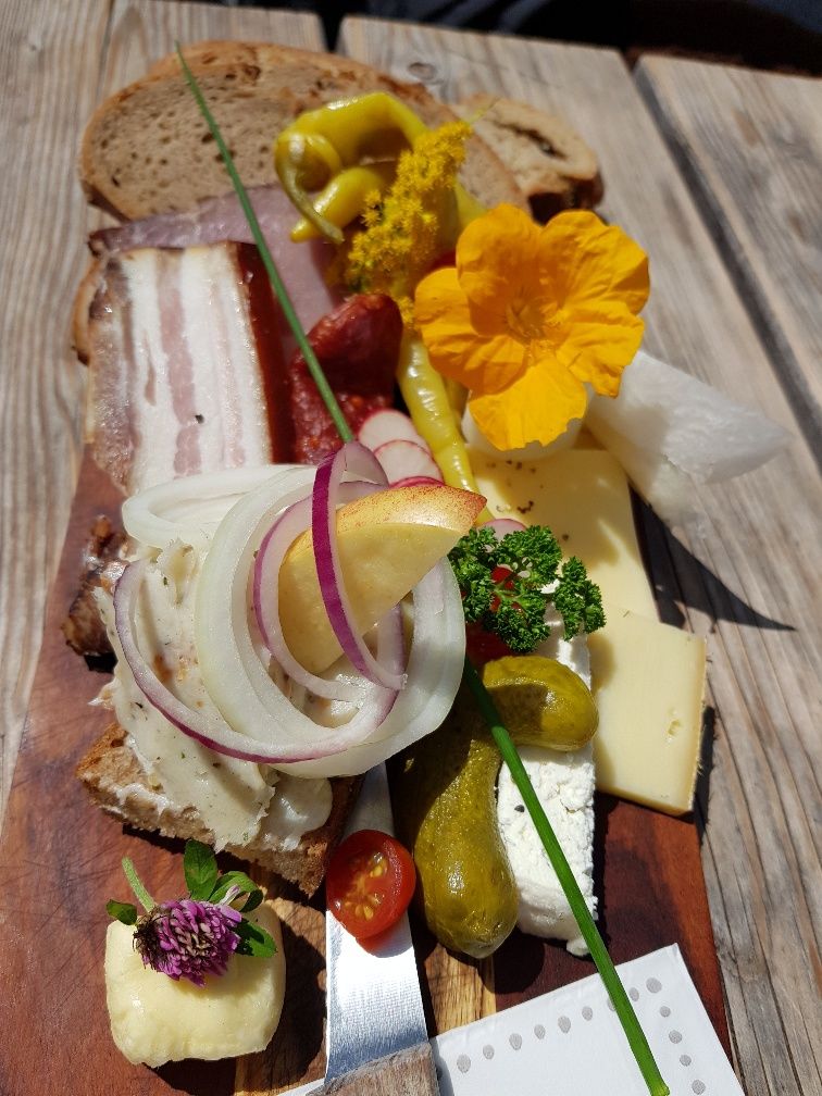
After a rest, the trail heads quickly downhill to the Pronebenalm, where we enjoy a Hochkönig snack.
Afterwards the sculptures of Mühlbach artists accompany us via the Paussenberg Gallery back to the village.
- Directions
-
The cable car Karbachalm (please note operating hours!) takes us to our starting point, the Karbachalm, at 1.590m. At the top station we already enjoy the wonderful views of the Hochkönig, the Tennengebirge, the Dachstein and the Niedere Tauern.
We hike downhill to the Karbachalm (path no. 75b) and pass the hut on the right hand side via the terrace. Now path no. 15 becomes a little steeper, but already after about 300m we follow the path to the right. Here we pass the lift track and in a loose up and downhill section we enter a cool forest. Again and again the forest thins out and impressive views of the Hochkönig massif open up.
Finally we reach a forest road, cross it again and again down into the forest and follow trail no. 79 downhill (follow the markings on the trees) to Althaus Sattel. The last part to Althausalm we walk along the forest road and enjoy the view towards St. Veit and the Salzach Valley.
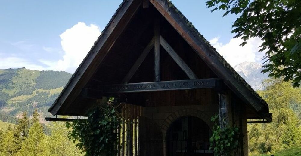
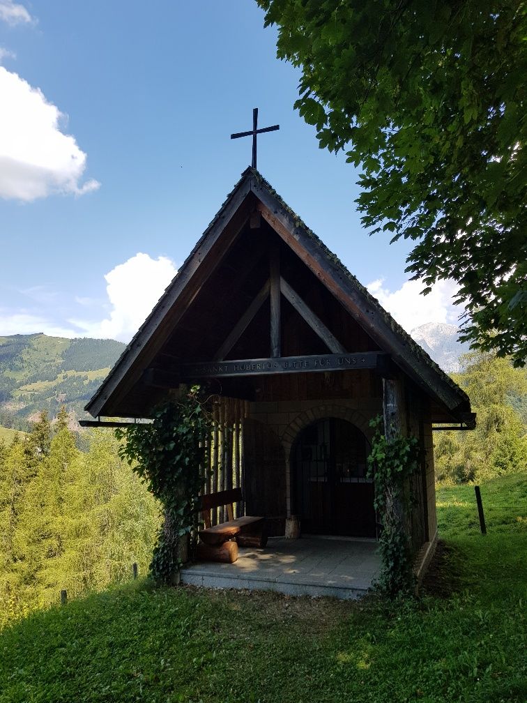
At the Althausalm we can refresh ourselves and get back on the trail. We now walk uphill on a wide forest road to the Hubertus Chapel. Here the hunters celebrate numerous solemn devotions.
Now we have to turn left and the path leads steeper uphill through a forest. With a bit of luck we will also find chanterelles and boletuses along the way.
After the ascent, the forest thins out and we stop at the oasis of peace for a short rest and enjoy the wonderful panorama before we follow the path downhill to the Pronebenalm, where we can enjoy a Hochkönig snack and homemade juices.
From the Pronebenalm, a narrow forest path, also called "path of good thoughts", leads steeper downhill until we reach a flatter pasture. We greet the friendly cows and walk on along a farm track to the Paussbauer.
The sculptures of Mühlbach artists now accompany us via the Paussenberg Gallery back to the village. At the end of the Paussenberggalerie we turn left over a small bridge and walk through a housing estate and past the ice rink towards the center of the village. After the ice rink the path leads right over a bridge. On the left side is the Bauer bakery and thus the center of Mühlbach, the destination of our hike.
- Highest point
- 1,590 m
- Endpoint
-
center of Mühlbach
- Height profile
-

- Equipment
-
Firm, ankle-high footwear
Hiking poles
Headgear
Sun protection
Sunglasses
Drinking bottle - Safety instructions
-
Self-assessment: Before every mountain tour, check your physical aptitude and correctly assess your strength and that of your companions - especially those of your children! Sure-footedness and a head for heights are often very important!
Planning and preparation: Plan every intended mountain tour in advance. Hiking maps and guides as well as information from alpine clubs and local experts such as mountain guides and hut keepers can be helpful.
Equipment: On the mountain you need appropriate equipment and clothing, especially sturdy, high shoes with a good grip sole. Weather and cold protection are essential, the weather can often change unexpectedly.
Weather forecasts: Please note the current weather conditions at: www.zamg.at or www.uwz.at
Do not kick stones, as this can seriously endanger other hikers. Marked areas with the danger of falling rocks should be crossed as quickly as possible and with attention and caution.
Turn back in time. This is not a disgrace, but a sign of common sense. It becomes necessary when the weather changes, fog comes in, and even if the path is too difficult or not in good condition.
- Tips
-
Observe the operating hours of the Karbachalm lift.
- Additional information
- Directions
-
Anreise von Salzburg kommend: Auf der Autobahn A10 bis Ausfahrt Bischofshofen, dann auf der B311 in Richtung Bischofshofen. Der Hochkönig Bundesstraße/B164 nach Dienten folgen.
Anreise von Innsbruck/ Kufstein kommend: Auf der Loferer Straße/B178 Richtung St. Johann i.T., dann über die Hochkönig Bundesstraße/B164 über Saalfelden nach Maria Alm und weiter nach Dienten.
Für die Nutzung des österreichischen Anutobahn- und Schnellstraßennetzes ist eine gültige Vignette erforderlich. Ebenfalls gilt eine Mitführpflicht von Verbandszeug, Warndreieck und Warnweste. Weitere Infos dazu unter Asfinag.
- Public transportation
- Parking
-
Free parking spaces at the cable car Karbachalm

- Author
-
The tour Pleasure hike, Karbachalm - Pronebenalm - Pauss - Mühlbach is used by outdooractive.com provided.