© Saalfelden Leogang Touristik GmbH - Saalfelden Leogang

- Brief description
-
3rd Hiking day
- Difficulty
-
difficult
- Rating
-
- Starting point
-
Hinterglemm
- Route
-
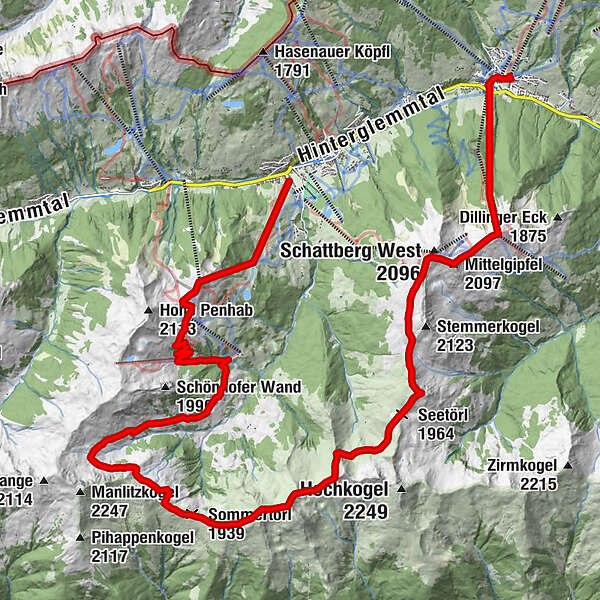
Zwölferkogel (1,984 m)1.0 kmWinkleralm (1,530 m)1.6 kmSeekarlift5.2 kmStoffen Hochalm9.0 kmSommertörl (1,939 m)12.5 kmLamperbichlkogel (2,036 m)13.2 kmBärensteigkopf (2,225 m)14.3 kmSonnberg (2,187 m)14.7 kmSeetörl (1,964 m)17.6 kmSaalbachkogel (2,092 m)18.1 kmWestgipfelhütte20.8 kmMittelgipfel (2,097 m)21.3 kmSkyRest22.1 kmSchattberg-Ost (2,018 m)22.3 kmSchattberg X-press Bergstation22.3 kmSchattberg X-press Mittelstation22.4 kmSchattberg X-press Talstation23.5 kmSaalbach23.8 kmKohlmaisbahn Talstation25.6 km
- Best season
-
JanFebMarAprMayJunJulAugSepOctNovDec
- Description
-
Hinterglemm
Ascent on the Zwölferkogel cable car
Seekar
Schönhoferwand (2116 m)
Stoffennieder
Sommertor
Seetörl
Schattberg western - and eastern summits
Schattberg cable car
- Directions
-
Starting point: The valley station of the Zwölferkogel cable car. Ascend to the Zwölferkogel (1984 m).
Ascent to the Zwölferkogel. From here, follow the panoramic trail to Seekar and Schönhoferwand to Stoffennieder. From the Sommertor, the trail continues to the Seetörl. Then it‘s on to the Schattberg Westgipfelhütte and the summit. Continue to the Schattberg East Summit and descend with the Schattberg cable car.
Alternative version
- Highest point
- 2,215 m
- Endpoint
-
Saalbach
- Height profile
-

- Equipment
-
climbing boots, map of trails, first-aid equipment, cagoule, sun cream, beverage / food, binoculars
- Safety instructions

-

-
AuthorThe tour Saalachtal High Trail - 3rd Hiking day is used by outdooractive.com provided.
GPS Downloads


Other tours in the regions
-
Saalbach Hinterglemm
1581
-
Uttendorf - Weissee
369