

- Brief description
-
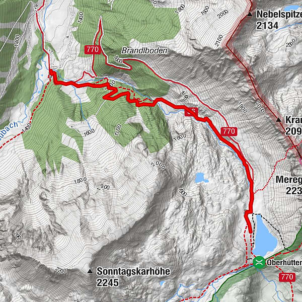
We reach the Vögeilalm by turning off the Ennstal road in Pichl, following signs for Forstau and driving through Forstau Valley until we reach its remotest corner, the Vögeialm.
- Difficulty
-
easy
- Rating
-
- Starting point
-
Vögeialm in Forstau
- Route
-
Vögeialm0.0 kmOberhütte2.8 kmOberhütte am See2.9 km
- Best season
-
JanFebMarAprMayJunJulAugSepOctNovDec
- Description
-
From the Vögeialm, a road takes us up a series of long, moderately steep switchbacks to the Oberhüttensee. But there is also an alpine trail, which leads us across meadows, alongside the stream and through the forest to the lake.
The beautiful hut and the impressive mountain scenery surrounding the lake make this a popular destination for families. We would also recommend turning this hike into a loop, hiking on through countryside teeming with variety to the Seekarscharte in the Radstädter Tauern. Beautiful flora, numerous small tarns, along with the magnificent sight of the Steirische & Lungauer Kalkspitze, make this stage truly magical. We then cross alpine pastures and come to an alpine gap, where we are treated to views of the Dachstein and Obertauern. Here trail No. 769 branches off to the north in the direction of the Klamml. Our hike down takes us past yet another lake below the steep mountainsides of the Sonntagskarwand, then through forest and down many rocky stages, to the pastures of the Sonntagskaralm and our original starting point at the Vögeialm. - Highest point
- 1,868 m
- Endpoint
-
Oberhüttensee
- Height profile
-

- Equipment
-
Sturdy shoes, rain gear
- Additional information
-
Safety information
Safety on the mountainside: changes in the weather, sudden fall in temperature, thunder storms, wind, fog and snow fields are all objective dangers and require the correct behaviour whilst underway. the landlords of the huts are all very knowledgeable about the mountains and can give you good tips about the weather and the routes. Insufficient equipment, exaggerated opinion of ones capabilities, frivolousness, poor health condition and a false evaluation of the situation can lead to a critical situation. In thunder storms: summits, crest-sites and safety rope aids are to be avoided.
If something should happen call following emergency numbers:
No. 140 - the number for all Alpine Emergencies in all of Austria
No. 112 - European emergency call GSM emergency-call-service - Arrival
-
From the Ennstal Bundesstraße B320 branch off to Forstau (at Pichl). Through the Forstautal to the Vögeialm.
- Public transportation
-
Hiking bus Radstadt-Forstau.
- Parking
-
Parking area Vögeialm.

- Author
-
The tour From the Vögeialm to the Oberhüttensee is used by outdooractive.com provided.


General info
-
Schladming - Dachstein
2999
-
Obertauern
1640
-
Untertauern
505


