
- Brief description
-
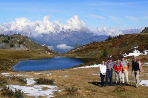
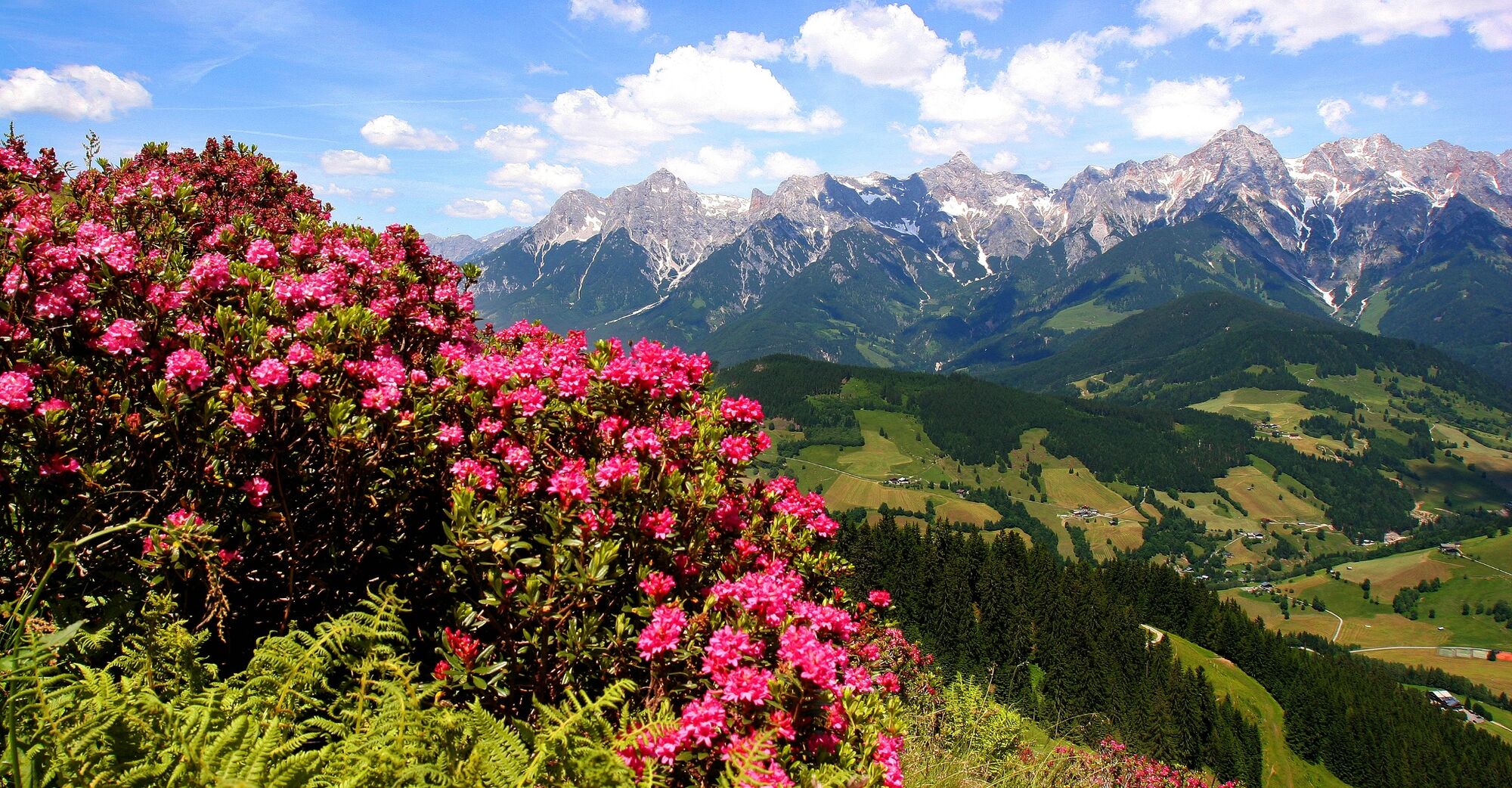
A challenging hike with eventful views of a magnificent panorama awaits all hikers.
- Difficulty
-
difficult
- Rating
-
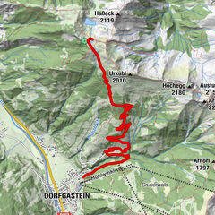
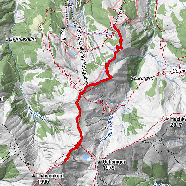
- Starting point
-
Schwarzeckalmbahn mountain station
- Route
-
Schwarzeckalm0.0 kmLangegg (1,899 m)3.0 kmBergstadl3.0 kmStatzerhaus5.8 kmHundstein (2,117 m)5.8 km
- Best season
-
JanFebMarAprMayJunJulAugSepOctNovDec
- Description
-
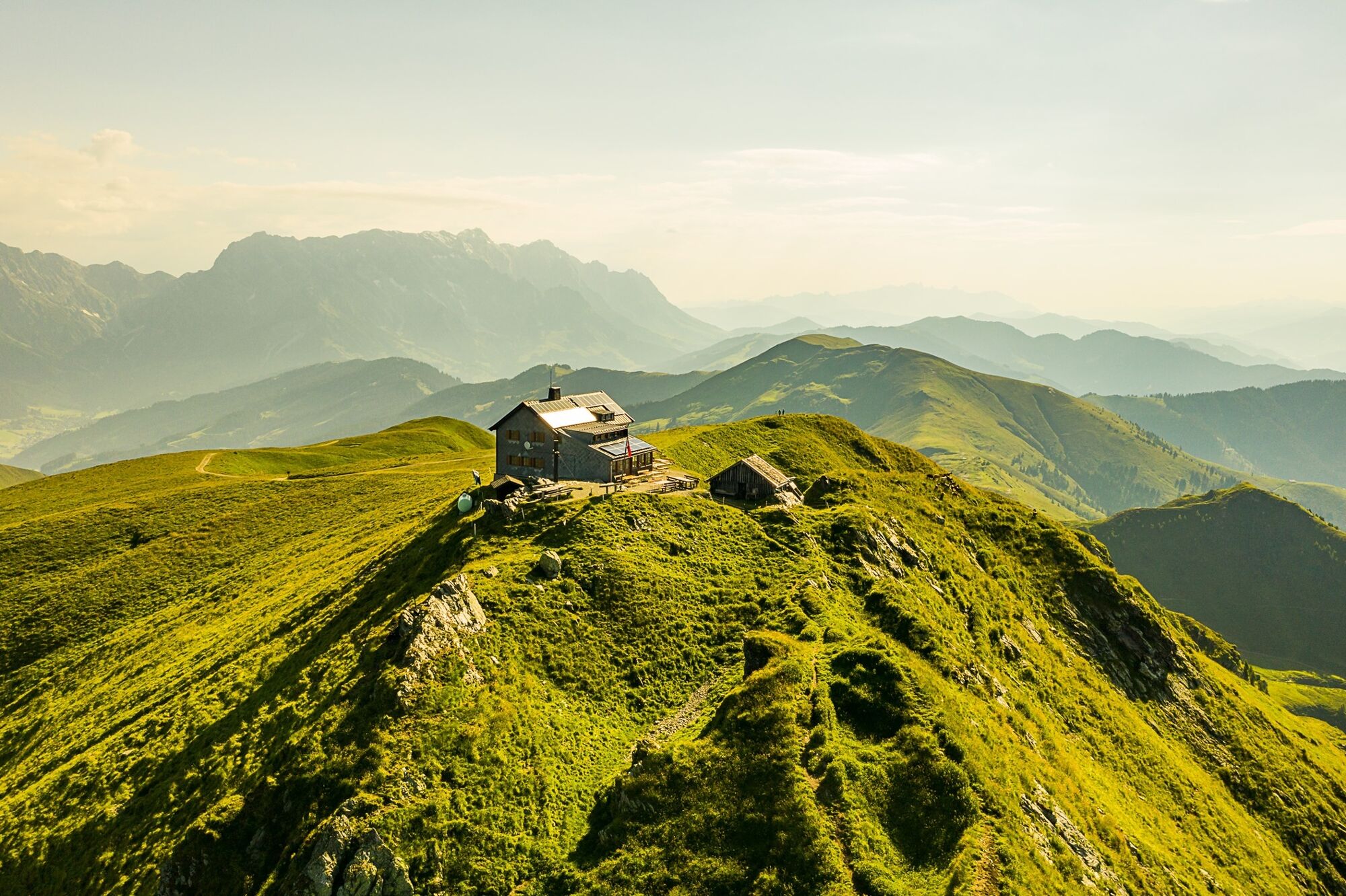
You complete part of the route comfortably with the Schwarzeckalm cable car (note operating times), before the trail leads steadily uphill. After a three-hour hike, you will reach your destination, the Hundstein summit, and will be rewarded with a breathtaking panorama of Lake Zell, the Kitzsteinhorn and the Hochkönig.
- Directions
-
Experience the unique "2 summits in one day feeling" on this mountain tour.
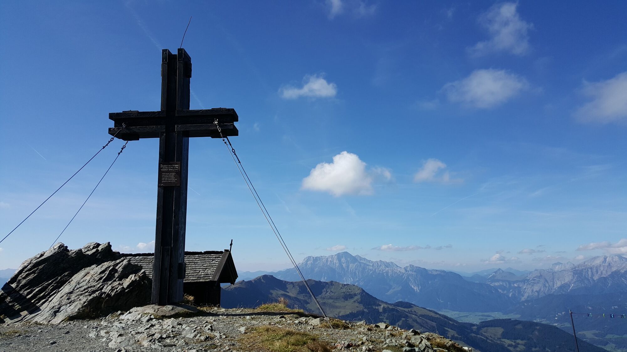
Don't worry - it's by no means as difficult as it might sound. Because the first part of the ascent is a leisurely ride on the Schwarzeckalm cable car, which takes you up to an altitude of 1,400m. Directly from the mountain station you hike along trail no. 28c to Langegg at an altitude of 1,899m. This means that you have already conquered the first peak. Before continuing, you must enjoy the breathtaking 360° panorama and take a souvenir picture at the specially built photo point. After the rest, continue uphill on trail no. 445 in the direction of Hundstein/Statzerhaus. The second summit cross is already at 2,117m. You have reached your goal and can be justifiably proud.
Hike back via the ascent route.
- Highest point
- 2,108 m
- Endpoint
-
Schwarzeckalmbahn mountain station
- Height profile
-

- Equipment
-
Sturdy, ankle-high footwear
Walking sticks
Headgear
Sun protection
Sunglasses
Rain protection
Drinks and a snack
Necessary medication
First aid kit
Hiking map - Safety instructions
-
Self-assessment Check your physical fitness before every mountain tour and correctly assess your strength as well as that of your companions - especially those of your children! Surefootedness and a head for heights are often very important!
Planning and preparation Plan each intended mountain tour in detail beforehand. Hiking maps and guides as well as information from alpine associations and local experts such as mountain guides and mountain hut keepers can be helpful.
Equipment On the mountain, you will need appropriate equipment and clothing, especially sturdy, high shoes with good grip soles. Weather and cold protection are essential, as the weather can often change unexpectedly.
Weather forecasts Take note of the current weather conditions at: www.zamg.at
Together Follow the 10 rules for the correct handling of grazing animals and do not leave any waste in nature!
Do not kick stones Do not kick stones as this can seriously endanger other hikers. Marked places with a danger of falling rocks should be crossed as quickly as possible and with attention and caution.
Turn back in good time This is not a disgrace, but a sign of common sense. It becomes necessary when the weather changes, fog rolls in, and also when the path is too difficult or not in good condition.Emergency numbers: Alpine emergency call: 140
International emergency call: 122 - Tips
-
Use the Schwarzeckalmbahn (please note the operating hours!) for ascent and descent.
- Additional information
- Directions
-
Coming from Salzburg: Take the A10 motorway to the Bischofshofen exit, then take the B311 towards Bischofshofen. Follow the Hochkönig Bundesstraße/B164 to Maria Alm.
Coming from Innsbruck/ Kufstein: Take the Loferer Straße/B178 in the direction of St. Johann i.T., then follow the Hochkönig Bundesstraße/B164 via Saalfelden to Maria Alm.
A valid vignette is required to use the Austrian motorway and motorway network. It is also compulsory to carry a first-aid kit, warning triangle and high-visibility waistcoat. Further information can be found under Asfinag. - Public transportation
- Parking
-
Free parking at the ski centre Hintermoos/Schwarzeckalmbahn

- Author
-
The tour Summit tour from the Schwarzeckalmbahn to the Hundstein is used by outdooractive.com provided.