- Brief description
-
Hiking tour to the Saukarkopf - from here you have a picturesque view. You get delicacies on the Saukaralm and the Gerstreitalm.
- Difficulty
-
medium
- Rating
-
- Starting point
-
Parking lot Vorderstadluck
- Route
-
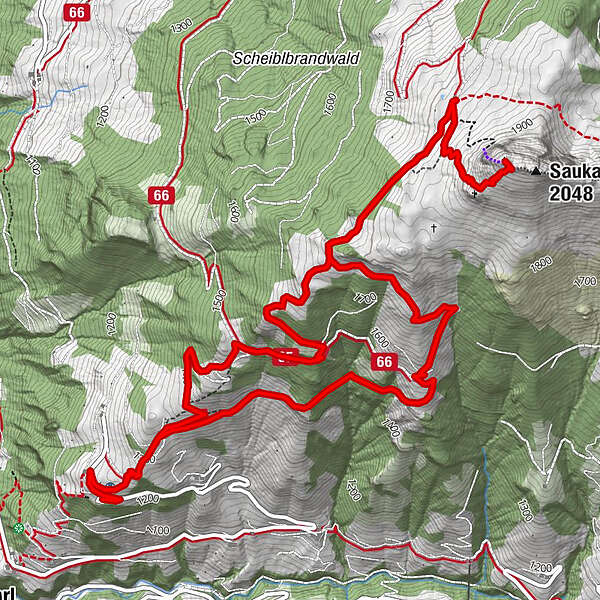
Saukarkopf (2,048 m)4.7 kmSaukaralm5.5 kmGerstreitalm7.5 km
- Best season
-
JanFebMarAprMayJunJulAugSepOctNovDec
- Description
-
You can take your own car or the hiking taxi to the parking lot Vorderstadluck.
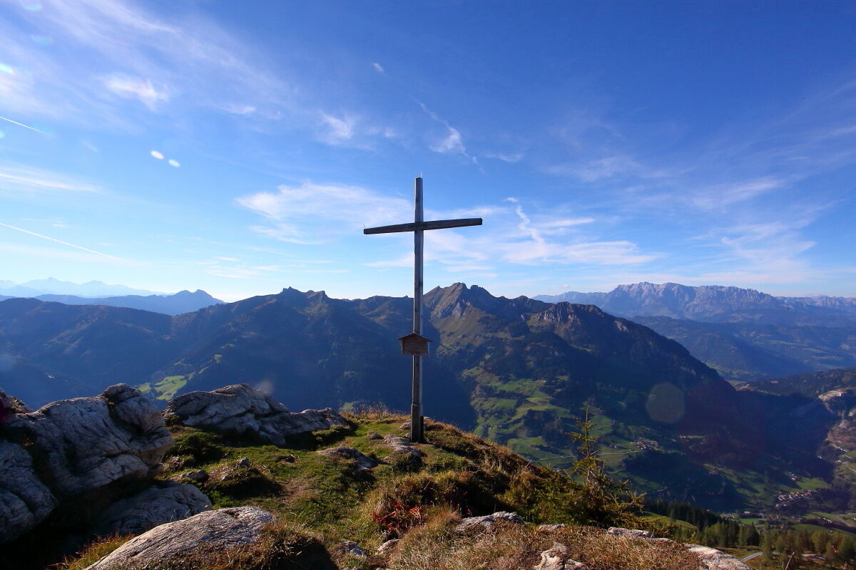
Ascent via the Röschenbergalm (not farmed) and the beautiful alpine meadows to the Saukaralm. Especially in early summer, everything here is white and pink - countless crocuses are in bloom. This is the highest alpine pasture in Grossarltal. The view from here is simply unique. The Hohe Tauern, Hochkönig, Tennengebirge and Hagengebirge mountains make this one of the most beautiful vantage points in Grossarltal. If you are a little later on your way, you should definitely watch the sunset on the Saukaralm. The unobstructed view to the south, west and north makes sunsets here particularly impressive.The ascent to the Saukarkopf, Grossarl's local mountain, is via a hiking trail. First you reach a small plateau. There is a cross here, which was erected by the Großarl-Hüttschlag rural youth organisation. However, this is only an intermediate destination. The trail leads uphill to the Saukarkopf. From up here, the view is even better than from the Saukaralm. As an alternative to the hiking trail, the "Bella Cascinaia" via ferrata also leads up to the Saukarkopf.
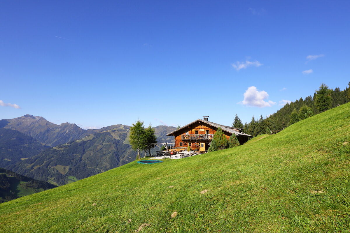
The descent follows the same route to the Saukaralm. Continue downhill again via the Röschenbergalm to the Gerstreitalm. There you will be spoilt with homemade delicacies from our own production. The large sun terrace invites you to take a break and the children can look forward to a great playground and petting animals.
After a leisurely stop at the Gerstreitalm, you return to the Vorderstadluck car park.
- Directions
-
You can get to the Vorderstadluck farm (parking available) by car or hiking taxi, or you can walk from the centre of Grossarl via the Hertas Rast trail (approx. 1 hour, parking available in the village at the Viehhauser petrol station). Ascent on trail no. 65 via the Röschenbergalm to the Saukaralm, 1,850 m (approx. 2 h) and continue on the same trail to the Saukarkopf, 2,048 m (approx. 3/4 h). The descent is the same to the Röschenbergalm, from there follow trail no. 65A to the Gerstreitalm, 1,575 m (approx. 1 1/4 h). Then descend from there to the parking lot Vorderstadluck (approx. 1 h).
- Highest point
- 2,011 m
- Endpoint
-
Saukarkopf
- Height profile
-

- Equipment
-
Hiking boots with treaded soles, hiking map, rucksack with provisions, water bottle and first aid pack
- Tips
-
You should definitely not miss out on the view from the Saukarkopf. It is particularly beautiful at sunset.
- Additional information
- Directions
-
Go by car or hiking taxi to the parking lot Vorderstadluck or go by car or Postbus line no. 540 to the centre of Großarl (parking available at the Viehhauser petrol station) and continue on foot along the Sonnseitweg via Hertas Rast to the Vorderstadluck farm.
- Public transportation
- Parking
-
Parking lot Vorderstadluck


- Author
-
The tour Grossarl: Saukaralm - Saukarkopf - Gerstreitalm is used by outdooractive.com provided.