- Brief description
-
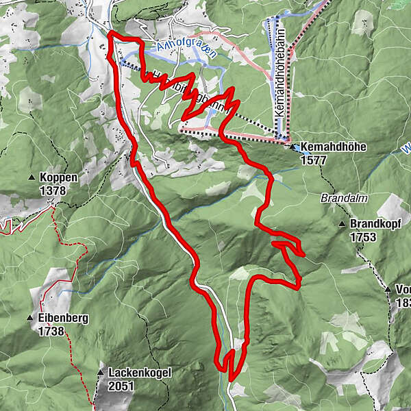
The Steinwand circular trail leads south-east in the low mountain range over a forest ridge.
- Difficulty
-
medium
- Rating
-
- Starting point
-
Start point at the Ameisenberg recreational area information board on Rettenbach road
- Route
-
Plum Restaurant0.0 kmGasthof Neuhäusl14.0 kmPlum Restaurant15.6 km
- Best season
-
JanFebMarAprMayJunJulAugSepOctNovDec
- Description
-
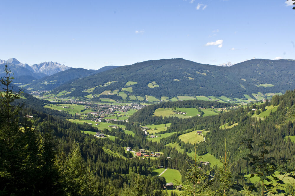
The Steinwand Circuit heads out in to the foothills in a south easterly direction and up on to the ridgeline. Visitors love the scented floral meadows, the peaty aroma of the forest, the great views over Altenmarkt as well as the mountain backdrop of the Tennengebirge mountains, Dachstein Massif and of course Altenmarkt’s own mountain the Lackenkogel.
- Directions
-
From the start point at the Ameisenberg on Rettenbach road, go up the road parallel to the ski piste and under the tunnel to Pailgut. Follow the forest track to Hochnössler up to the highest point of the route at Wolfsgrube. Carry on on the forest trail to Zauchensee road, cross the road on to the Muhlenweg, past Neuhäusl Guesthouse back down to the start. Or catch the bus at the first road crossing back down.
- Highest point
- 1,523 m
- Endpoint
-
Start point Ameisenberg recreational area information board on Rettenbach road
- Height profile
-

- Equipment
-
Good shoes, rain protection
- Safety instructions
-
Sure-footed
- Additional information
- Directions
-
Tauernautobahn A 10, exit Altenmarkt (EXIT 63), exit Altenmarkt West, direction Zauchensee, from the church 2.2 km direction Zauchensee, car park Hochbifangbahn on the left side
- Public transportation
- Parking
-
Car park at the Hochbifangbahn
-

-
AuthorThe tour Steinwand Circuit is used by outdooractive.com provided.