


- Brief description
-
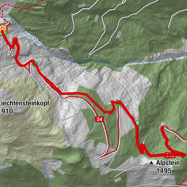
Nice hiking tour in Grossarl to the Aualm.
- Difficulty
-
medium
- Rating
-
- Starting point
-
Parking lot Aualmweg
- Route
-
Alpstein (1,495 m)0.5 kmAualm2.4 kmAlpstein (1,495 m)4.4 km
- Best season
-
JanFebMarAprMayJunJulAugSepOctNovDec
- Description
-
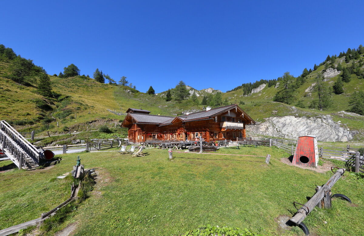
In the district Unterberg you go up by car to the farm Lainholz. You can still go by car right up to Aualm on the forest road, then you haven't to hike up there. Otherwise you hike on the shortcuts through the forest or along the forest road to the Aualm. Here you can taste self-made delicacies such as bread, butter, cheese, bacon or schnapps. The children like the big playground around this mountain hut.
You can even go by car or hiking taxi to the Aualm.
- Directions
-
Ascent via the Rattersberg road in the Unterberg district to the parking lot Aualmweg (alternatively continue on trail no. 34 to the Aualm). Hike along forest trail no. 34 or via the shortcuts through the forest to the Aualm, 1,795 m (approx. 1 1/2 h).
- Highest point
- 1,791 m
- Endpoint
-
Aualm
- Height profile
-

- Equipment
-
hiking boots with grip sole, hiking map
- Tips
-
The Schuhflicker is above the Aualm and an ascent is definitively worth it.
- Additional information
- Directions
-
You go by car to the district Unterberg and turn into the Güterweg Rattersberg. You go until the farm Lainholz/Pointgrün.
- Public transportation
- Parking
-
parking possibility in the first bend after the farm Pointgrün and at the Aualm

- Author
-
The tour Grossarl: Aualm is used by outdooractive.com provided.


