

- Difficulty
-
difficult
- Rating
-
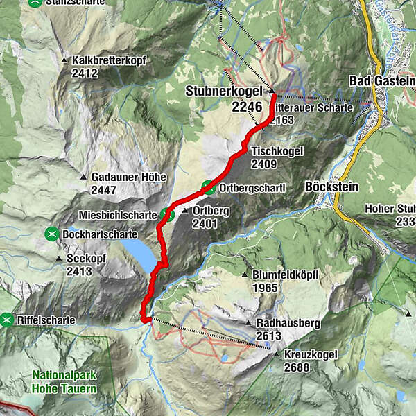
- Route
-
Gipfelrestaurant Stubnerkogel0.1 kmAussichtsplattform Glocknerblick0.3 kmZitterauer Scharte (2,163 m)0.9 kmTischkogel (2,409 m)1.8 kmZitterauer Tisch (2,463 m)2.1 kmZitterauer Alpe4.0 kmBockhartseehütte6.9 kmValeriehaus8.2 kmNaßfeld8.2 kmRestaurant Talstation8.2 kmSportgastein8.2 km
- Best season
-
JanFebMarAprMayJunJulAugSepOctNovDec
- Highest point
- 2,412 m
- Endpoint
-
Sportgastein/Naßfeld
- Height profile
-

-

-
AuthorThe tour Bad Gastein: Zittrauer Tisch und Miesbichlscharte is used by outdooractive.com provided.
GPS Downloads


General info
Refreshment stop
Cultural/Historical
Flora
Fauna
A lot of view
Other tours in the regions


