

© Pongau

© Pongau

© Pongau

© Pongau
Tour data
2.86km
1,743
- 1,936m
196hm
18hm
01:20h
- Rating
-
- Route
-
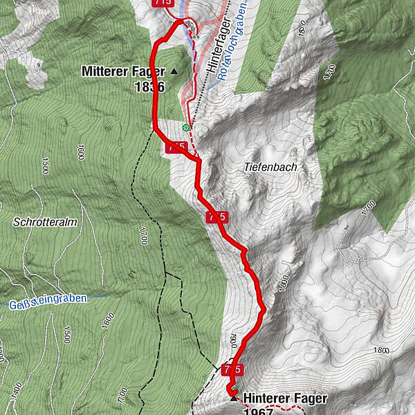
Hinterer Fager (1,967 m)2.8 km
- Highest point
- 1,936 m
- Height profile
-


- Author
-
PongauThe tour Fageralm Höhenwanderung is used by outdooractive.com provided.
GPS Downloads


Other tours in the regions
-
Schladming - Dachstein
3000
-
Obertauern
1641
-
Fageralm / Forstau
630


