


- Difficulty
-
medium
- Rating
-
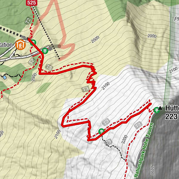
- Route
-
Hüttenkogel (2,231 m)1.1 km
- Highest point
- 2,184 m
- Endpoint
-
Hüttenkogel
- Height profile
-

-

-
AuthorThe tour Bad Gastein: Hüttenkogel is used by outdooractive.com provided.
GPS Downloads


General info
Refreshment stop
Flora
Fauna
A lot of view
Other tours in the regions


