- Brief description
-
Great hiking tour in Grossarl, where you reach the 3 mountain lakes - the Schuhflickersee and the both Paarseen.
- Difficulty
-
medium
- Rating
-
- Starting point
-
Grossarl - Aualm
- Route
-
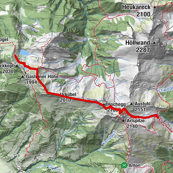
Aualm0.0 kmSchuhflicker (2,214 m)1.4 kmHochegg (2,180 m)2.1 kmUrkübel (2,010 m)3.5 kmUrkübel (2,010 m)7.7 kmHochegg (2,180 m)9.1 kmSchuhflicker (2,214 m)10.0 kmAualm11.3 km
- Best season
-
JanFebMarAprMayJunJulAugSepOctNovDec
- Description
-
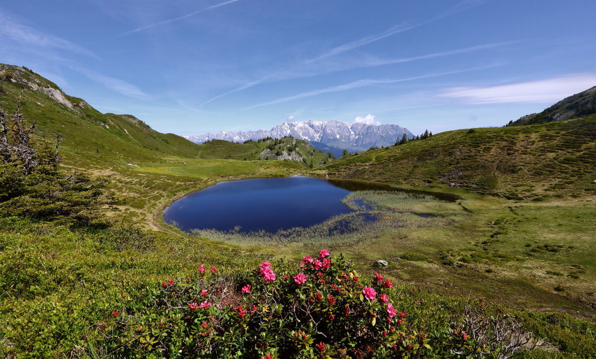
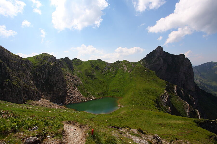
In the district Unterberg you go up by car to the farm Lainholz. You can still go by car right up to Aualm on the forest road, then you haven't to hike up there. Otherwise you hike on the shortcuts through the forest or along the forest road to the Aualm. Here you can taste self-made delicacies. First, you hike up towards the Schuhflicker, then you descend to the Schuhflickersee. This is a picturesque mountain lake.
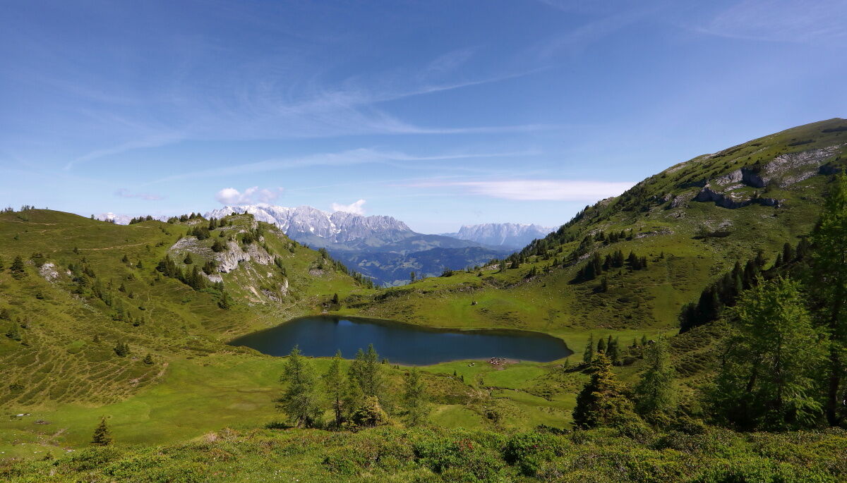
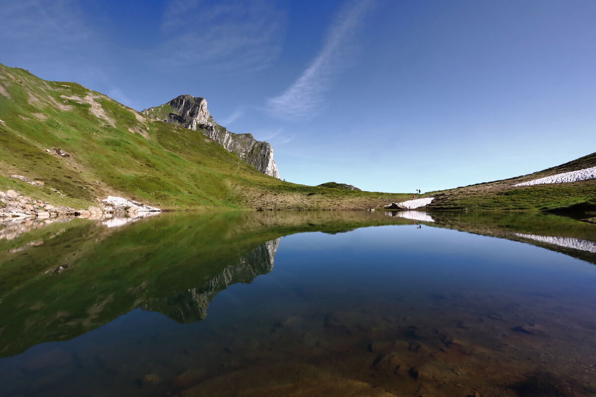
This hiking tour leads along the ridge to the two Paarseen, which are also beautiful mountain lakes.
From the Paarseen, you could hike along the hiking path no. 530 to the Luxkogel, 1,824 m, further to the Hasseggalm and to St. Veit im Pongau. Then you go back by public transport. Otherwise you hike back on the same route.
- Directions
-
You go by car on the Rattersbergweg in the district of Unterberg to the Aualm. You hike up the path no. 34 to the Austuhl. Then you descend to the Schuhflickersee on the path no. 37 (approx. 1 h). You hike to the Urkübl, 2,010 m, and to the Paarseen, approx. 1,850 m (approx. 2 h).
You hike back on the same route.
- Highest point
- 2,144 m
- Endpoint
-
Paarseen
- Height profile
-

- Equipment
-
hiking boots with grip sole, hiking map
- Safety instructions
-
Take enough beverages with you, you do not pass a mountain hut for a long while.
- Tips
-
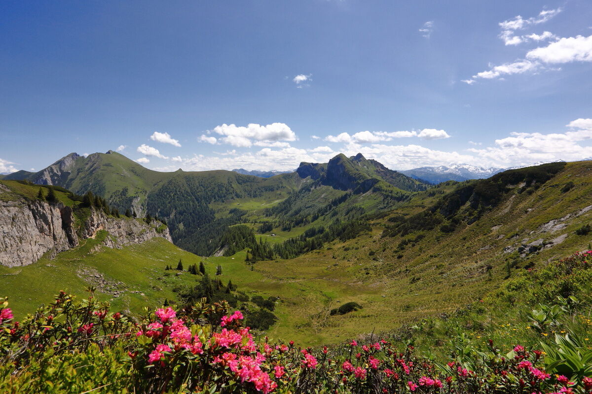
If you hike up to the Schuhflicker, you have an amazing view to the surrounding mountains.
- Additional information
- Directions
-
You go by car on the Rattersbergweg in the district of Unterberg to the Lainholz farm and further to the Aualm.
- Public transportation
- Parking
-
parking space at the Aualm
- Author
-
The tour Grossarl: Schuhflickersee - Paarseen is used by outdooractive.com provided.