- Brief description
-
After the introductory valley hike, the route crosses the Osterhorn Mountains along meadow roads and marked, but sometimes steep and rocky, mountain trails, which require surefootedness at times.
- Difficulty
-
medium
- Rating
-
- Route
-
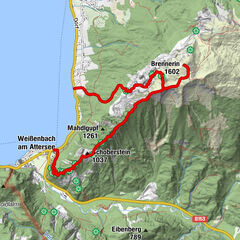
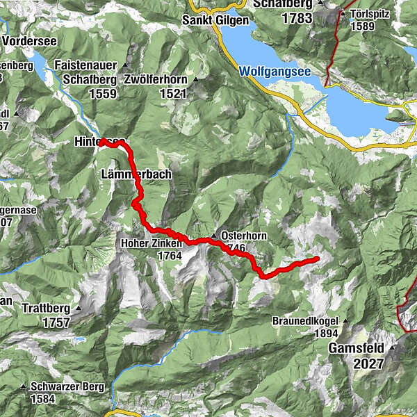
Hintersee (746 m)Alte KrämereiLämmerbach (801 m)3.2 kmPosch'nhütte7.4 kmHoher Zinken (1,764 m)10.7 kmGroßer Pitscherberg (1,720 m)13.5 kmHuber Hütte18.3 km
- Best season
-
JanFebMarAprMayJunJulAugSepOctNovDec
- Description
-
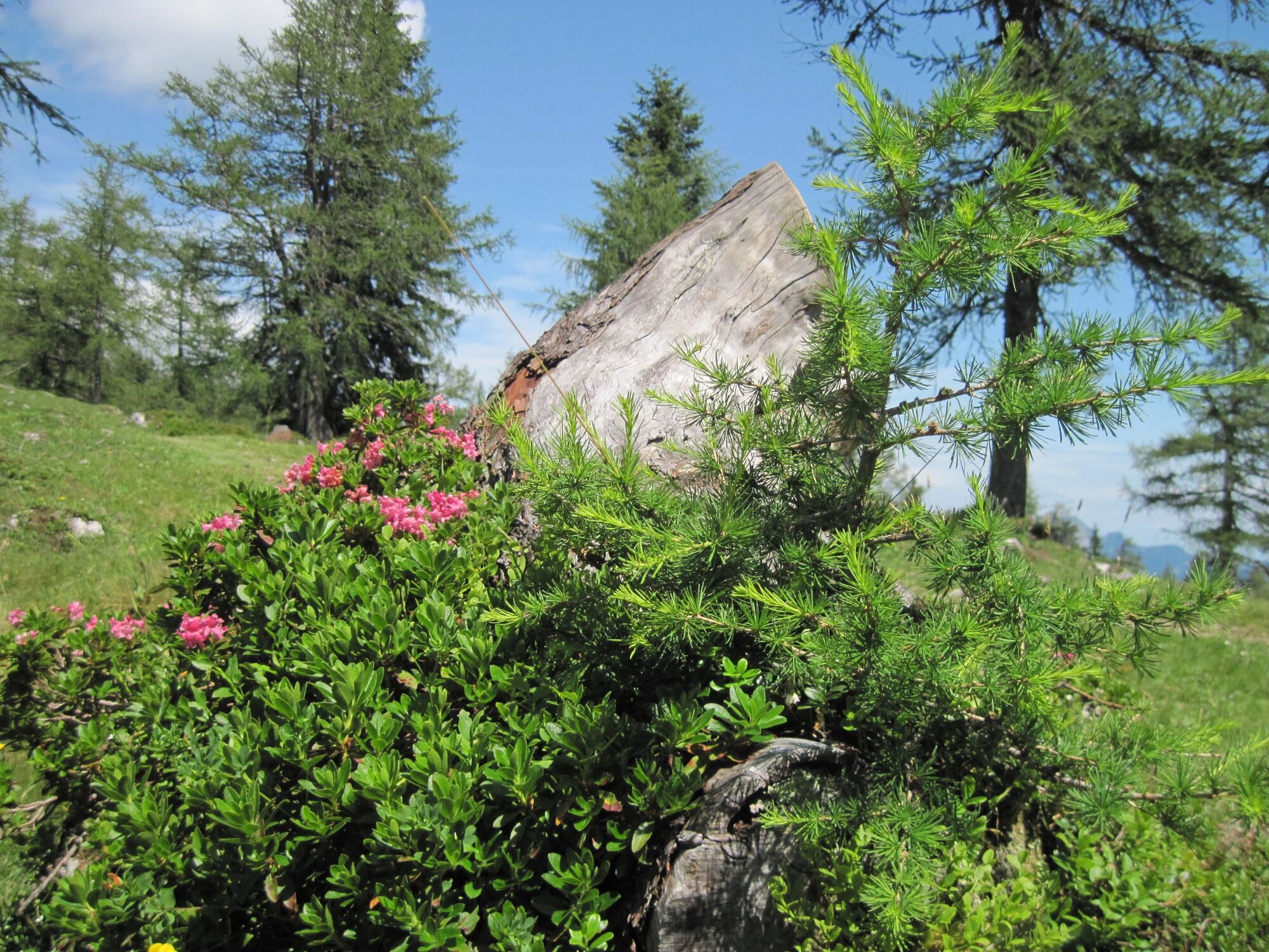
Stage 9 of the Salzkammergut BergeSeen Trail leads through the Osterhorn Group, a particularly interesting section of the Salzburg limestone pre-Alps. The highest peaks – Egelseehörndl (1782 m), Gennerhorn (1735 m), Hoher Zinken (1764 m) and the Osterhorn (1746) live up to their “rugged” names: the limestone layers from which they are built are noticeable for their distinctive and almost horizontal embankments. In the centre, erosion has created enormous rock basins reminiscent of oversized circus arenas. However, wide alpine meadows spread out between the mountains, giving the mountain group a very friendly touch. The 42 km2 Postalm Meadow on the northeastern edge is one of the largest high meadows of the Alps. This pastoral paradise located at 1300 metres is the destination of today’s route.
- Directions
-
From the church in Hintersee, the trail heads briefly into the valley and over the Ladenbach Bridge. Immediately turn left to the Taugl River and then go right along the stream. Cross over the next bridge and keep right to arrive at the forester’s house. From there, hike along a beautiful trail via Unterzagl to arrive again at the street, which leads left to the community of Lämmerbach (801 m), and finally reach a car park where the toll road to the Genneralm Meadow begins.
From the car park, the trail continues upwards along the gravel toll road to the Genneralm. Some of the hairpin turns can be shortened by taking cut-through paths. Once the forest finally thins between the Gennerhorn and the rocky peak of the Holzeck and gives way to the alpine meadows, you arrive at the Genneralm (1295) and find the Hinter and Reit Huts to the right and the Posch’n Hut to the left. 1:30 h
The trail now continues south along the meadow road towards “Hoher Zinken, Pitscherberg, Postalm” (no. 840) passing underneath the Holzeck and descends briefly into a saddle. There, a path, which is rocky at first, initially ascends to the Hoher Zinken through steep forest slopes. Finally, you reach the summit cross on the surprisingly large peak of the Hoher Zinken (1764 m) via a meadow slope. Hikers are rewarded with magnificent views of the nearby peaks of the Osterhorn Group as well as vistas of the Schafberg, Schober, Berchtesgadener Alps (Hoher Göll, Untersberg), Tennengebirge Mountains, Gosaukamm and Dachstein Mountains (Gosau Glacier), Gamsfeld, Rettenkogel and Bergwerkskogel. There are also views of Lake Hintersee and – after a few steps further east – St. Wolfgang. 2:00 h
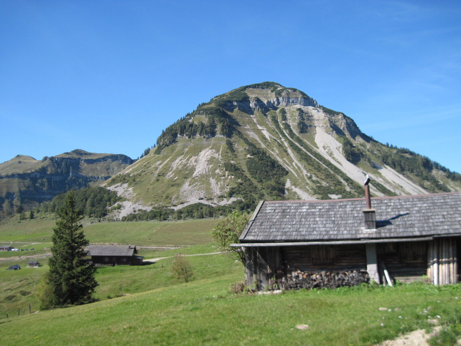
From the eastern edge of the summit, the trail descends over a grassy slope and through mountain pines to the wide Osterhorn Saddle (1707 m). From there, it is worth taking the 10-minute detour to the left to ascend the neighbouring Osterhorn (1746 m), the panoramic namesake of the mountain group. Alternatively, trail no. 840 towards “Pitscherberg, Postalm” heads down to the right to an alpine pasture (1490 m). Continue through sparse trees and – keeping left a fork to remain on the marked route – ascend the sometimes steep, but somewhat forested southwest flank of the Pitscherberg Mountain (1720 m). The summit cross is a few steps to the left above the trail.
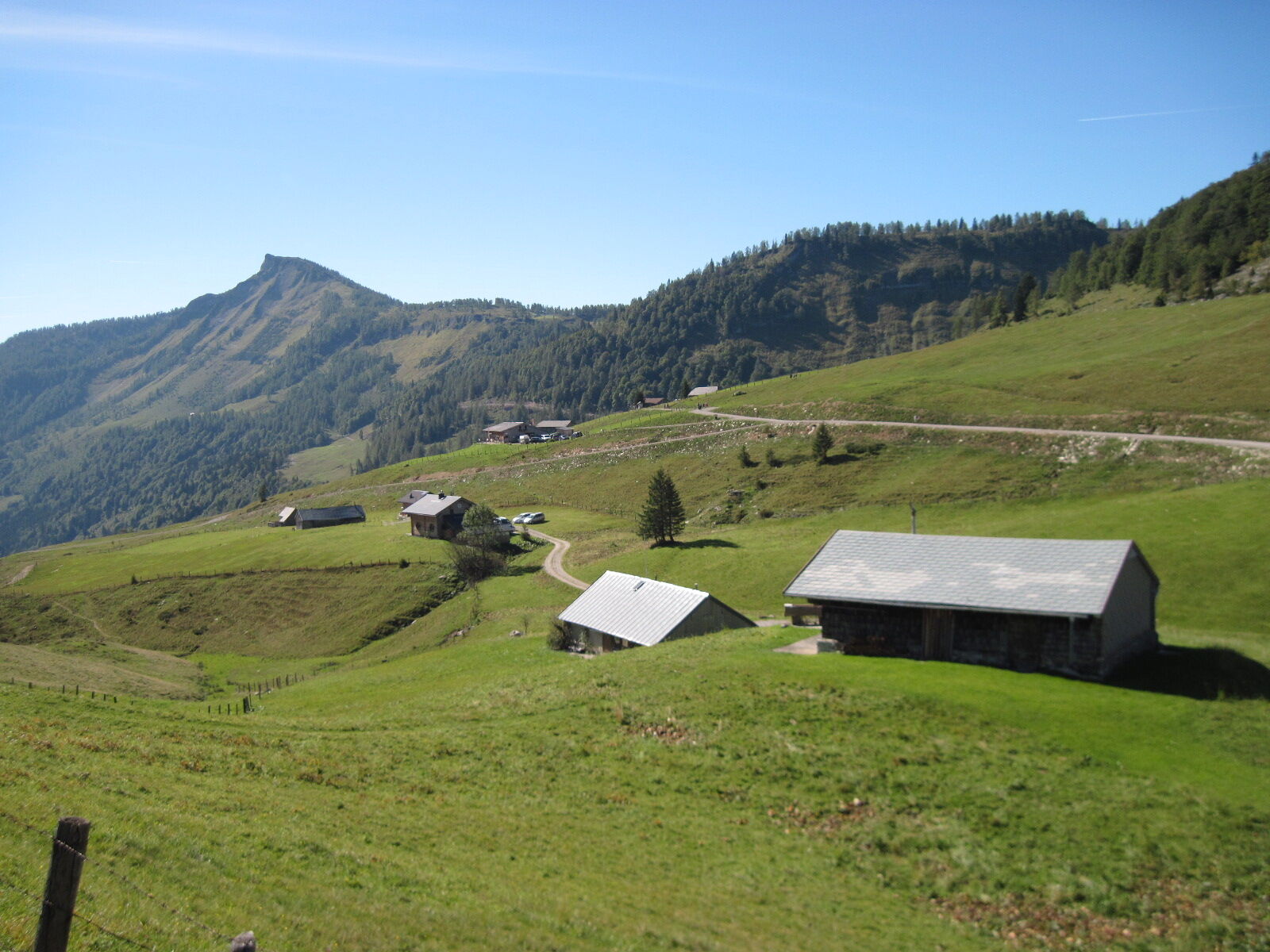
The descent follows a more well-worn trail over the steep southeastern slope (hunting stand) to a small plateau with several sinkholes (dolines) and rustic larches, where you cross a forest road. Below the road, you arrive at the Pitscherbergalm (1449 m) meadow (with snack station). Continue briefly along the forest road and then turn left through the forest and down to the wide meadow of the Labenbergalm. Straight ahead is a possible short detour to the Lienbach Hut (1431 m), which serves food, at the foot of the Labenberg Mountain (1643 m). However, the Salzkammergut Trail continues left along trail no. 840 over a 2-kilometre-long, partially forested ridge to the Postalm (1346 m).
On its western edge, the cosy, wooden Huber Hut welcomes hikers. Further overnight accommodation options can be reached if you continue 800 metres to Parkplatz 3 and from there head right – past the Strobler Hut – to the Postalm toll road (alpine guest house Zur Blonden, Welser Hut, Lienbachhof). Forking left from Parkplatz 3, you arrive at the Schafbergblick, Wiesler and Erlbach Huts (approx. 30 minutes each).
- Highest point
- 1,758 m
- Endpoint
-
Postalm - Strobl
- Height profile
-

- Equipment
-
For all stages, you will need hiking or mountain boots with treaded rubber soles as well as wind- and rainproof clothing. A change of clothes and a small first-aid kit should also be included in your backpack. The amount of provisions you should pack depends on the number of available rest stops. In any case, you should always take along plenty to drink. Telescopic poles are helpful, especially when walking downhill.
- Safety instructions
-
In alpine terrain, be aware of the danger of falling rocks.
Through early summer, you may encounter steep snowfields or firn gullies – especially during icy conditions, there is an acute risk of falling and thus fatal injury!
Due to storm damage, forestry work or construction work, individual trail sections may be difficult or impassable at times.
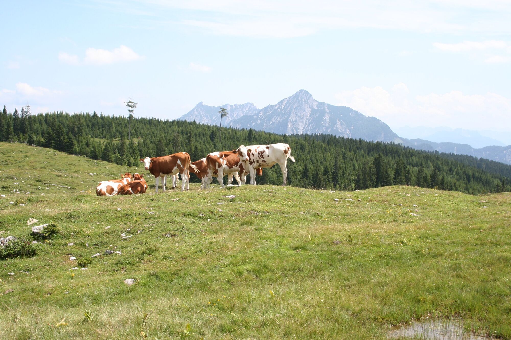
Cows in the alpine meadows are often curious. Because they are nursing mothers, they develop a strong tendency to protect their calves. Therefore, move through cow pastures quietly, keep at least 20 metres of distance to the animals and never pet calves! In the case of threatening behaviour (pawing, stamping) slowly back away (do not turn your back). Keep dogs on a leash. They must not bark at or chase cows. In the case of an attack, the dog must be released from the leash. - Additional information
-
Text kindly provided by the publisher KOMPASS-Verlag and Wolfgang Heitzmann.
Further information at trail.salzkammergut.at
- Author
-
The tour BergeSeen Trail 09: Hintersee - Postalm is used by outdooractive.com provided.