


- Brief description
-
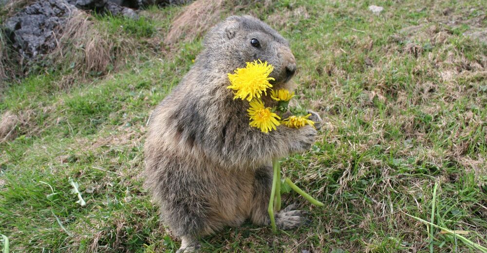
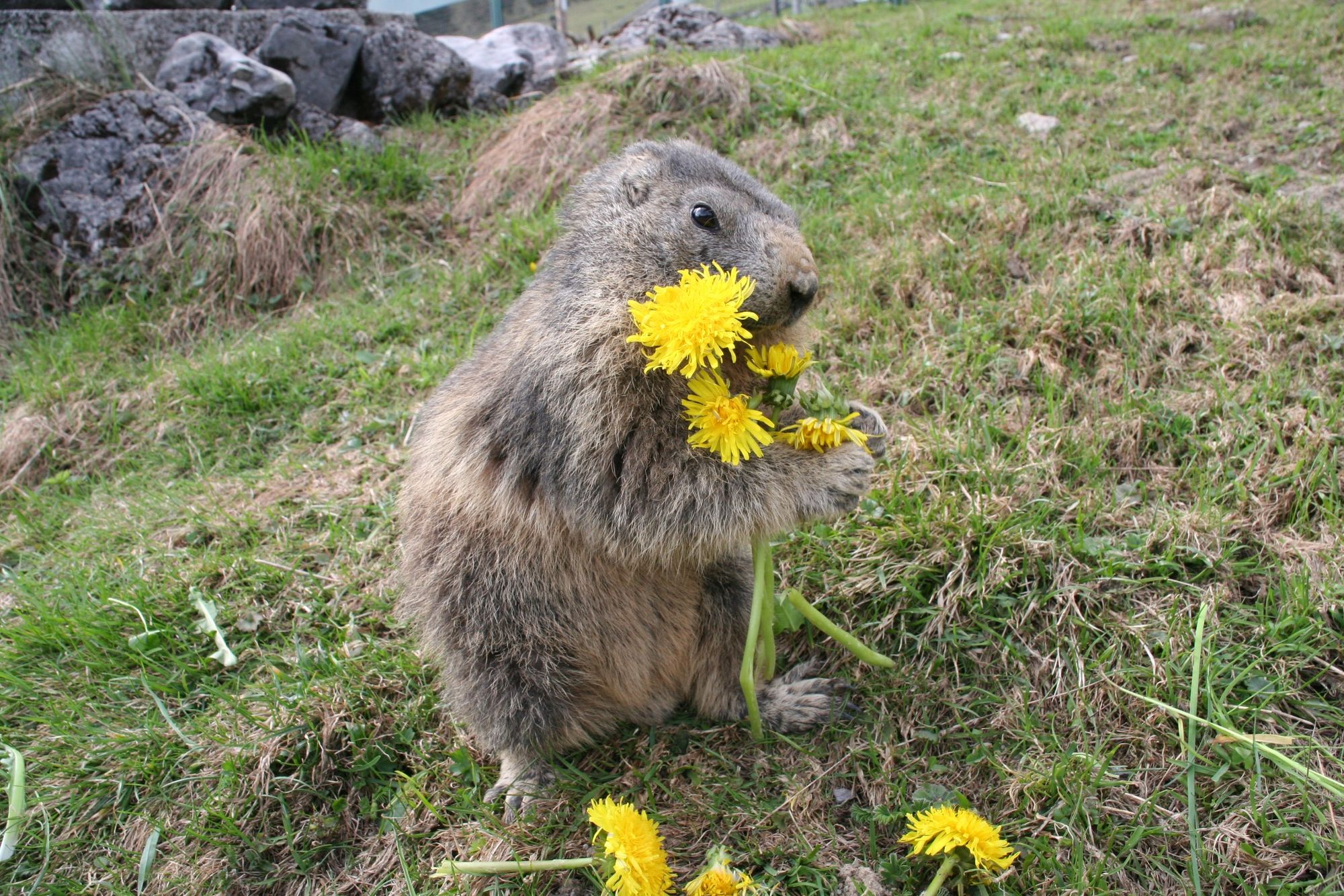
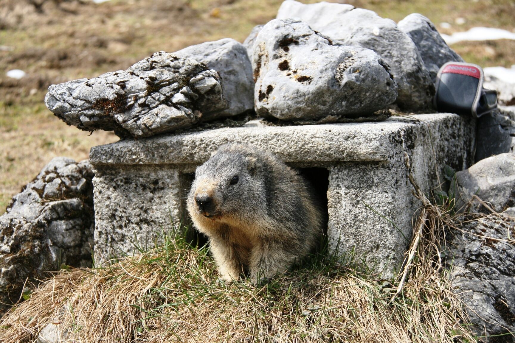
Whatch out! - it 's on our marmot path, perhaps you noticed our "Mümmler" !
- Difficulty
-
easy
- Rating
-
- Starting point
-
Schweizerhütte Arthurhaus
- Route
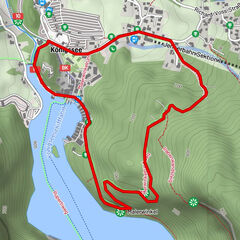
-
Sennerei SchweizerhütteArthurhausMitterbergsattel (1,515 m)0.4 km
- Best season
-
JanFebMarAprMayJunJulAugSepOctNovDec
- Description
-
The Marmot path begins right behind the Schweizerhütte and goes along a wide, flat, gravel track for about 1km to the "kingdom of the lazy animals". Large information boards describe the life of the marmots in the Hochkönig. Up close, you can see a colony of around 20 marmots in their natural habitat.
- Directions
-
Dirt road, a pram friendly path.
- Highest point
- 1,519 m
- Endpoint
-
Marmot Path
- Height profile
-

- Equipment
-
Good walking shoes , possibly rain gear, something to drink.
- Directions
-
Hochkönigbundesstraße B164, Mandlwandstraße towards Arthurhaus.
- Public transportation
-
Hiking-bus ( from June to mid October ), Bus from Bischofshofen to Mühlbach
- Parking
-
Parking at the Arthurhaus


- Author
-
The tour FAMILY WALKING ROUTE The Marmot Path is used by outdooractive.com provided.
GPS Downloads


General info
Refreshment stop
A lot of view
Other tours in the regions