© Ferienwohnungen Saalbach-Hinterglemm - Sabrina Gensbichler

- Brief description
-
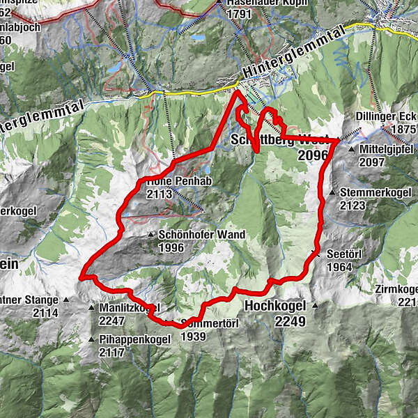
Weitenwanderung vom Perfeldhof über den Penhab, Seekar, Sommertor, Hackelbergsee bis zum Westgipfel
- Difficulty
-
difficult
- Rating
-
- Route
-
Zwölferkogel (1,984 m)2.3 kmWinkleralm (1,530 m)2.7 kmHohe Penhab (2,113 m)5.1 kmSchoenhofer Wand6.7 kmStoffenscharte (2,015 m)8.2 kmSommertörl (1,939 m)11.4 kmSeetörl (1,964 m)16.7 kmSchattberg West (2,096 m)19.9 kmWestgipfelbahn Bergstation19.9 kmWestgipfelbahn Mittelstation21.2 kmBergstadl21.4 km
- Best season
-
JanFebMarAprMayJunJulAugSepOctNovDec
- Highest point
- 2,123 m
- Endpoint
-
Perfeldhof
- Height profile
-


-
-
AuthorThe tour Panoramarundweg - Start & Ziel: Perfeldhof is used by outdooractive.com provided.
GPS Downloads


Other tours in the regions
-
Saalbach Hinterglemm
1581
-
Uttendorf - Weissee
369