- Brief description
-
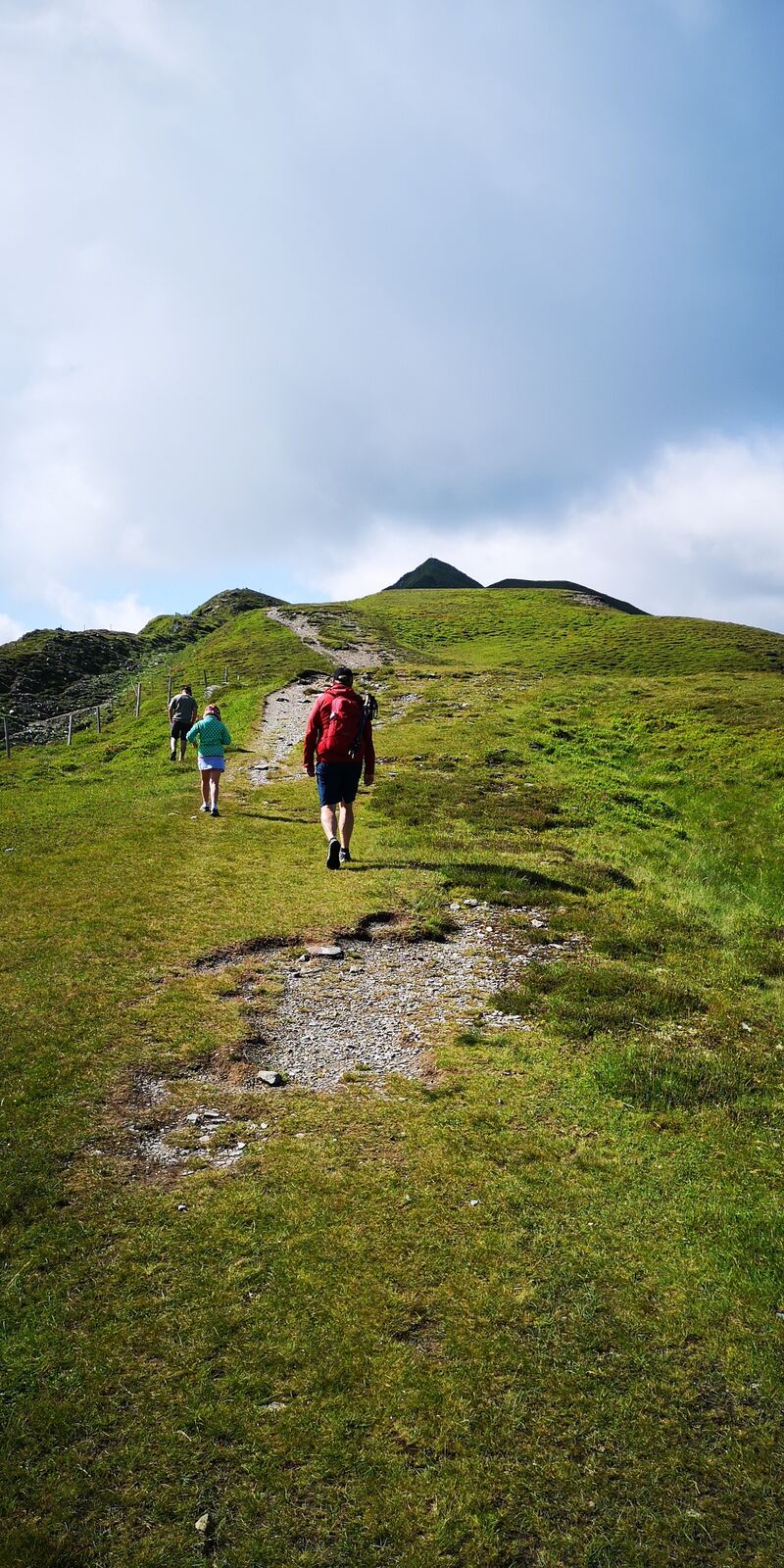
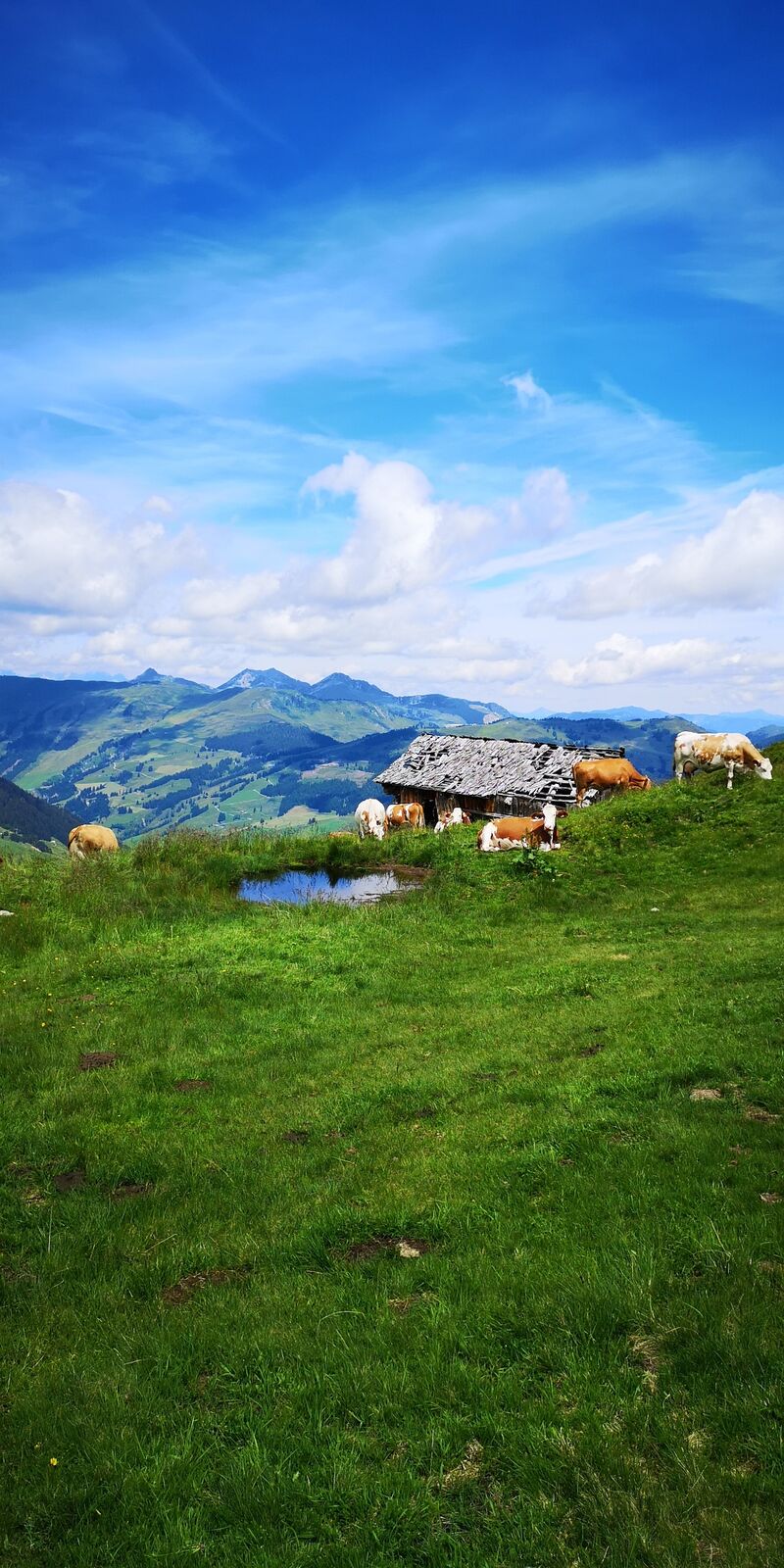
This panoramic round tour from the Schattberg West peak offers 3 peaks and 2 lakes and is also suitable for families. Surefootedness and medium fitness are required.
- Difficulty
-
medium
- Rating
-
- Starting point
-
Schattberg Westgipfel
- Route
-
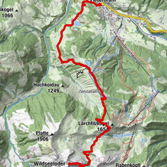
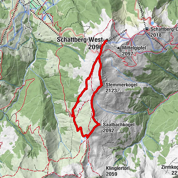
Westgipfelbahn Bergstation0.0 kmStemmerkogel (2,123 m)1.4 kmSaalbachkogel (2,092 m)2.8 kmSeetörl (1,964 m)3.3 kmWestgipfelbahn Bergstation7.3 kmSchattberg West (2,096 m)7.3 km
- Best season
-
JanFebMarAprMayJunJulAugSepOctNovDec
- Description
-
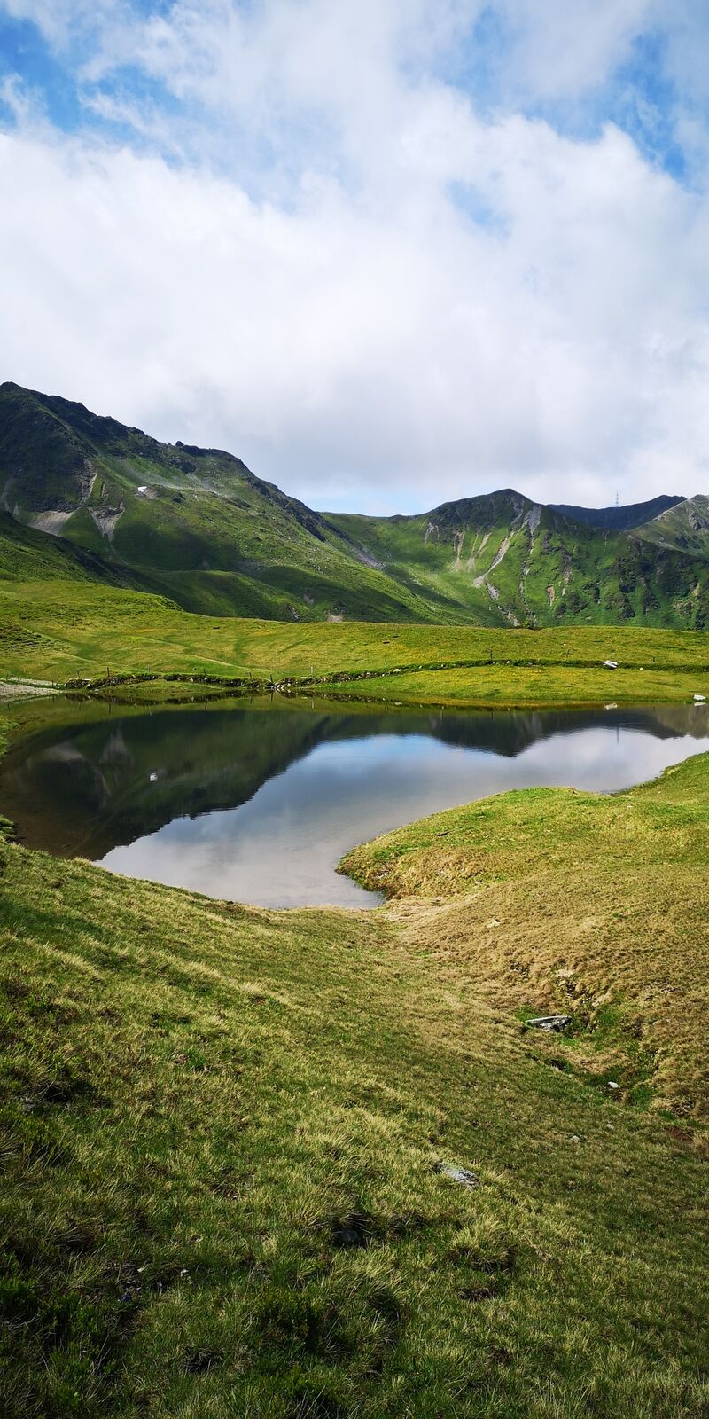
Ascent with the Westgipfelbahn (free for JOKER CARD holders) to the Schattberg Westgipfel. From there start in a southerly direction, first downhill, then along the path with a slight to moderate ascent to the first peak, the Stemmerkogel. A somewhat rocky descent in a south-westerly direction. Were 2 paths meet, continue straight on until you reach the second peak - the Saalbachkogel. From there, descend in the direction of Seetörl (partly over scree). Leave the two Hacklberg lakes on the left - perhaps after a short rest - and continue towards Hacklberg Alm. Return via the path that starts behind the hut to the third peak, the west peak of the Schattberg. Descent with the Westgipfelbahn gondola.
- Directions
-
Ascent with the Westgipfelbahn (free for JOKER CARD holders) to the Schattberg Westgipfel. From there start in a southerly direction, first downhill, then along the path with a slight to moderate ascent to the first peak, the Stemmerkogel. A somewhat rocky descent in a south-westerly direction. Were 2 paths meet, continue straight on until you reach the second peak - the Saalbachkogel. From there, descend in the direction of Seetörl (partly over scree). Leave the two Hacklberg lakes on the left - perhaps after a short rest - and continue towards Hacklberg Alm. Return via the path that starts behind the hut to the third peak, the west peak of the Schattberg. Descent with the Westgipfelbahn gondola.
- Highest point
- 2,102 m
- Endpoint
-
Schattberg Westgipfel
- Height profile
-

- Equipment
-
Good hiking shoes, sun protection and hiking poles are recommended.
- Tips
-
Plan enough time, especially with children, and observe the operating times of the mountain railways. Depending on the temperature, you may be tempted to cool off in the Hacklberg lakes, so pack a swimsuit if necessary.
- Directions
-
Coming from Saalbach, go through the tunnel in Hinterglemm, turn left immediately after the tunnel. Afterwards turn right to enter the Schwarzacherweg. Follow the road until you reach the bottom station of the Westgipfel gondola after about 1 km.
- Public transportation
-
Take the public bus to the Zwölferkogel stop, from there it's a 10 minutes walk to the bottom station of the Westgipfel gondola.
- Parking
-
Free parking.


-

-
AuthorThe tour Panorama tour with 3 summits and 2 lakes is used by outdooractive.com provided.


General info
-
Saalbach Hinterglemm
1601
-
Uttendorf - Weissee
369