
- Brief description
-
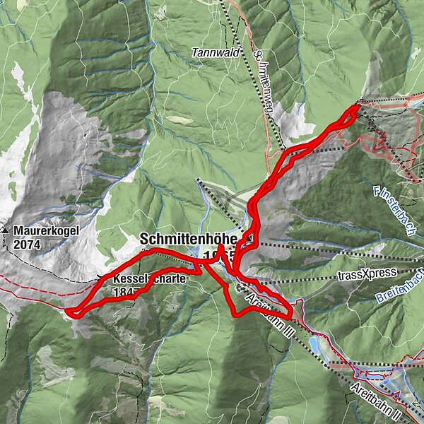
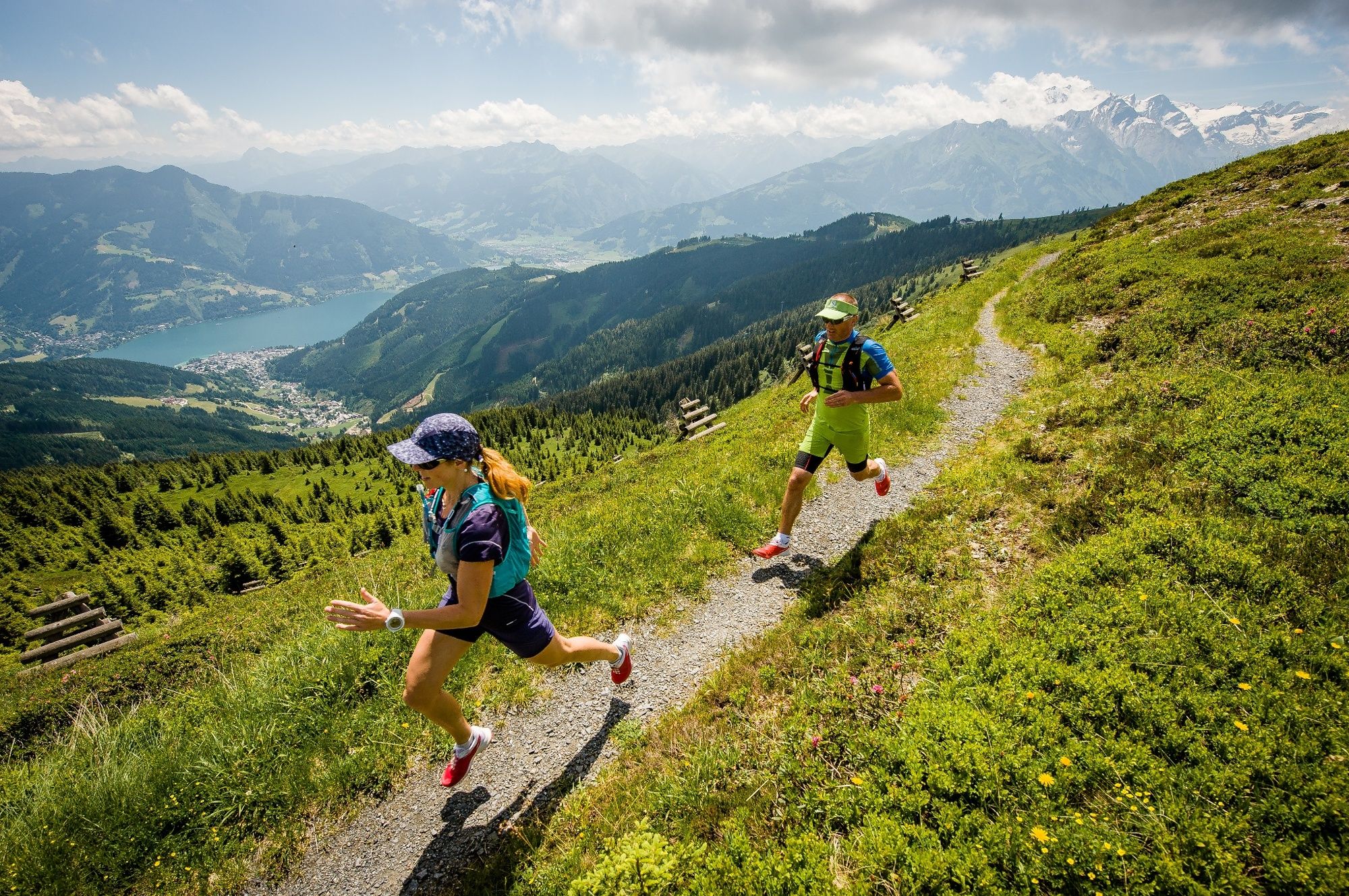
The Schmitten Trail Run, with start and finish at the trassXpress upper terminus, is pure trail running pleasure and leads over the high-altitude promenade between Schmittenhöhe, Sonnkogel, Breiteckalm and Pinzgauerhütte.
- Difficulty
-
difficult
- Rating
-
- Starting point
-
mountain station trassXpress
- Route
-
Schmittenhöhe (1,965 m)0.5 kmHochzeller-Alm0.8 kmSonnkogel Alm2.9 kmSalersbachköpfl (1,934 m)3.9 kmHochzeller-Alm4.9 kmSchmittenhöhe (1,965 m)5.3 kmElisabeth-Kapelle5.3 kmBreiteckalm6.7 kmEderhütte8.4 kmKettingtörl (1,780 m)8.5 kmPinzgauer Hütte9.6 kmKesselscharte (1,847 m)11.1 kmKettingkopf (1,865 m)11.8 kmKettingtörl (1,780 m)12.4 kmEderhütte12.4 km
- Best season
-
JanFebMarAprMayJunJulAugSepOctNovDec
- Description
-
Beautiful trails lead the runners along the high-altitude promenade. Initially, you follow in the footsteps of Empress Elisabeth on the Sissi Circular Trail. Sensational views of Lake Zell, the Kitzsteinhorn glacier ski resort, the Grossglockner and many other stunning mountain worlds await. From here, the adventure trail runs past the Hochzeller Alm, a ridge valley and the Salersbachköpfel to the Sonnkogel. Here is the turning point - the trail returns partly on a forest road, and again on cool trails. Past the Schmittenhöhe, the trail meanders a few metres downhill to the Breiteckalm. From the Breiteck, the trail leads along the hiking trail to the Pfaffenkendelsteig, which is also very popular in hot temperatures due to its sheltered forest location. Continue south past the Pinzgauerhütte and over the Kettingkopf back to the Kettingalm and Ederhütte. Now you should still have some energy left, because from here it's only uphill towards your destination back to the trassXpress upper terminus.
- Highest point
- 1,953 m
- Endpoint
-
mountain station trassXpress
- Height profile
-

-

-
AuthorThe tour Panorama Trail long is used by outdooractive.com provided.