
- Brief description
-
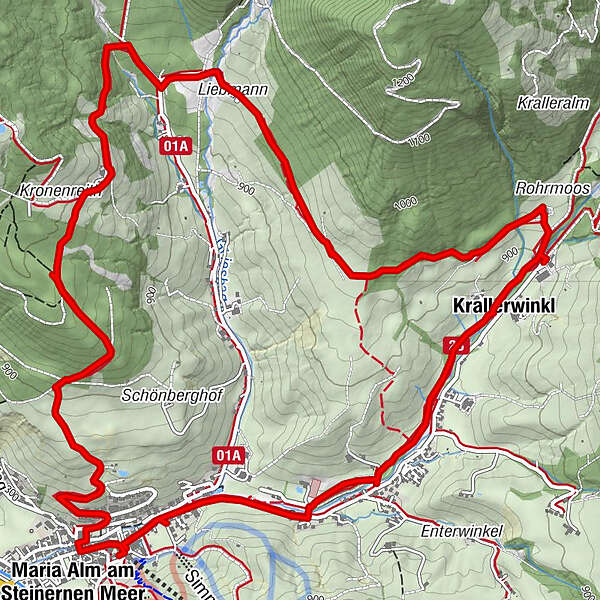
Informative, panoramic circular trail around Maria Alm with 5 information stations on the Bartholomä pilgrimage.
- Difficulty
-
easy
- Rating
-
- Starting point
-
Tourist office Maria Alm
- Route
-
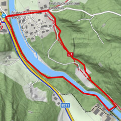
Maria Alm am Steinernen Meer0.2 kmKronreithhof2.7 kmKrallerwinkl6.6 kmEnterwinkl7.6 kmGasthaus Waldhaus7.7 kmMaria Alm am Steinernen Meer8.9 km
- Best season
-
JanFebMarAprMayJunJulAugSepOctNovDec
- Description
-
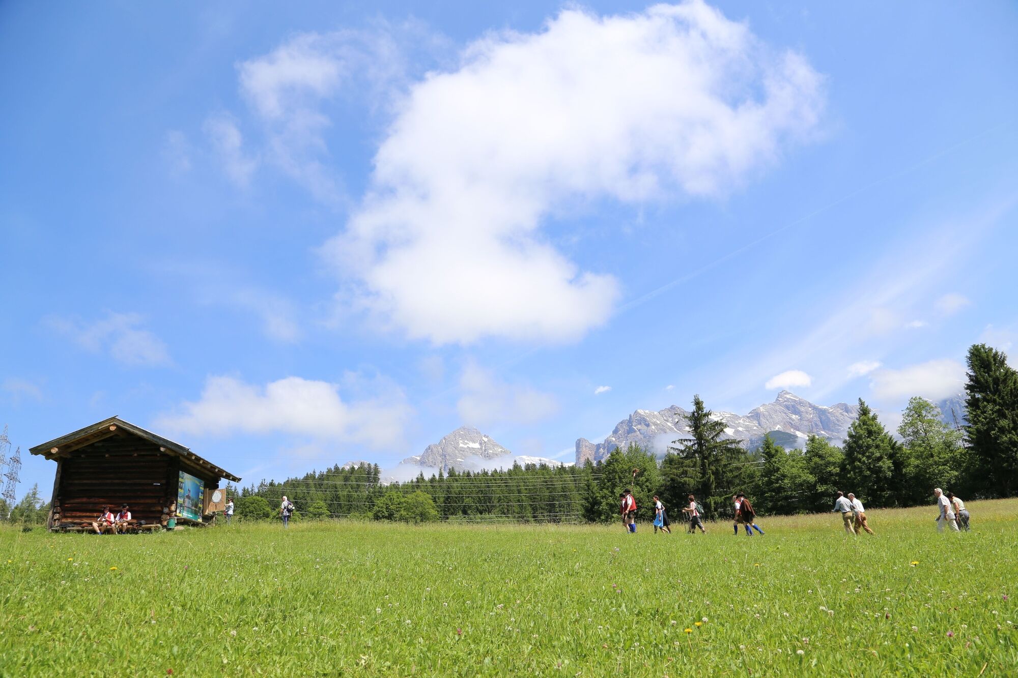
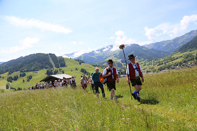
One of the oldest high mountain pilgrimages in Europe leads to St. Bartholomä. This pilgrimage is documented on the interestingly designed pilgrim trail in 5 stations. Both interesting information about the over 500-year-old tradition of pilgrimage and numerous pictures and descriptions depicting the pilgrimage are presented.
- Directions
-
For 400 years, pilgrims have made their way every year in August from Maria Alm across the Stone Sea to St. Bartholomö at Königssee in neighboring Bavaria. Don't worry, you don't have to walk the entire pilgrimage route on this hike, but at least you will get an idea of this very special atmosphere.
Starting point is at the village square of Maria Alm. Over the bridge opposite (next to the Moserwirt Inn), past the Almerwirt Inn, path no. 21 branches off to the right to the Dürnberg. Continue on path no. 21c to the Kronreith Inn. At the access road, trail no. 23 turns left here. The wonderful meadow path is replaced by an idyllic path through the light forest and ends in the alpine pasture area. Past the Kraller farm, the trail follows the Krallerbach stream via the Waldhaus inn back to the village square.
Along the way, five stations provide information about the traditional pilgrimage - Highest point
- 993 m
- Endpoint
-
Tourist office Maria Alm
- Height profile
-

- Equipment
-
Sturdy, ankle-high footwear
Walking sticks
Headgear
Sun protection
Sunglasses
Rain protection
Drinks and a snack
Necessary medication
First aid kit
Hiking map - Safety instructions
-
Self-assessment Check your physical fitness before every mountain tour and correctly assess your strength as well as that of your companions - especially those of your children! Surefootedness and a head for heights are often very important!
Planning and preparation Plan each intended mountain tour in detail beforehand. Hiking maps and guides as well as information from alpine associations and local experts such as mountain guides and mountain hut keepers can be helpful.
Equipment On the mountain, you will need appropriate equipment and clothing, especially sturdy, high shoes with good grip soles. Weather and cold protection are essential, as the weather can often change unexpectedly.
Weather forecasts Take note of the current weather conditions at: www.zamg.at
Together Follow the 10 rules for the correct handling of grazing animals and do not leave any waste in nature!
Do not kick stones Do not kick stones as this can seriously endanger other hikers. Marked places with a danger of falling rocks should be crossed as quickly as possible and with attention and caution.
Turn back in good time This is not a disgrace, but a sign of common sense. It becomes necessary when the weather changes, fog rolls in, and also when the path is too difficult or not in good condition.Emergency numbers: Alpine emergency call: 140
International emergency call: 122 - Tips
-
Shortly before Kronreith there is a botanically interesting high moor.
This theme path can also be walked in the opposite direction. There is no need to walk the steeper part after the Almerwirt.
- Additional information
- Directions
-
Coming from Salzburg: Take the A10 motorway to the Bischofshofen exit, then take the B311 towards Bischofshofen. Follow the Hochkönig Bundesstraße/B164 to Maria Alm.
Coming from Innsbruck/ Kufstein: Take the Loferer Straße/B178 in the direction of St. Johann i.T., then follow the Hochkönig Bundesstraße/B164 via Saalfelden to Maria Alm.
A valid vignette is required to use the Austrian motorway and motorway network. It is also compulsory to carry a first-aid kit, warning triangle and high-visibility waistcoat. Further information can be found under Asfinag. - Public transportation
- Parking
-
Free parking at the entrance to the village and in the center of Maria Alm

- Author
-
The tour Theme hike "On the trail of the pilgrims" is used by outdooractive.com provided.