
- Brief description
-
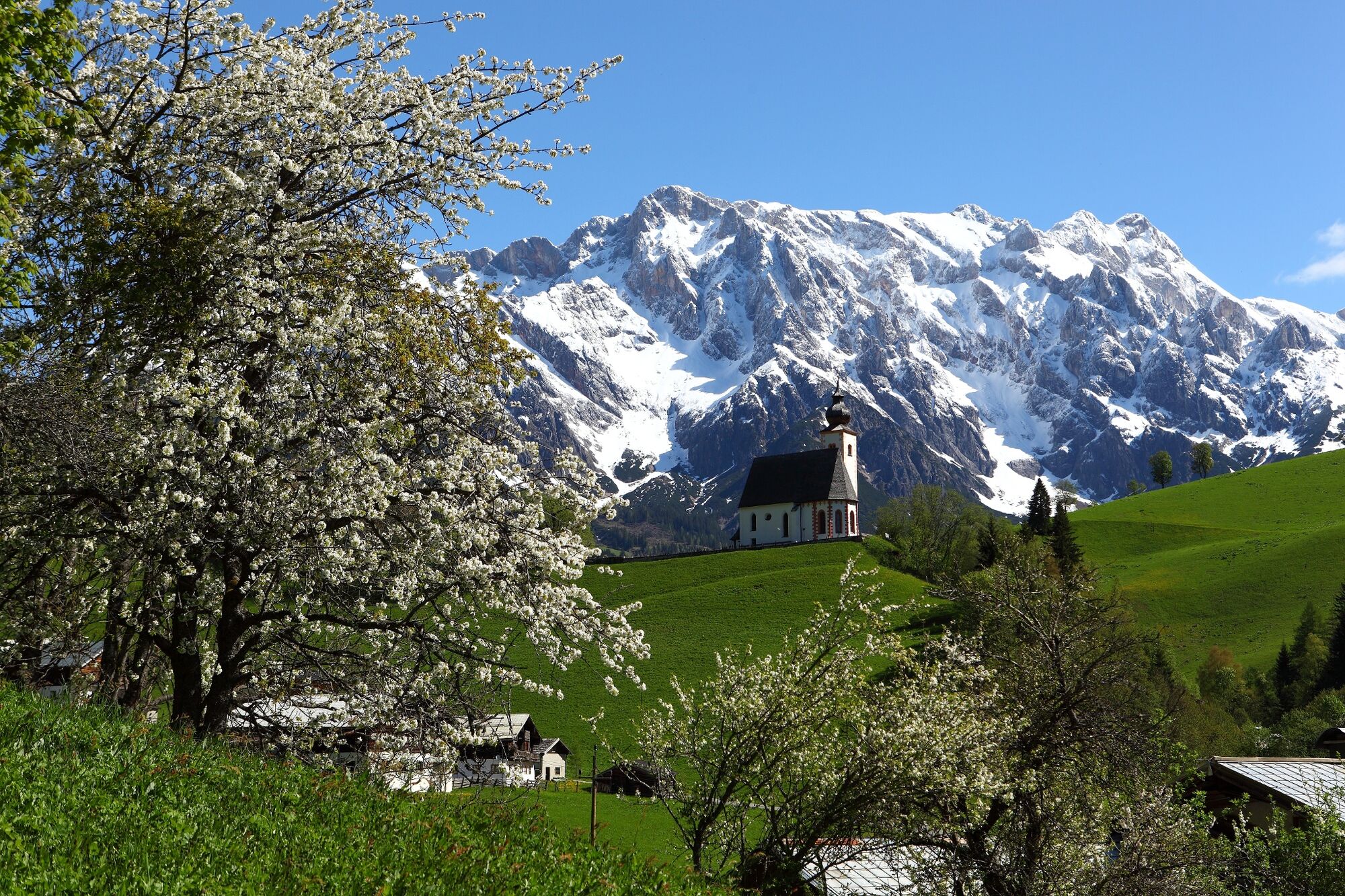
Family-friendly audio path around the village of Dienten
- Difficulty
-
easy
- Rating
-
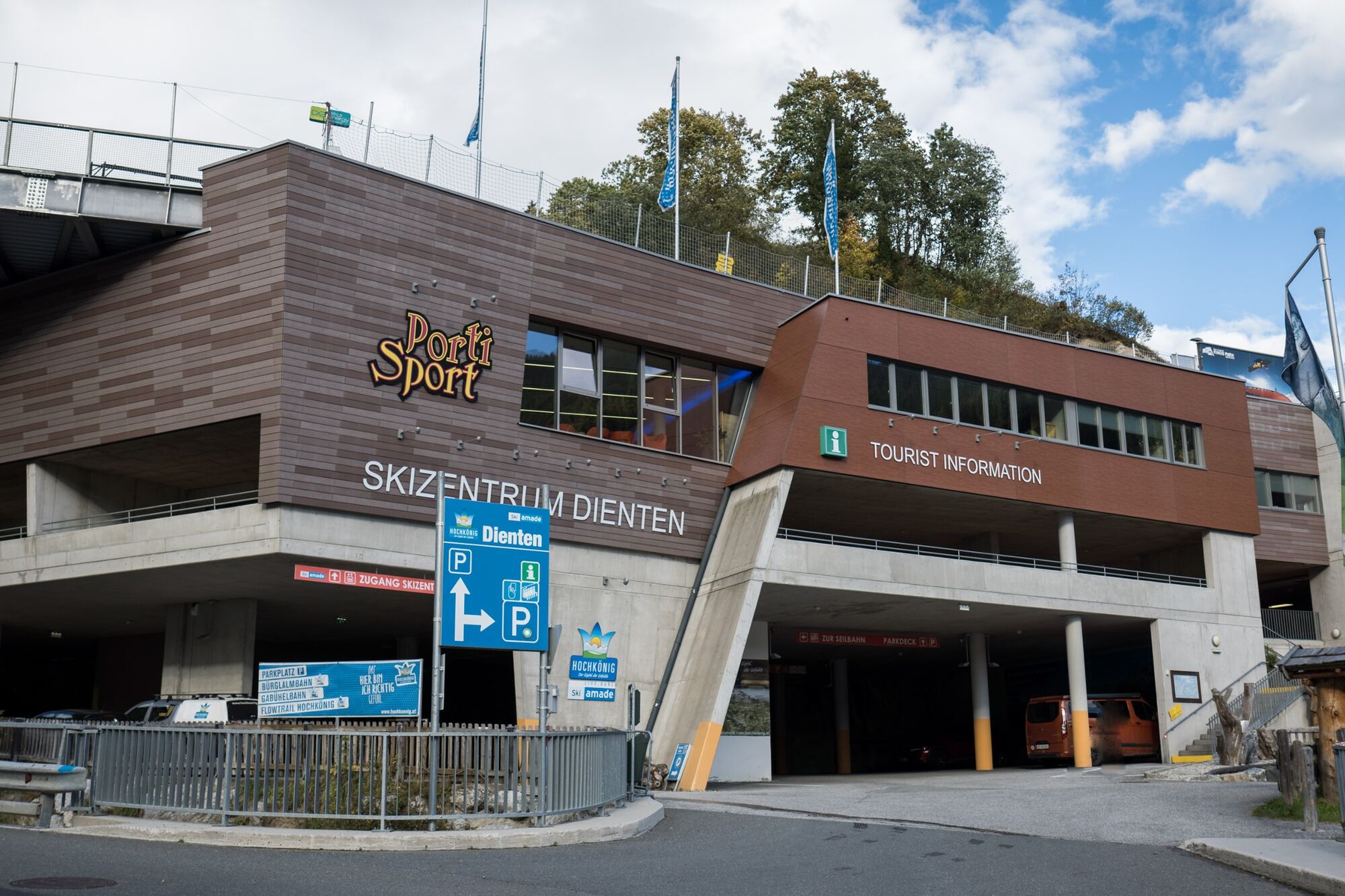
- Starting point
-
Ski centre Dienten
- Route
-
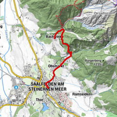
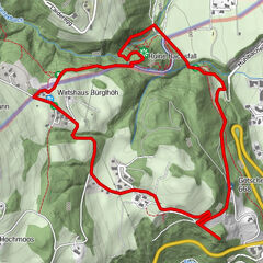
Dienten am Hochkönig0.3 kmGrünegg Alm2.4 kmSankt Nikolaus3.5 km
- Best season
-
JanFebMarAprMayJunJulAugSepOctNovDec
- Description
-
12 audio stations tell the famous Dientner legends.
Conveniently download the Hochkönig Story 2 Go app onto your mobile phone and listen to the most famous Dientner legends. The Legend Trail is an experience for the whole family. The hike is four kilometres long and takes about 1.5 - 2 hours.
Download für iOS | Download für Android
- Directions
-
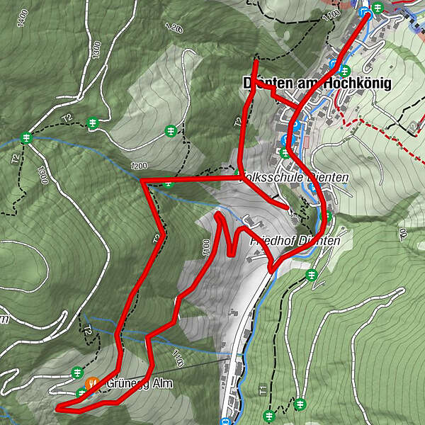
The audio legend trail starts at the ski centre in Dienten and leads through the village to the car park/ Grünegg turn-off.
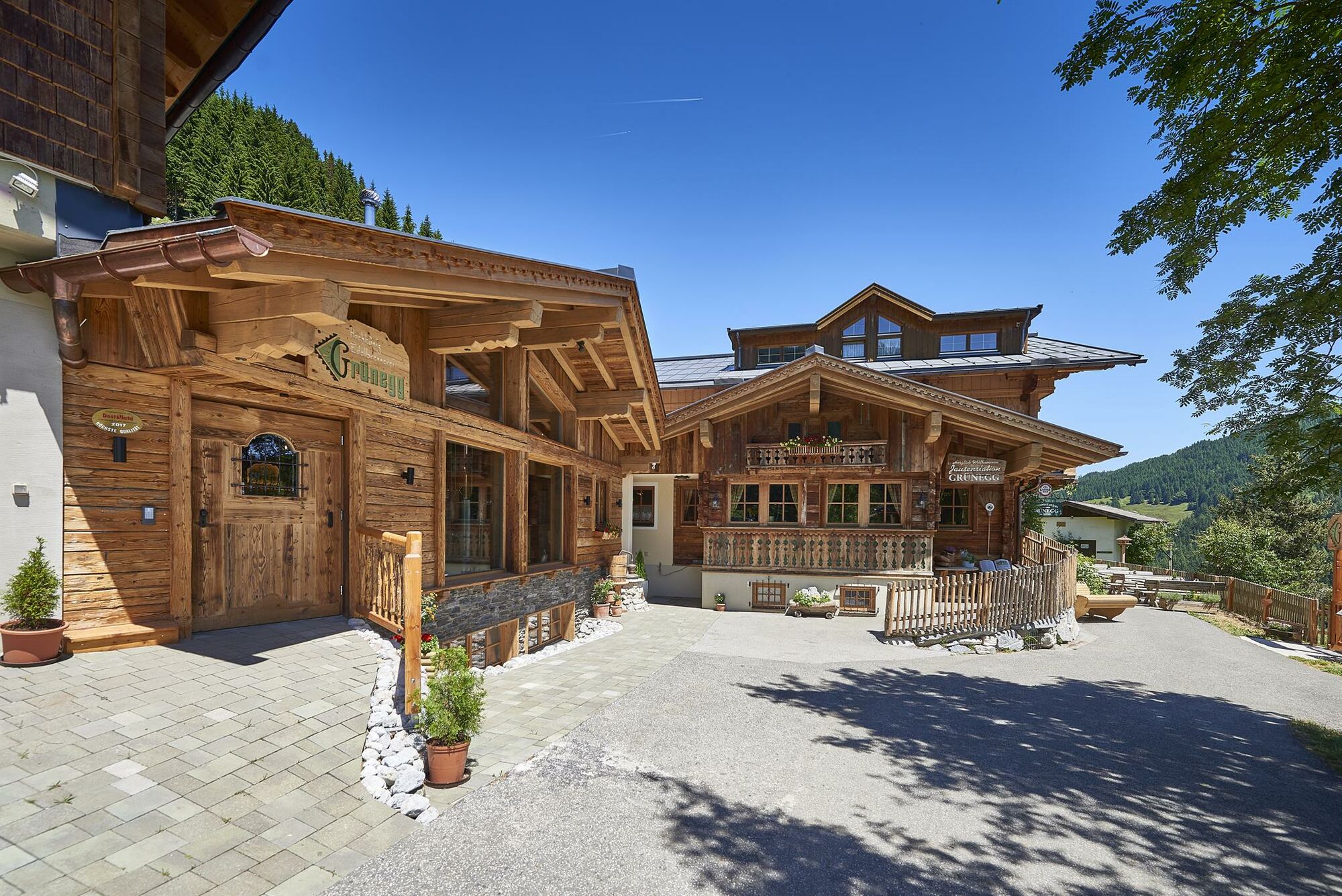
Here the asphalted goods path leads to the Grünegg Alm (refreshment stop) on the right. Follow the path until you reach the hut.
Past the hut, a narrow trail leads back across the field in the direction of Dienten (trail no. 53b/c). The so-called "Kirchsteig" leads us back to above the Dienten parish church (trail 440).
Arriving at the fork in the Dorfpanoramaweg, we follow the path to the left until we reach the waterfall (trail no. 53a). From there we have to go back along the same path for a bit until we follow the path downhill to the left into Dorf. - Highest point
- 1,197 m
- Endpoint
-
Village Dienten
- Height profile
-

- Equipment
-
Sturdy, ankle-high footwear
Walking sticks
Headgear
Sun protection
Sunglasses
Rain protectin
Drinks and a snack
Necessary medication
First aid kit
Hiking map - Safety instructions
-
Weather forecasts Take note of the current weather conditions at: www.zamg.at
Together Follow the 10 rules for the correct handling of grazing animals and do not leave any waste in nature!
Do not kick stones Do not kick stones as this can seriously endanger other hikers. Marked places with a danger of falling rocks should be crossed as quickly as possible and with attention and caution.
Turn back in good time This is not a disgrace, but a sign of common sense. It becomes necessary when the weather changes, fog rolls in, and also when the path is too difficult or not in good condition.Emergency numbers: Alpine emergency call: 140
International emergency call: 122 - Tips
-
Great family hiking trail for young and old.
- Additional information
- Directions
-
Coming from Salzburg: Take the A10 freeway to the Bischofshofen exit, then take the B311 in the direction of Bischofshofen. Follow the Hochkönig Bundesstraße/B164 to Mühlbach and further to Dienten.
Coming from Innsbruck/ Kufstein: On the Loferer Straße/B178 in the direction of St. Johann i.T., then on the Hochkönig Bundesstraße/B164 via Saalfelden and Maria Alm to Dienten or to the Filzensattel.
A valid vignette is required to use the Austrian motorway and motorway network. It is also compulsory to carry a first-aid kit, warning triangle and high-visibility waistcoat. Further information can be found under Asfinag. - Public transportation
- Parking
-
Free parking at the Dienten Ski Centre

- Author
-
The tour Hochkönig “Hike of Legends” audio path is used by outdooractive.com provided.


General info
-
Hochkönig
2014
-
Dienten am Hochkönig
536