
- Brief description
-
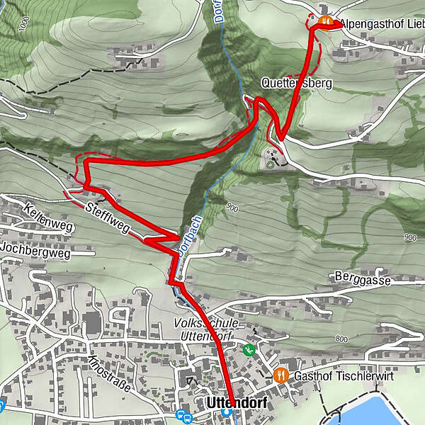
From the town center along Dorfbachstrasse and then following the information boards up the sunny slope of Uttendorf. The boards describe the growth and decay, the life and use of butterflies.
- Starting point
-
Uttendorf town center
- Route
-
UttendorfQuettensberg2.0 kmAlpengasthof Liebenberg2.3 km
- Description
-
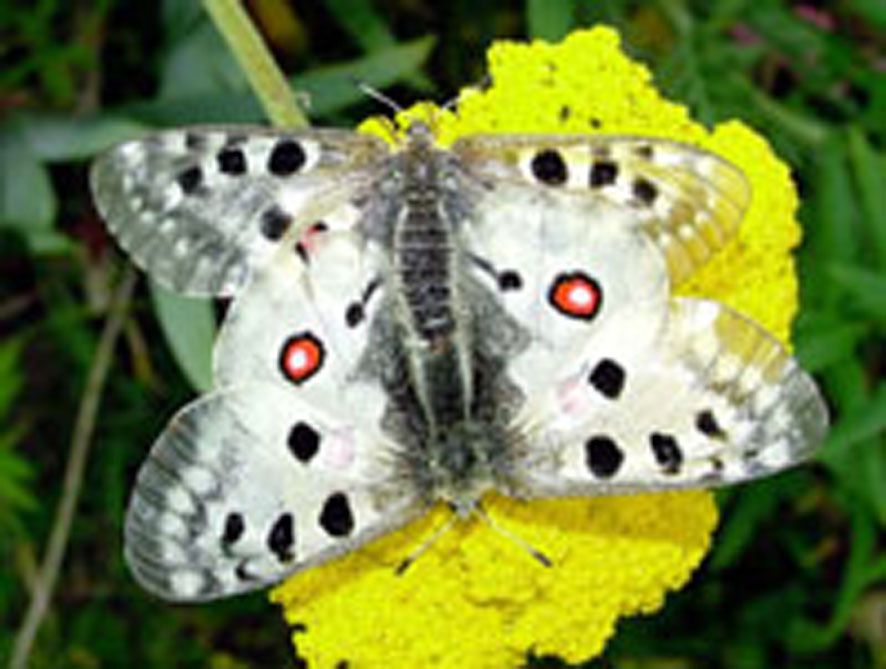
The path leads along Dorfbachstraße to the Stefflbauer, where the first information board is located. Then the exposed dry slope with its warmth-loving flora and fauna is crossed, which often offers the opportunity to admire the life and death of the colorful butterflies such as the swallowtail, apollo butterfly, lemon butterfly, peacock butterfly, little fox, admiral, mourning mantle, schiller butterfly and many more. The path leads over wooden stairs to the shady Steinergraben, where seats invite you to rest. The path leads past a swampy Erlenau with delicate mosses and ferns to the erratic boulders (devil's stones - witnesses of the Ice Age).In the immediate vicinity of the geological peculiarity, hikers will come across a wet biotope, again a place of calm and prudence, but also an oasis for other butterfly species and insects. Before you reach the Alpengasthof Liebenberg, a popular excursion destination, the path finally leads along the edge of the forest, past littered meadows and through an old orchard.
Enjoy the wonderful nature and let yourself be drawn into the spell of the many "flying gemstones"!
The starting point is the town center and the end point after about 1.5 hours of walking is the Alpengasthof Liebenberg. The difference in altitude is 300 m.
- Highest point
- 1,070 m
- Endpoint
-
Alpengasthof Liebenberg
- Height profile
-

- Additional information
-
Tourismusverband A-5723 Uttendorf/Weißsee
Tel. 06563/8279
E-mail: info@uttendorf.com
www.uttendorf.com
- Public transportation
-
By bus or Pinzgau local train to Uttendorf.
- Parking
-
Parking in the center of Uttendorf.
-

-
AuthorThe tour Uttendorf: Butterfly nature trail is used by outdooractive.com provided.
GPS Downloads


General info
Fauna
Other tours in the regions