
- Brief description
-
Signposted touring ski trail in Dienten am Hochkönig to Grünköpfl with breathtaking panoramic views of the Hochkönig massif.
- Difficulty
-
medium
- Rating
-
- Starting point
-
Parking Grünegg Alm
- Route
-
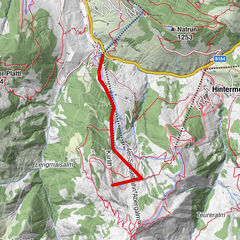
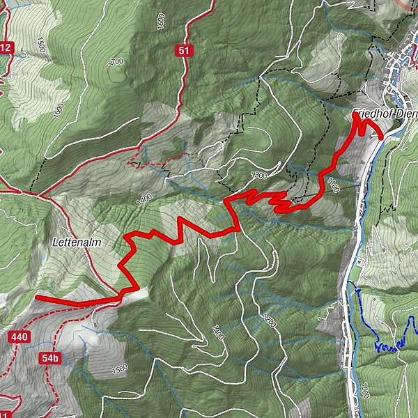
Dienten am Hochkönig0.1 kmGrünegg Alm1.3 kmGrinnköpfl (1,707 m)4.1 km
- Best season
-
AugSepOctNovDecJanFebMarAprMayJunJul
- Description
-
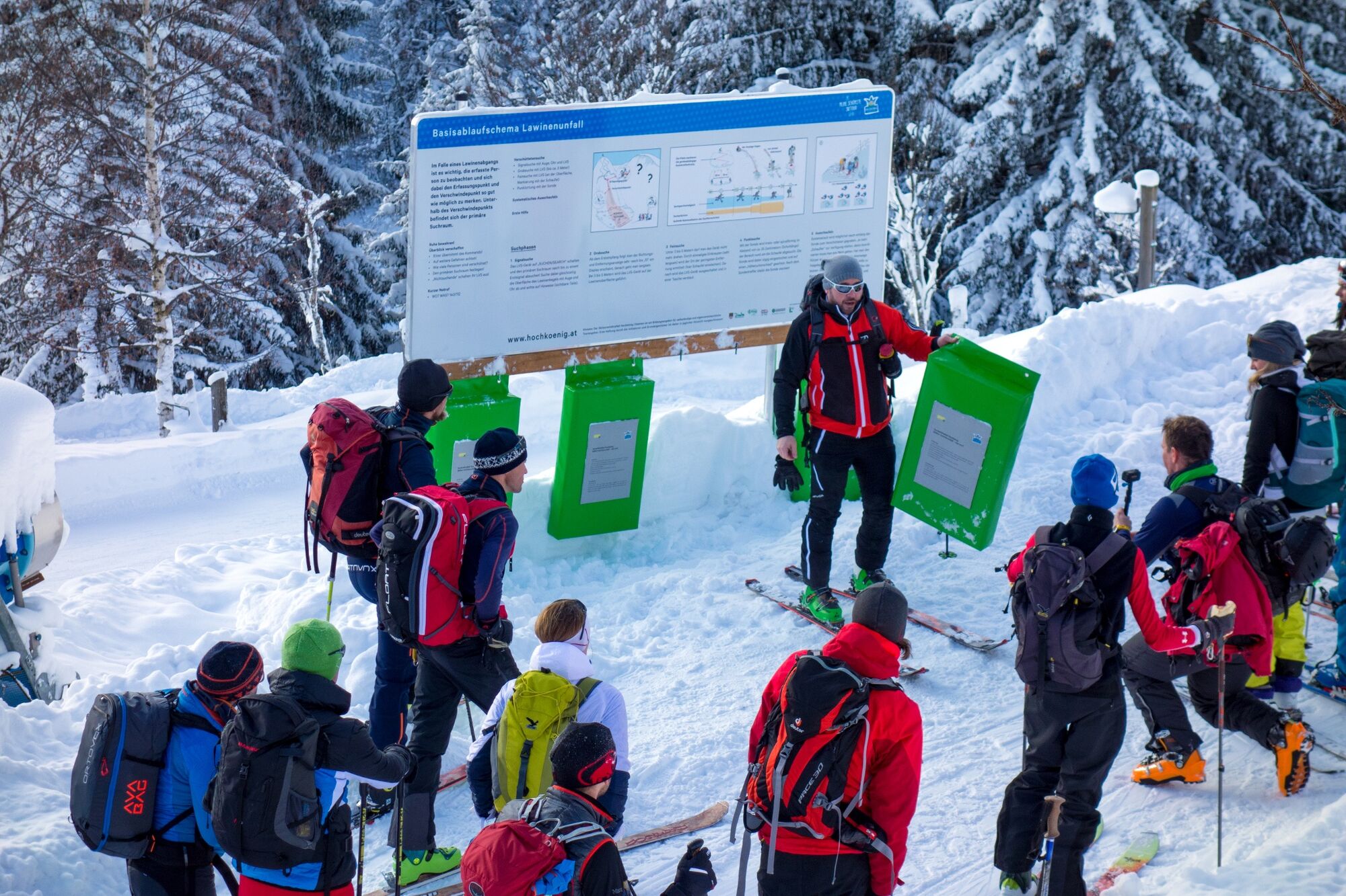
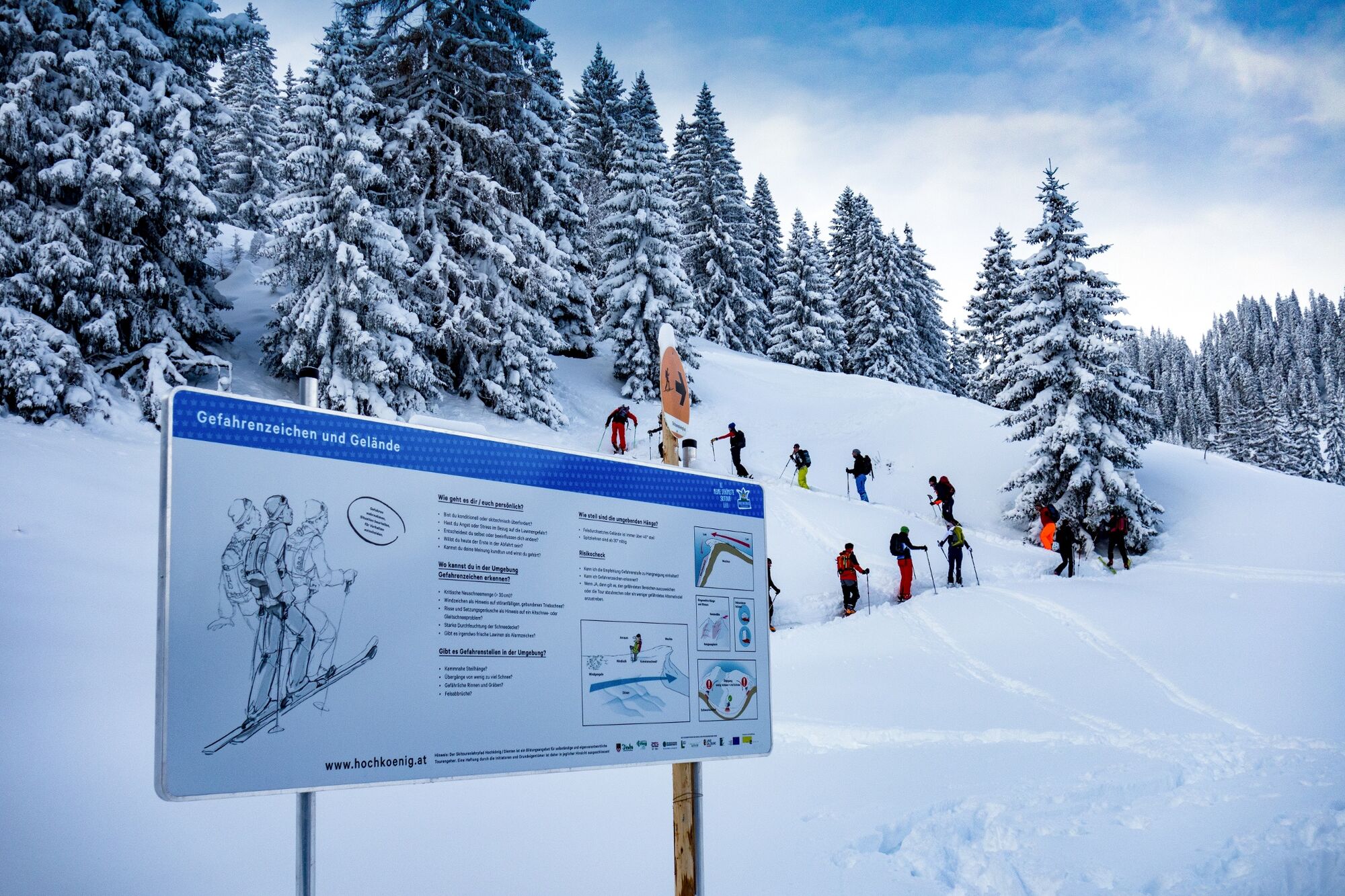
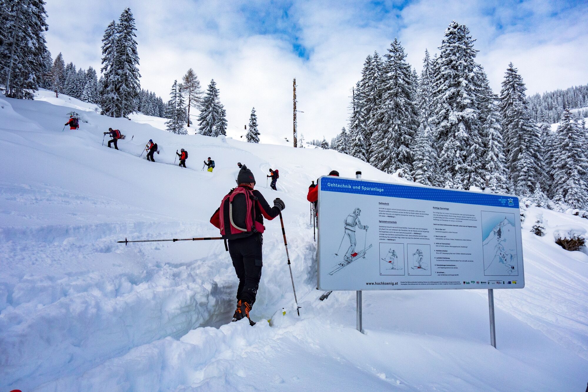
The nature trail combines theory and practice in a methodically designed concept. Winter sports enthusiasts can learn new and interesting things "along the way". Use of the nature trail is free of charge and useful and interesting for beginners and experts, individuals and groups, and for winter sports enthusiasts of all ages. Seven display boards provide information on planning, risk assessment and emergency management.
The starting point is the car park of the Grüneggalm toboggan run in Dienten.
- Directions
-
The trail begins on the L216 coming from Lend shortly before entering Dienten directly at the car park of the Grüneggalm toboggan run.
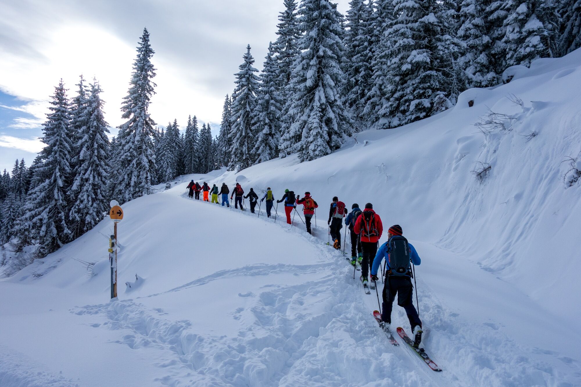
At the beginning, the trail leads along the toboggan run to the Grüneggalm and later on along forest paths, alpine pastures and sparse forests past the Lettenalm and Mühllehenalm to the Grünköpfl.
The entire nature trail is signposted and marked and, with a total of 720 metres in altitude and a maximum steepness in some places of approx. 30 °, can be classified as an easy tour.
Comfortable walking time is approx. 2h. The descent leads over almost the same ascent track back to the Grüneggalm and further down into the valley to the starting point. - Highest point
- 1,705 m
- Endpoint
-
Grünköpfl
- Height profile
-

- Equipment
-
Ski touring equipment
Crampons
Backpack with hot drink and light snack
Necessary medication
First aid kit - Safety instructions
-
Healthy in the mountains Ski and snowshoe tours are endurance sports. The valuable stress stimuli for heart and circulation require health and good self-assessment. Avoid time pressure and choose the pace so that no one in your group gets out of breath. Make sure you have energy reserves for the descent.
Careful planning Maps, guide books, internet and experts provide information on length, altitude difference, difficulty and current conditions. Pay particular attention to the weather forecast, as strong winds and poor visibility greatly increase the risk of accidents.
Study the avalanche situation report Before setting out on the tour, inform yourself in detail about the current danger level (European danger scale for avalanches in 5 levels). Pay particular attention to the information on danger points (Where is it dangerous today?) and sources of danger (What is the main danger today?).
Complete equipment Adapt your equipment to the winter conditions and make sure your backpack is light. For avalanche emergencies, an avalanche transceiver, shovel and probe are standard, as are a first aid kit, bivouac sack and mobile phone. An airbag system increases the chances of survival.
Regular hydration breaks Fluids, energy and breaks are necessary to maintain performance and concentration. Hot, isotonic drinks are ideal thirst quenchers and warmers. Easy-to-digest foods such as muesli bars, dried fruit and biscuits satisfy small hunger pangs on the way.
Weigh up the avalanche risk When it comes to recognising the avalanche danger, humans have narrow limits. Therefore, base your decisions on strategic methods of risk assessment (reduction methods) and learn to recognise danger signs in the terrain.
Maintain distances Relief distances of 10 m when ascending steep slopes (≥ 30°) reduce the load on the snowpack and increase comfort when making hairpin turns. Always keep distances of at least 30 m when skiing downhill and ski very steep slopes (≥ 35 °) individually.
Avoid falls Falls on the descent are the most frequent cause of accidents on ski tours. They also place a great deal of additional stress on the snowpack. Good skiing technique and a speed adapted to your ability reduce the risk. A ski helmet can protect against head injuries.
Small groups Small groups enable mutual help and reduce the risk of triggering an avalanche. Stay together in the group. Attention lone skiers: Even small incidents can lead to serious emergencies. Therefore always inform familiar people about destination, route and return.
Respect for nature To protect nature: Do not leave waste behind, avoid noise, do not enter reforested areas, respect protected and restricted areas. Show special consideration for wild animals in winter! To get there, carpool or use public transport.Emergency numbers: Alpine emergency call: 140
International emergency call: 122 - Tips
-
The Grünegg Alm is open for a break.
- Additional information
- Directions
-
Coming from Salzburg: Take the A10 freeway to the Bischofshofen exit, then take the B311 in the direction of Bischofshofen. Follow the Hochkönig Bundesstraße/B164 to Mühlbach and further to Dienten.
Coming from Innsbruck/ Kufstein: On the Loferer Straße/B178 in the direction of St. Johann i.T., then on the Hochkönig Bundesstraße/B164 via Saalfelden and Maria Alm to Dienten or to the Filzensattel.
A valid vignette is required to use the Austrian motorway and motorway network. It is also compulsory to carry a first-aid kit, warning triangle and high-visibility waistcoat. Further information can be found under Asfinag. - Public transportation
- Parking
-
Free parking at the Grünegg Alm car park
- Author
-
The tour Skitouring educational trail Dienten is used by outdooractive.com provided.


General info
-
Hochkönig
140
-
Dienten am Hochkönig
37