Winter
Summer
Weather
Webcams
Accommodations
Tours
Search history
Search suggestions
No results found
Search
Tours
Home
Summer Österreich
Salzburg
Tours
Fanning
Regions
Weather
Webcams
Tours
Highlights
Bathing lakes
Accommodations
Offers
Sports provider
Events
Ski resorts
Cross-country skiing
Snow parks
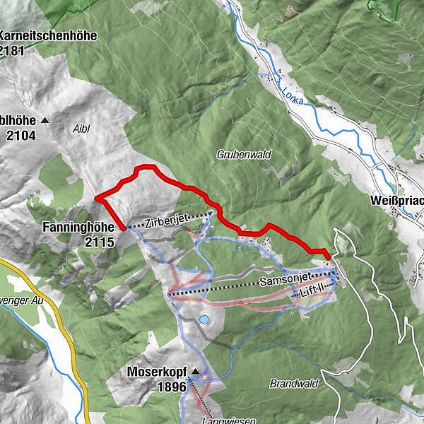
Fanning
Ski tour
Bookmark
Map
show
hide
Print
Tour data
4.1
km
1,492 - 2,115
m
Distance
623
hm
Ascent
01:30
h
Duration
digi
created am 26.12.2012
1,522
Views
Rating
Technique
Fitness
Landscape
Experience
Best season
Aug
Sep
Oct
Nov
Dec
Jan
Feb
Mar
Apr
May
Jun
Jul
Highest point
2,115 m
Write a review
Overall rating
5
0
%
4
0
%
3
0
%
2
0
%
1
0
%
Reviews
(0)
0 Comments
Write a review
Error
An error has occurred. Please try again.
Thank you for your review
Rating has been deleted
Report tour
GPS Downloads
GPX
GPS Exchange Format (XML)
KML
Google Earth, Google Maps
QR Download Codes for Mobile Phones
Fanning
QR Codes - tour download for cell phones
GPX
KML
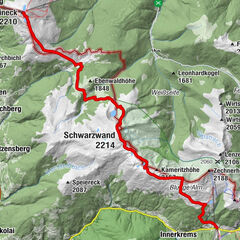
Other tours in the regions
Katschberg Lieser-Maltatal
262
Lungau - Ferienregion
109
Weißpriach
27
Popular tours in the area
Nockberge-Trail: Skiroute Etappe 1
medium
Ski tour
17.28
km |
769
hm |
06:00
h
Leckriedel - Skitour zwischen Untertauern und Zauchensee
medium
Ski tour
6.55
km |
544
hm |
01:49
h
Kleiner Pleisslingkeil in Obertauern
medium
Ski tour
17.2
km |
1136
hm |
04:00
h
Südwiener-Hütte und Spirzinger in der Skiregion Obertauern
easy
Ski tour
12.27
km |
729
hm |
03:00
h
No entries found.
The search is currently not available.
Please refine your search.
Local search results
(<= 25km)
More results
(> 25km)
%count% Search results
%name%
%type%
%elevation%
%population%
%lpButton%


 und den Kleinen (rechts daneben) Pleißlingkeil.")

 mit ihrem Hausberg Spirzinger (2066 m) im Hintergrund.")
