- Brief description
-
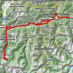
Distance: 74,9 km
Lowest / Highest point: 544m / 1.372m
Sum of all ascents: 1.467 hm
Wagrain tourist office – St. Johann im Pongau – St.Veit im Pongau – Goldegg am See – Lend – Dienten – Dientner Sattel – Mühlbach am Hochkönig – Bischofshofen – Mitterberghütten – St. Johann im Pongau – Wagrain tourist office
- Difficulty
-
difficult
- Rating
-
- Starting point
-
Wagrain tourist office
- Route
-
Filalkirche Hl. Franziskus („Marktkirche“)0.0 kmMarkt0.1 kmGoldanger0.4 kmGasthof Grubhöhe5.9 kmSankt Johann im Pongau8.4 kmPfarrkirche St. Johann8.5 kmEvang. Annakapelle8.5 kmPalfnerdörfl9.9 kmReinbach11.6 kmCafe-Restaurant Bacher11.8 kmHalldorf12.2 kmGrafenhof14.1 kmSchwarzach im Pongau16.3 kmFreie Christengemeinde17.6 kmGoldegg im Pongau19.8 kmHofmark20.3 kmAltenhof21.5 kmAltenhofkapelle21.7 kmMaierhof22.6 kmBuchbergdörfl22.9 kmBruderau26.3 kmLend26.3 kmSonnberg33.9 kmSchattberg34.0 kmFischerstüberl34.8 kmDienten am Hochkönig37.9 kmHöfl-Zachhof39.6 kmKönig & Kuh41.3 kmMittereggalm43.1 kmBirgkarhaus43.2 kmMühlbach am Hochkönig49.5 kmHöring49.6 kmAnderlwirt49.6 kmMesnerhaus, Café, Bar & Restaurant49.6 kmPfarrkirche zum hl. Sebastian49.7 kmMitterberghütten57.8 kmBischofshofen58.4 kmPizzeria60.5 kmEvang. Annakapelle66.2 kmSankt Johann im Pongau66.2 kmPfarrkirche St. Johann66.3 kmGasthof Grubhöhe68.9 kmGoldanger74.4 kmFilalkirche Hl. Franziskus („Marktkirche“)74.8 kmMarkt74.8 kmWagrain74.9 km
- Best season
-
JanFebMarAprMayJunJulAugSepOctNovDec
- Description
-
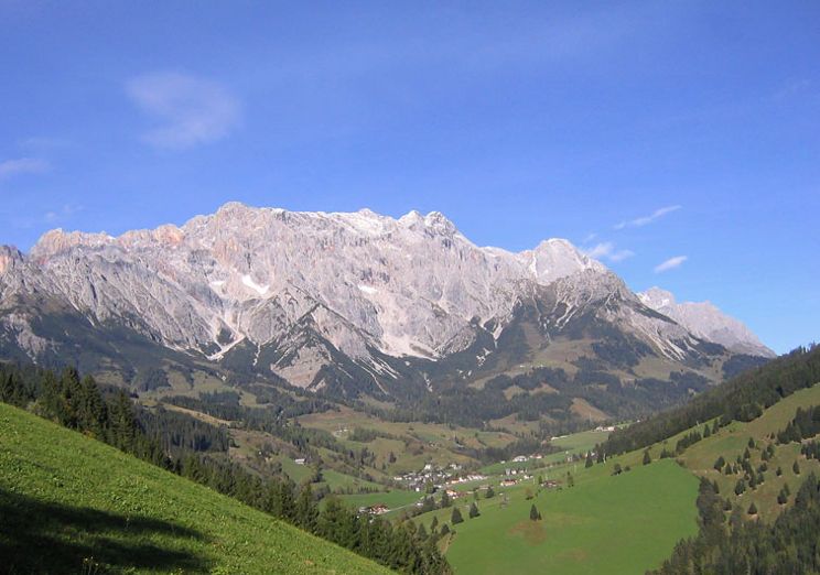
High and royal – the clue is in the name.
Start at the Wagrain tourist office. In Wagrain take the crossing to direction St. Johann im Pongau. From there continue to the Salzach-valley to St. Veit im Pongau and across the Pongauer Sonnenplateau and Goldegg am See to Schwarzach. Continue to Lend alongside the roaring river Salzach. Turn right and follow the narrow valley for 10 km to Dienten. Take the mountain pass Dientner Sattel with the legendary Übergossene Alm to Mühlbach. A recommended bonus is an excursion to the Arthurhaus (15% ascent!). Follow the Mühlbachtal-street downhill along the stream to Bischofshofen and Mitterberghütten. Turn left crossing the rails and ride to St. Johann im Pongau, the district capital with the Pongauer Dom and continue to the starting point Wagrain.
- Highest point
- 1,368 m
- Endpoint
-
Wagrain tourist office
- Height profile
-

- Equipment
-
Bike helmet, drinking bottle,..


-

-
AuthorThe tour At the foot of the Hochkönig is used by outdooractive.com provided.