- Brief description
-
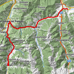
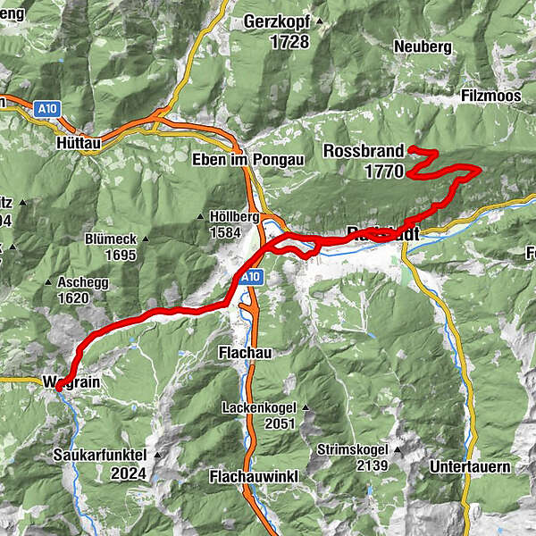
Distance: 55,4 km
Lowest / Highest point: 837m / 1.752m
Sum of all ascents: 973 hm
Kleinarl or Wagrain tourist office – Flachau – Reitdorf – Altenmarkt – Radstadt – Rossbrand
- Difficulty
-
medium
- Rating
-
- Starting point
-
Wagrain tourist office
- Route
-
Markt0.1 kmFilalkirche Hl. Franziskus („Marktkirche“)0.1 kmWagrain0.3 kmWagrain0.6 kmHof1.1 kmMoos1.9 kmHubdörfl2.7 kmSchwaighof3.5 kmMoawirt4.7 kmMoadörfl4.8 kmScharfettkapelle7.8 kmFeuersang8.1 kmGh. Schützenhof8.8 kmReitdorf9.1 kmAltenmarkt im Pongau12.5 kmRadstadt (858 m)16.2 kmKapuzinerkirche16.6 kmJausenstation Mühlbach21.3 kmRossbrand (1,770 m)27.8 kmJausenstation Mühlbach35.0 kmRadstadt (858 m)39.6 kmSinnhub43.2 kmReitdorf46.0 kmGh. Schützenhof46.3 kmFeuersang46.9 kmScharfettkapelle47.5 kmMoadörfl50.3 kmMoawirt50.4 kmSchwaighof51.4 kmHubdörfl52.3 kmMoos53.3 kmHof54.2 kmWagrain54.6 kmWagrain54.9 kmMarkt55.0 kmFilalkirche Hl. Franziskus („Marktkirche“)55.2 km
- Best season
-
JanFebMarAprMayJunJulAugSepOctNovDec
- Description
-
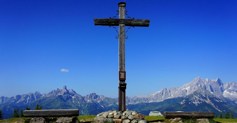
Rossbrand – at an elevation of 1.768 m it is the mountain with the most beautiful view in the Eastern Alps: 360° panoramic view.
Start at the Kleinarl or Wagrain tourist office. In Wagrain take the crossing to direction Flachau and continue through Schwaighof and Moadörfl. The bike-track to Flachau starts at the village sign Wagrain. Take the exit Reitdorf at the first roundabout, follow the Ennsradweg to direction Altenmarkt and continue to Radstadt. Pass the city-pond and take the Schloßstraße and continue at the Rossbrandstraße, which leads uphill for 12 km (not steep). The summit cross of the Rossbrand and the Radstädter Hütte are located just over the tree line. Return on the same track.
- Highest point
- 1,750 m
- Endpoint
-
Wagrain tourist office
- Height profile
-


-

-
AuthorThe tour Wagrain-Kleinarl to Rossbrand is used by outdooractive.com provided.