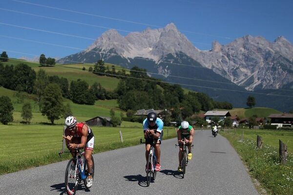
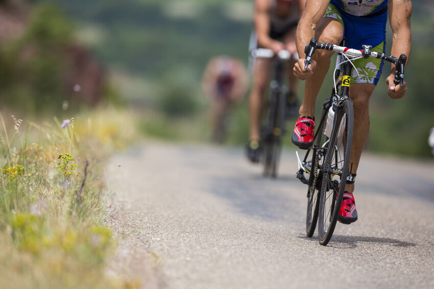
© Tourismusverband Altenmarkt-Zauchensee - Angelika Lackner
- Difficulty
-
difficult
- Rating
-
- Starting point
-
Start point Altenmarkt-Zauchensee Tourist Office
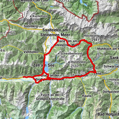
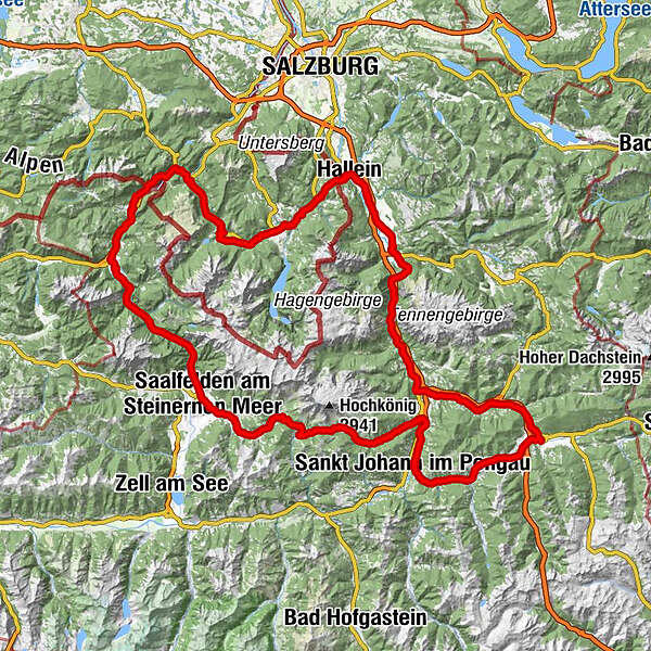
- Route
-
Altenmarkt im Pongau0.1 kmReitdorf2.9 kmGh. Schützenhof3.2 kmFeuersang3.9 kmScharfettkapelle4.4 kmMoadörfl7.2 kmSchwaighof8.4 kmHubdörfl9.1 kmMoos10.1 kmHof11.1 kmWagrain11.5 kmWagrain11.8 kmMarkt12.1 kmGoldanger12.5 kmGasthof Grubhöhe17.9 kmSankt Johann im Pongau20.5 kmPfarrkirche St. Johann20.6 kmEvang. Annakapelle20.6 kmVenediger21.5 kmPizzeria26.4 kmMitterberghütten28.6 kmPfarrkirche zum hl. Sebastian36.6 kmMesnerhaus, Café, Bar & Restaurant36.6 kmMühlbach am Hochkönig36.6 kmAnderlwirt36.6 kmHöring36.6 kmBirgkarhaus42.9 kmMittereggalm43.0 kmKönig & Kuh45.0 kmHöfl-Zachhof46.6 kmBirnbach52.9 kmSchloßberg60.1 kmMaria Alm am Steinernen Meer60.2 kmRain62.2 kmSaalfelden am Steinernen Meer (748 m)65.2 kmStadtpfarrkirche Saalfelden65.2 kmGeorgskapelle65.3 kmPabing66.5 kmMayrhofen67.2 kmMarzon68.4 kmSchörhof68.6 kmHohlwegen71.7 kmFrohnwies78.8 kmOberweißbach79.2 kmWeißbach bei Lofer79.4 kmUnterweißbach79.4 kmDürnberger83.0 kmObsthurn84.4 kmSankt Martin bei Lofer86.6 kmGumping88.8 kmPfarrkirche Hll Maria und Leonhard89.8 kmLofer89.8 kmKreuzkirche Lofer90.0 kmBairau90.6 kmMaurach92.0 kmGasthof zum Blanken93.2 kmHallenstein93.4 kmBrent94.8 kmKniepass (554 m)95.6 kmUnken98.1 kmNiederland99.0 kmMelleck101.5 kmRistfeucht101.8 kmGasthof Motzenwirt102.0 kmLenzenbauer102.6 kmScheuerl102.7 kmWurznwirt105.7 kmSchneizlreuth106.1 kmUlrichsholz106.3 kmUnterjettenberg108.6 kmWirtshaus Wachterl113.8 kmSchwarzbachwacht (848 m)113.8 kmGasthof Baltram116.4 kmBindenkreuz118.4 kmKalvarienbergkapelle120.4 kmGasthof Oberwirt120.6 kmPfarrkirche St. Sebastian120.7 kmRamsau bei Berchtesgaden120.9 kmMairinger Kapelle121.7 kmWimbachbrücke123.0 kmDuft125.5 kmEngedey125.6 kmGebirgshäusl125.9 kmLuegerer126.8 kmStrub127.8 kmMitterbach129.9 kmBerchtesgaden (572 m)130.6 kmUntersalzberg II131.3 kmUntersalzberg I133.2 kmUnterau134.5 kmBrochenbergkapelle135.1 kmKoppenleiten135.3 kmGasthof Oberstein137.2 kmWegscheid139.3 kmAltstadt140.4 kmPeterskapelle140.6 kmStadtpfarrkirche Hallein140.6 kmBarbarakapelle140.6 kmHallein140.9 kmGasthof Langwies144.4 kmKuchl149.2 kmKatholische Kapelle150.2 kmKellau152.3 kmGolling an der Salzach153.5 kmBrunnerwirt154.4 kmBrunnecker Höhle157.2 kmStegenwald161.6 kmAschauer164.6 kmWimm166.5 kmGasthof Hochkogel167.7 kmTenneck167.9 kmGasthof zum Eisenwerk167.9 kmWispelhofsiedlung169.6 kmWerfen170.3 kmReitsamerhof171.9 kmPfarrwerfen (545 m)172.8 kmPöham179.0 kmPöham179.3 kmHüttau183.8 kmPostwirt "Darijo"183.9 kmFritztalstube183.9 kmGasthof Brunnhaeusl187.1 kmImbiss Wieser190.7 kmEben im Pongau191.1 kmGasthof Ebnerwirt191.2 kmSteiner's191.4 kmSchwaiger191.6 kmSinnhub194.2 kmAltenmarkt im Pongau195.4 km
- Best season
-
JanFebMarAprMayJunJulAugSepOctNovDec
- Description
-
Start at the Altenmarkt-Zauchensee Tourist Office and continue to Berchtesgarden. Many beautiful highlights can be seen on the Watzmannrunde.
- Directions
-
The start is at the tourism association Altenmarkt-Zauchensee, continue on the Obere Markstraße in the direction of Reitdorf. At the roundabout at the entrance to Flachau, turn right (second exit) towards Wagrain. Via Wagrain and St. Johann to Bischofshofen. 1 km before the centre of Bischofshofen (at the 1st roundabout) turn left towards Mühlbach a. Hochkönig/Dienten. Steep climb over Mühlbach and the Dientner Sattel, before the centre of Dienten turn right towards Maria Alm/Saalfelden. Continue over the Filzensattel to Maria Alm and Saalfelden. In the centre of Saalfelden, turn right towards Lofer. Then via Lofer and Unken the route is flat throughout towards Berchtesgarden - Attention: at Schneitzlreuth turn right towards Berchtesgarden! You will pass the Königssee at a slight distance, past Berchtesgarden in the direction of Salzburg - Attention: approx. 3 km after the village of Berchtesgarden, turn right in the direction of Unterach and Oberauch to the Dürrnberg. Continue on a steep ascent to the Dürrnberg and then a rapid descent to Hallein. In Hallein turn right towards Kuchl/Golling, through the Salzach valley over the Lueg pass to just before Bischofshofen. 3 km before the centre of Bischofshofen, turn left towards Hüttau/Eben into the Fritztal valley and through the Fritztal valley to Eben and on to the starting point in Altenmarkt.
- Highest point
- 1,368 m
- Endpoint
-
Start point Tourist office Altenmarkt-Zauchensee
- Height profile
-

- Additional information
- Directions
-
Altenmarkt Centre/Tourist office Altenmarkt-Zauchensee
- Parking
-
In front of the Altenmarkt-Zauchensee Tourist Association at the public car park.
-

-
AuthorThe tour Watzmannrunde is used by outdooractive.com provided.
GPS Downloads


General info
Refreshment stop
Other tours in the regions