
- Brief description
-
Prepair yourself for one the most attractive Mountains in the Eastern Alps
- Difficulty
-
medium
- Rating
-
- Starting point
-
Flachau Tourist Info
- Route
-
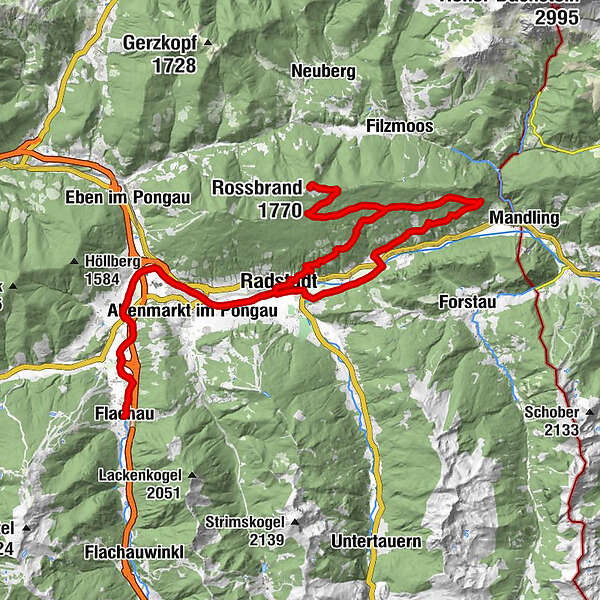
FlachauSinnhub7.3 kmAltenmarkt im Pongau8.5 kmKrallinger8.9 kmRadstadt (858 m)10.9 kmKapuzinerkirche11.7 kmJausenstation Mühlbach16.8 kmRadstädterhütte23.7 kmRossbrand (1,770 m)24.0 kmSteinalm31.3 kmRadstadt (858 m)42.5 kmKrallinger44.8 kmAltenmarkt im Pongau45.4 kmSinnhub46.5 kmFlachau53.9 km
- Best season
-
JanFebMarAprMayJunJulAugSepOctNovDec
- Description
-
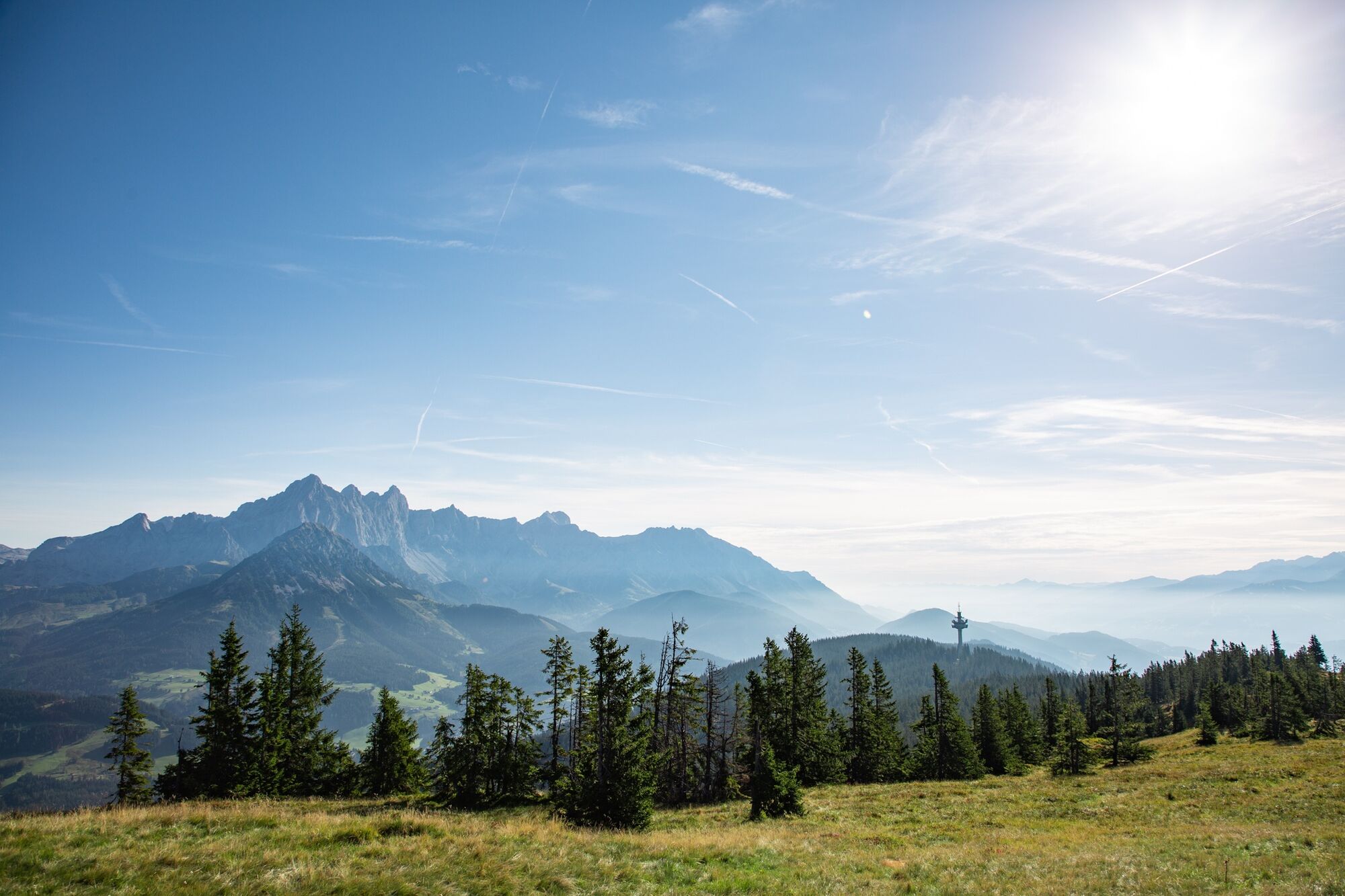
We start the tour in the centre of Flachau. Along the Ennsradsweg we continue to Radstadt. From there we reach the Rossbrand via a long asphalt road to the summit of the Radstadt local mountain. It is no coincidence that binoculars and info panorama boards inform about the surrounding mountains, because the 360° panoramic view is really fantastic. The farm at the Radstädter Hütte, which is close to the summit, is also fantastic. The way back takes place at the beginning on the way there, but you leave the Rossbrandstraße in the third bend and take the forest path over to the managed Steinalm and over this in a wide loop down to the valley bottom. The last kilometres back to Flachau we take the Ennsradweg.
- Directions
-
Flachau Tourist Information - cross the bridge - immediately after the bridge turn left and follow the cycle path to the sports field - at the crossroads straight on along the cycle path to the municipal road - turn right and follow the Enns cycle path in the direction of Altenmarkt/Radstadt - from the sports centre in Radstadt along the asphalted Rossbrand panorama road to the summit of the 1,770 m high Rossbrand - the same route back to Flachau Tourist Informationed.
- Highest point
- 1,761 m
- Endpoint
-
Tourist office Flachau
- Height profile
-

- Equipment
-
A mountainbiker's basic equipment:
protective gear enough to drink and eat for inbetween sunglasses, optionally sun cream or rain cover mobile phone - Safety instructions
-
Check the functionality of your mountain bike before each ride and inform yourself in about the current weather on site. For your own safety, we recommend to wear a helmet.
- Tips
-
At the tourist info Flachau you get a bike map with information to this tour.
- Additional information
-
This mountain bike tour is also suitable for e-bikes! Charging stations are available in the village center at Flachau.
Here you'll find more about mountainbiking in Flachau: https://www.flachau.com/en/sport/hiking-biking/mountain-bike.html
Info on the current weather on site: https://www.flachau.com/en
- Directions
-
to Flachau Center / Flachau Tourist Office
- Public transportation
-
From June to September, the Sportweltbus is the ideal shuttle service for your bike tours in the entire region (Flachau, Wagrain-Kleinarl, St. Johann-Alpendorf, Radstadt, Altenmarkt-Zauchensee, Eben, Filzmoos, Obertauern, Großarl & Hüttschlag).
With the Flachau Summer Card you can use the Sportweltbus for only Euro 1,00 per person and route. Children under 6 years travel free!
More information at: https://www.flachau.com/en/more/information/sportweltbus.html
- Parking
-
Parking space near the starting point


-

-
AuthorThe tour Radstadt-Rossbrand-Runde (SW 13) is used by outdooractive.com provided.


General info
-
Schladming - Dachstein
403
-
Salzburger Sportwelt
338
-
Radstadt
134